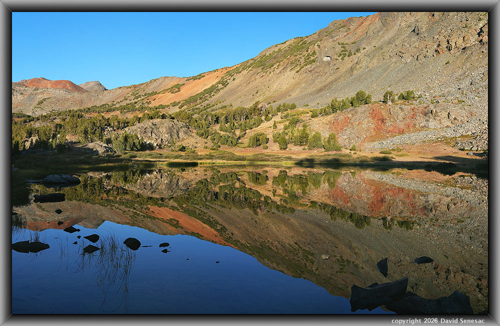
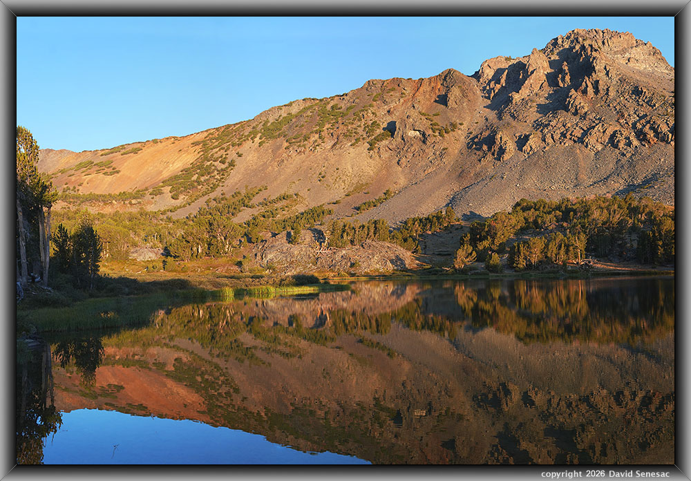
VT01429-01442-3x1v 9600x6100 pixels 3 column 1 row 3 frame 14 shot focus stack stitch blend a6700 30mm
enlarged vertical slice view image text section
NEXT: Page 14 Frog Lakes Backpack 8/31 2of2
2026 Trip Chronicles: Contents
Frog Lakes Backpack 8/30 1of2
Frog Lakes Backpack 8/31
After the SFBishop Creek backpack, I was quickly planning another trip while conditions at highest elevations were still aesthetic enough to be worthwhile. I settled for a trip from the high-elevation Virginia Lakes paved road trailhead at 9830 feet into the upper Virginia Creek basin of the Hoover Wilderness that is part of Toiyabe National Forest. Obtaining a wilderness permit at recreation dot gov was straightforward, with multiple quota spots open for this relatively remote trailhead without quota pressures. So setting exact dates was more an issue for an adequate weather window, the most important issue being a lack of wind. For that, Monday, August 31 was looking most certain, with adjacent Sunday and Tuesday possible too. Thus, at short notice, I reserved via recreation dot gov, Sunday, August 30 through Wednesday, September 2, trip dates.
On Saturday, August 29, I left my Santa Clara County residence late morning, driving east on I580 to SR120, stopping briefly in Oakdale for gasoline and first-day food, up into the foothills, then through Yosemite, over Tioga Pass, and down to Lee Vining and Mono Lake by late afternoon. It was cool and breezy from a dry inside Great Basin slider system. I drove north on US395 to Conway Summit, then left west onto the spur road junction. By day's end, I was parked in the gravel Virginia Lakes parking lot with about a dozen other vehicles. So, set up my usual sleeping in my 2023 Trailblazer LS back bed, where I enjoyed an uneventful night while temperatures lowered to about 35F by dawn.
Intent on reaching the destination of Frog Lakes early enough to work some subjects in good light, an easy 2 miles and 550 vertical feet in, I woke at sunrise Sunday, August 30, 2026, and in the chilly air was soon on my way along the dry, heavily travelled sagebrush trail. The first half mile has minor ups and downs as it passes along the east side of metamorphic talus and scree-bound Blue Lake. Three of the five Virginia Lakes that attract many fishermen with planted trout can be parked near, while another two are short walks.
I had day-hiked into the basin years ago and knew it offered some strong photographic material for minimal effort. In particular, 4 lakes in the upper basin were relatively unblocked eastward in late summer towards the rising sun and setting dusk earth shadow. Thus, the upper canyon slopes offered strong alpen glow potential on calmer days. Along the route, given my 60 pounds or so of carrying weight, I stopped frequently, per my style, on rocks and logs along the route. At Cooney Lake, I noticed morning sounds of a group camping along its eastern shore. By 8:15am, I reached the middle Frog Lake at 10372 feet, where I took off my photography daypack to work in the calm surface conditions. The shallow middle lake is the smallest of the 3 Frog Lakes, with the best open views up canyon while being more blocked by a glacial dome down canyon.
On this trip, instead of my new, expensive Sigma 17-40mm DC ART zoom lens I'd found to be a bit soft on my previous 4 trips, I would be carrying my Sigma 30mm F1.4 and new Sigma 16mm F1.4 prime lenses in addition to 56mm and 85mm primes.
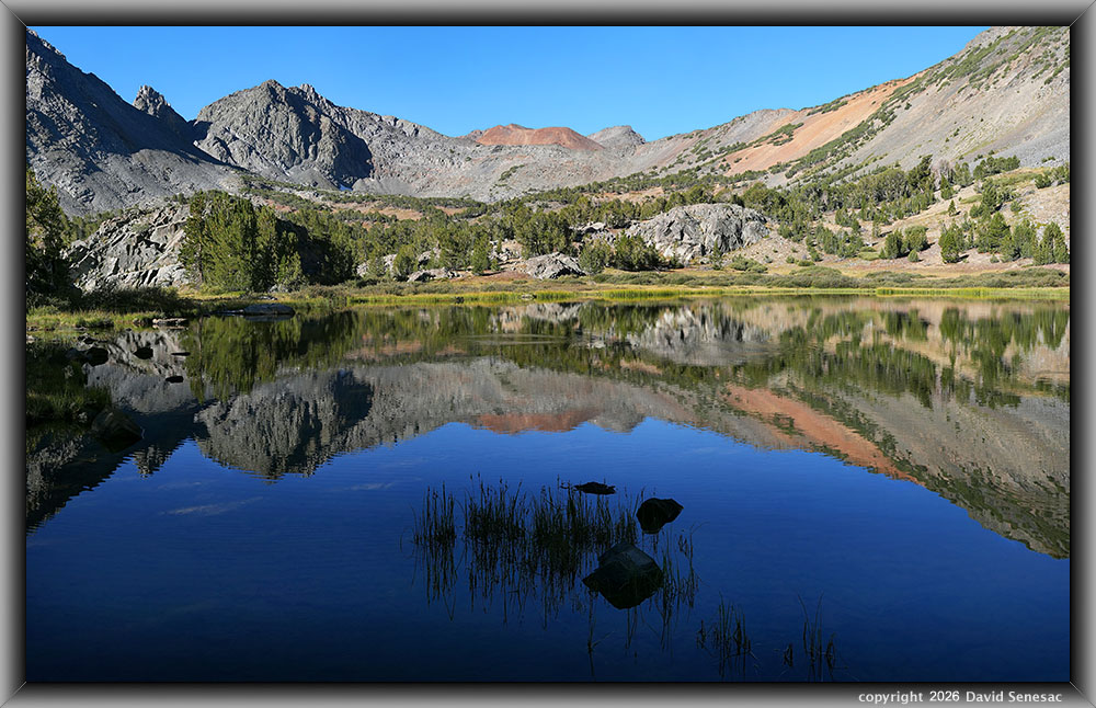
VT01133-01154-3x1v 9700x6100 pixels 3 column 1 row 3 frame 22 shot focus stack stitch blend a6700 30mm
enlarged vertical slice view
This first image above at 8:28am, was a 3-column stitch blend of 9700 by 6100 pixels towards the center of the basin, using my sharp Sigma 30mm F1.4 prime lens at F5.0. The above required 3 Focus Bracket mode automated sequences for a 3-column, 1-row stitch blend using a total of 22 focus stack blended shots. Notably, the near shore was still in shadow due to blocking whitebark pines, which allowed better reflection saturation. The lake was still nearly calm per weather forecasts, while surface-feeding eastern brook trout were causing less-than-optimal reflections. For a foreground, I used a silhouette of shadowed water grasses and stones. At center frame in the distance is part of rusty-hued Excelsior Mountain at 12400+ feet, with the main peak behind at the Yosemite National Park border. Most of the basin is metavolcanic geology with minor areas of granite.
Post-processing was a bit difficult, as the Kolor Autopano Giga stitching software split the second and third column frames at the center of the trout fish ring, creating an unnatural transition. Thus, after stitching the 3 frames together, I superimposed another layer with the full fish ring from a third column shot that was at the correct focus distance, working with the Opacity setting for it to appear natural.
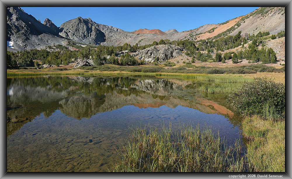
VT01155-01189-3x1v 10200x6100 pixels 3 column 1 row 3 frame 34 shot focus stack stitch blend a6700 30mm
enlarged vertical slice view
This second image above at 8:37am is another 3-column stitch blend with the 30mm lens from along the small lake's shallow, grassy northern shore, using 34 shots at F5.0. Suspect the shrub at frame mid-right is a Booth's willow, Salix boothii. Since the reflection of distant elements is combined with light off the shallow lake bottom, that combined light reflection is less saturated. With so much late summer organics in the water, I did not want to use the pond for my drinking water source. One can readily discern such by scooping up water in a clear bottle then seeing all the little lifeforms squirming about.
VT01203-01217-3x1v 7400x6000 pixels 3 column 1 row 3 frame 15 shot focus stack stitch blend a6700 30mm
enlarged vertical slice view
For my last subject at this lake at 9:01am, I used my new 16mm at F5.0 in a 3-column stitch blend, from the south side of the lake northward towards a rugged near section of the canyon with peak 11568. I took 2 sets of shots, while deleting the first set with a poorer reflection. The following morning, I would be moving my camp spot to a group of trees above that opposite lake shore. At this point, the modest calm had ended with an upcanyon breeze discouraging any more work. I was glad that I had arrived as early as I did, just when the sun was optimal up the canyon, and breezes had briefly waned.
At this point, I reattached my camera daypack to my main Osprey Aether backpack, then headed off along the shore of the upper Frog Lake, then up one of 2 inlet streams to the south fed by a prominent all-year snowfield. Along that route, verified the best dawn and sunrise subjects would be from this upper lake. A solo gal on a minor dome above the shore was the only other person camping at these lakes, though plenty of day hikers moved through towards Virginia Pass. It is actually somewhat surprising that the basin isn't visited as much as one might expect, as the backpacking distance to Cooney or Frog Lakes is among the shortest in the range to a lake with decent scenery and fishing. Of course, with a name like Frog Lakes, many fishermen will expect the lakes just have frogs haha.
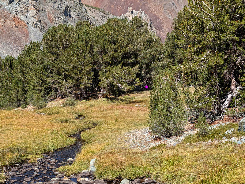
After dropping my pack where I eventually set up camp per image right, I spent an hour exploring this south side of the canyon for possible camp spots. There, I made camp at about 10500 feet, setting up my tent within shading and wind-blocking whitebark pine, with a convenient streamlet of clean water nearby. Note: this person, for decades, has rarely bothered to filter High Sierra water sources, without any consequences. I prefer taking water from topo-analyzed as likely safe streams versus lakes, especially by late summer. I would be using this same water source the rest of my trip to fill a couple of 32-ounce bottles. The above Pixel 10 PRO image shows my camp zone with my tent in the shadows, just left of the magenta dot, and my water source at frame left.
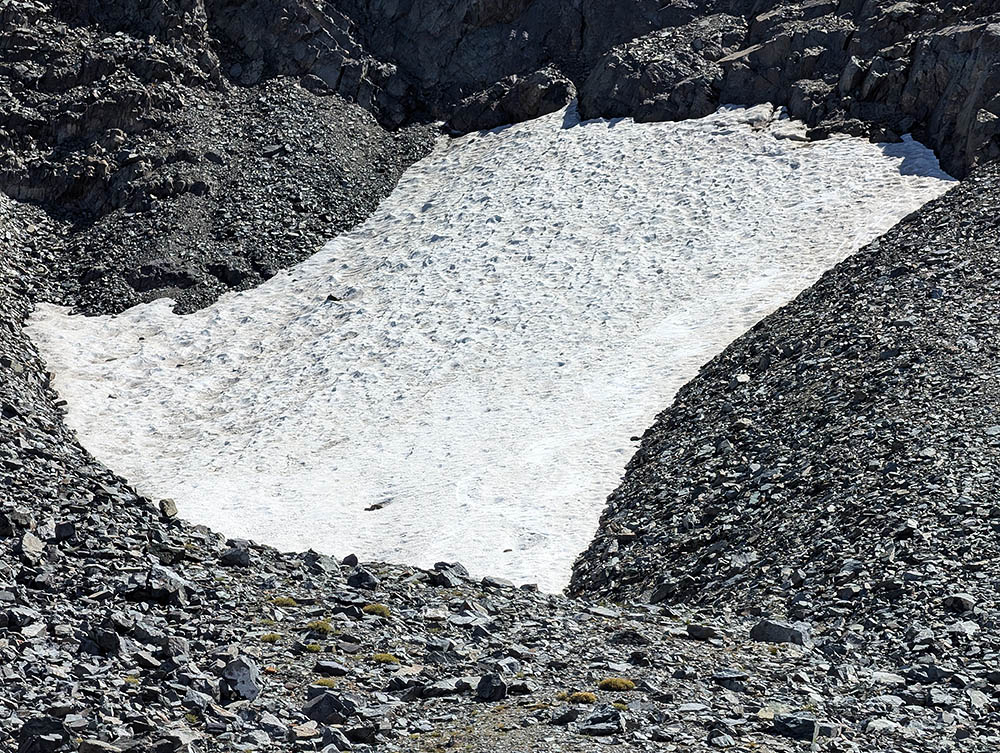
After making camp, I went back to exploring the zone, including visiting the prominent all-year snow patch per image below, which I expected would have a streamlet with good fresh water flowing from it on this late-summer date when many smaller streams have dried up. Note how there was no above-ground stream, as water soaks down into the porous talus and scree before resurfacing as a spring at the stream near my camp. This currently permanent snowfield is one of many on topographic maps that will likely disappear in this next decade due to global warming. At midday, I cooked lunch, took a nap, and then got up about 2pm. It was breezier than forecast, which made me wonder what the following morning would offer.
For this afternoon, since I was now a bit revived after the morning effort carrying my heavy pack, I would visit the upper Teapot Lake, then climb the trail to Virginia Pass, and then move south to the overlook of the Burro Lake basin, a key objective of this trip. From my camp, I took an off-trail route south of the main trail up to Teapot Lake, where I explored areas of interest I had viewed pre-trip on Google Earth. The lake would be the first during the morning to receive warm sunrise light, and there were plenty of decent subjects for afternoon photos were it not for the now strong breeze. A possible lake to camp near in the future given calm weather.
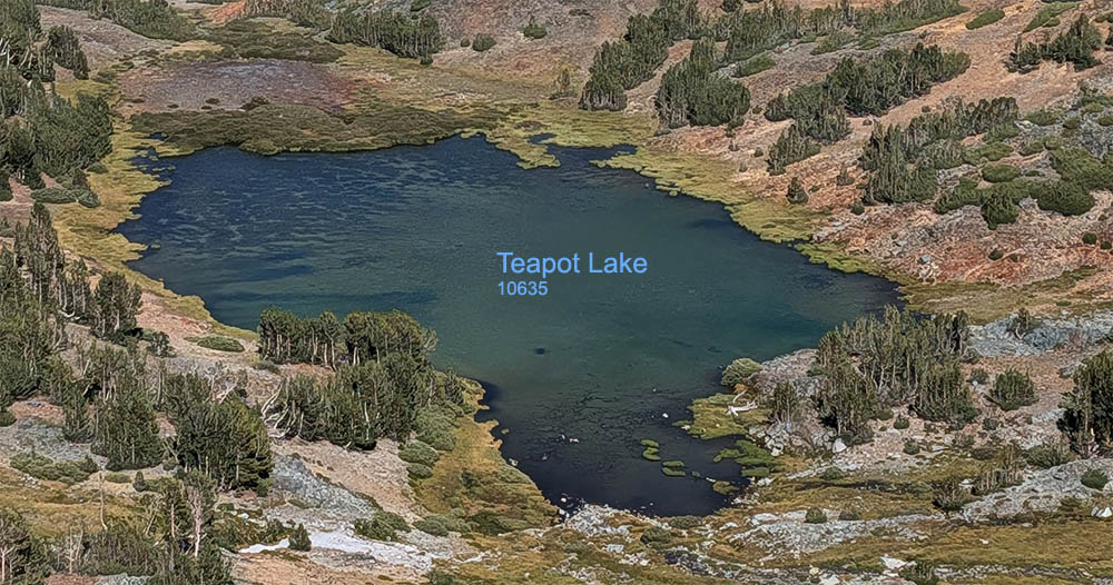
At 3:30pm, I left the 10635-foot Teapot Lake area, climbed up to the main trail, then began slowly making my way up its switchbacks to the 11100-foot pass. Along the way, I shot down a 2x canyon 2x with my Pixel 10 PRO, with the above a crop showing Teapot Lake. Note how the lake is probably too shallow to support fish due to ice over. The east end of the lake has a marshy area with a shallow rocky pond section where surface rocks earlier in the summer probably poke up above the surface, so in July, offer dawn and dusk sky reflections.
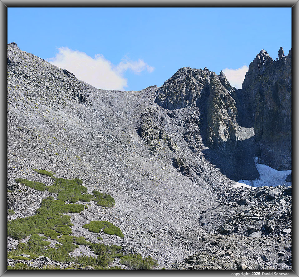
VT01253-01254-2x1v 15100x6200 pixels 5 column 1 row 5 frame 36 shot focus stack stitch blend a6700 30mm
enlarged vertical slice view
I also aimed my 85mm lens towards 11360-foot Burro Pass that appeared to be an unpleasant long effort up steep metamorphic scree and small talus. The south side of the pass on Google Earth looks a bit more difficult. However, descending any of the other chutes from the overlooks south of Virginia Pass are also unpleasant scree routes. Routes that would be a better choice with just a daypack, while one would not want to be carrying a heavy backpack down. Thus, if I do backpack into the Burro Lake basin, it would be via Lundy Canyon, which is about the same total vertical with less talus but a trickier route avoiding brush and steep sections.
At the pass, I immediately vectored off trail to pass south of the upper Tweener Lake, which required dropping about 50 feet. This whole very windy, locally unaesthetic zone is alpine tundra with just a few whitebark pines in sheltered spots. There are some good early morning views towards Summit Lake, Virginia Peak, and the rusty slope just west of the Burro overlooks. From the drying shallow lakes at 3:50pm, it was about another 250-foot uphill climb to 11300 feet, where a vague use trail was evident from peakbaggers heading towards Excelsior Mountain. By 4:15pm I had reached the overlook at my target time in order to capture the best afternoon color saturation of Burro Lake and its basin. Thus, it required about 45 minutes to hike up 700 vertical feet, 1.2 miles, from Teapot Lake to the overlook. And the lake indeed had an incredible glowing, aqua blue color that was noticeably more saturated than any other Sierra Nevada lakes I've seen, with an aqua blue color like Second Lake or Moonlight Lake.
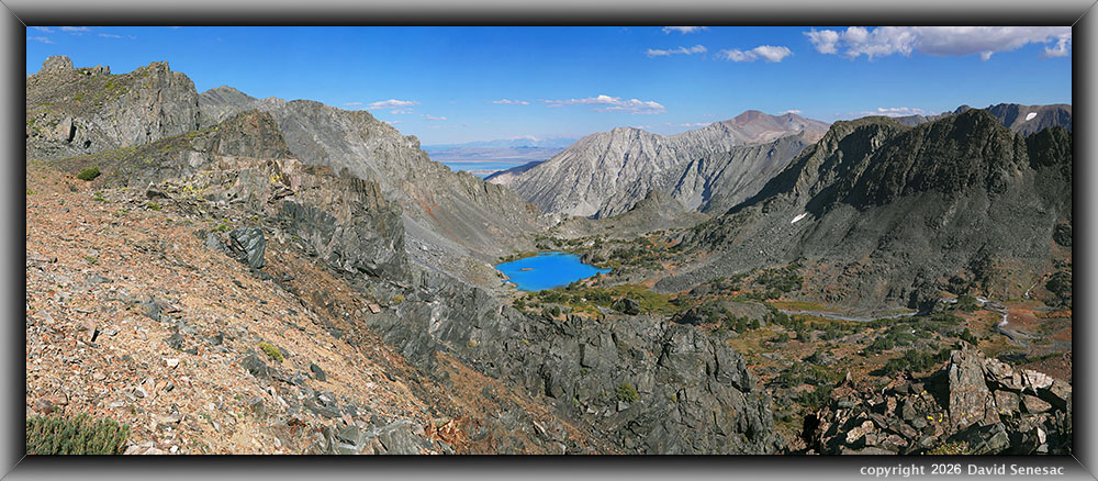
VT01266-01301-5x1v 15100x6200 pixels 5 column 1 row 5 frame 36 shot focus stack stitch blend a6700 30mm
enlarged vertical slice view
After taking a set of shots with the Pixel 10 PRO, I set up the tripod with the a6700 at a somewhat airy location near the canyon edge. The moderately strong wind kept me within a hand's reach of the tripod as I waited for periods with less wind to fire off panorama shots with 3 of my lenses. This first set of shots above at 4:21pm, is a 5-column stitch blend with the 30mm lens at F5.0 from 36 shots for a 15100 by 6200 pixel panorama. This captured the widest image and would be most useful for later evaluating features of the basin below. Seeing its amazing glowing blue color, I was now more intent than ever on reaching this basin, maybe this next summer of 2027. I was impressed by the aesthetic features of other elements of the basin and surprised at the size of the inlet stream that reflects the considerable all-year snowfields on Excelsior Mountain. Parts of Mono Lake and the White Mountains were in the distance. I was glad the atmosphere was rather clear.
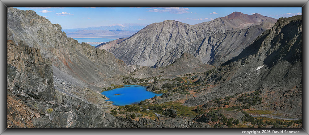
VT01302-01323-5x1v 14900x6100 pixels 5 column 1 row 5 frame 22 shot focus stack stitch blend a6700 56mm
enlarged vertical slice view
Next, at 4:28pm with my sharp Sigma 56mm lens at F5.0, I worked a narrower 5-column stitch blend above, requiring 22 shots for a 14900 by 6100 full image. Once again, I was able to capture part of the rugged canyon rim. In the background is the north end of the White Mountains, 53 miles distant. In the upper right is rusty-hued 12327-foot Mt Warren. I particularly like the
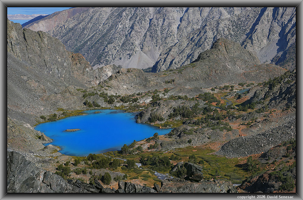
VT01324-01351-3x1v 9600x6000 pixels 3 column 1 row 3 frame 28 shot focus stack stitch blend a6700 85mm
enlarged vertical slice view
And finally, at 4:34pm, I mounted the Sony 85mm lens for a 3-column stitch blend of the main Burro Lake zone per above. I had hoped to spend more time in the area looking at possible scree descents down 760 feet to Burro Lake at 10540 feet. Although I was confident I could do so with just my photo daypack and gear, as expected, I would not want to do so with my heavy pack. So, didn't bother pursuing further looks down chutes and instead headed back the 1.5 miles to camp with my primary mission accomplished. Right of the lake, I particularly like the long finger of black talus reaching into the meadow that may have been the result of a massive rockslide.
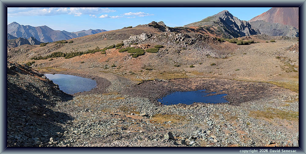
By 5:15pm I was back down at the Tweener Lakes. As I was descending the use trail, I shot a 2 horizontal wide stitch panorama, later processed with Autopano Kolor Giga, of the shallow lakes and the barren pass landscape, using the Pixel 10 PRO per above. The full image is 5000 by 2400 pixels that I downsized from the native smartphone sensor size to a level of reasonable detail. Before 6:15pm had rambled down over the pass and back to my camp spot. It was too windy to bother with any late afternoon photo work. Then at dusk I noted the eastern sky looked mediocre, so I retired into my tent early. I was glad to have knocked off these Burro Lake shots on my first day. I wanted to return to the pass on the third morning in order to aim my lens towards distant Summit Lake and Virginia Peak. However, that would not occur as the weather became much windier.
It was a chilly night, resulting in much frost in meadows by sunrise. Well, I'm fine inside my 15F Nemo Aya goose down sleeping bag. But this guy always has to, at least once or twice during the chill of night, feel the urge we old folks know well, upon waking up, grab his headlamp, unzip and leave his tent, slip into his boots, then walk off a few steps to lose some of that water he drank earlier. I awoke before pre-dawn on Monday, August 31, 2026, and despite wanting to remain in my warm bag, went through the process of slipping on in the dark, layering most of the clothes I had brought. That included polyester shell pants inside my Levi 505s, my rain gear pants, cotton, a polyester long-sleeve shirt, a cotton long-sleeve shirt, a down puffy jacket, my rain shell, my expedition weight wool balaclava, and lightweight gloves. Thus, I let all that warm up some in my bag before exiting a bit later during dim early dawn, just as I've done many times in the past.
From my camp spot with photo day pack on my back while hand-carrying a camera mounted on the big tripod, with a headlamp helping the dim light, I made my way down 1/4 mile to the inlet marsh and meadow of the upper Frog Lake at 10274 feet, then followed its often grassy lake edge to a spot I could work a reflection once the sun shone on the northern canyon walls. After setting up for the shot, I had about 10 minutes to explore the zone a bit before that happened. So took off and found one very nice location with an open view down to Cooney Lake to possibly camp at in the future.
VT01394-01405-3x1v 8800x6000 pixels 3 column 1 row 3 frame 10 shot focus stack stitch blend a6700 30mm
enlarged vertical slice view
Unfortunately, unseen clouds far to the east apparently blocked the earliest phase of the rising sun, so I didn't start the capture until 6:37am PDT, or 15 minutes after astronomical sunrise, with this first of the day subject due west, a 3-column stitch blend using F8.0. Thus, landscapes were illuminated in a less saturated orange light phase. After the breezy Sunday afternoon, I'd worried that the forecast calm morning might not occur. But yes, it was nicely calm. Not dead perfect calm, but noticeably better than on average mornings. In this drainage, cool night-sumping air, gravity flowing down the canyon, would be a problem many days.
Note, as a photographer in my chosen style going back decades, I try to capture and then post-process reasonably close images to what our human eyes actually see, and we experience. I keep my Sony a6700 on neutral settings and more often underexpose at -1/3 or -2/3. Anything away from that during capture can be adjusted back to natural during post-processing. Thus my Sony a6700 settings...
Menu...Exposure/Color...Color/Tone...Creative Look...NT
NT...Contrast 0...Highlights 0...Shadows +1...Fade 0...Saturation 0...Sharpness 2...Sharpness Range 3...Clarity 0.
VT01408-01428-3x1v 9200x6000 pixels 3 column 1 row 3 frame 21 shot focus stack stitch blend a6700 30mm
enlarged vertical slice view
This second modest subject above, in the upper Frog Lake inlet marsh, was shot at 6:45am with my lens directed west-northwest. Walking about in the mushy, wet marsh below shoelace depth was not an issue with my expensive Zamberlan Vioz Lux GTX hiking boots.
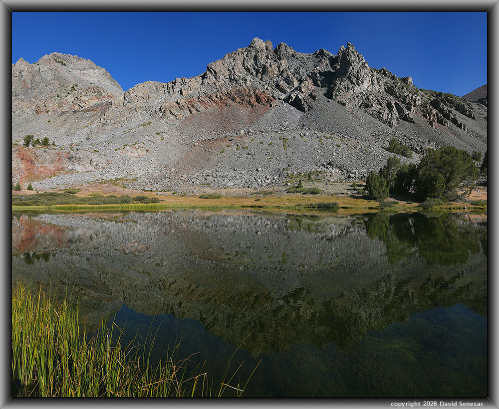
After that, I decided to ramble the 4/10 mile quickly to the middle Frog Lake I had worked Sunday at 8:30am after arriving. That took just 12 minutes, but it was enough that sunlight changed from an orange phase to a more daylight, natural warm yellow. So I was 90 minutes ahead of Sunday's light. The more shadowed foreground water allows a more saturated reflection. The fine 3-column stitch blend image VT01429-01442-3x1v at page top, using F5.0, was my first subject at 7:00am at that middle Frog Lake at elevation 10372 feet.
An issue with these kinds of lake reflection shots in the Focus Bracket mode with a shadowed foreground is accurately setting the nearest element focus. To do so after setting up the shot, I rotated the Nodal Ninja III MK II manual panoramic head axis knob clockwise to the nearby, much more visible ground shore area, where I set focus to a similar distance to the nearest water at frame bottom. I then rotated it back to the intended direction. Without a panoramic head with an axis swivel balanced with bubble levels, that process would be awkward and difficult to return to the original position. Using a panoramic stitching head has many tripod adjustment benefits that few photographers are aware of.
Notice how the landscape reflecting in the lake is slightly darker than the actual landscape it is reflecting. One sometimes sees photographs by inexperienced photographers using neutral density filters, where a water reflection is identical or brighter than its landscape. That is unnatural, as a water reflection will always be a bit dimmer.
Another issue in post-processing with any water reflection subjects, for the sake of capturing a natural result, is how to blend near-frame underwater elements with top water surface reflections of distant infinity objects. A solution I'll decline to explain herein.
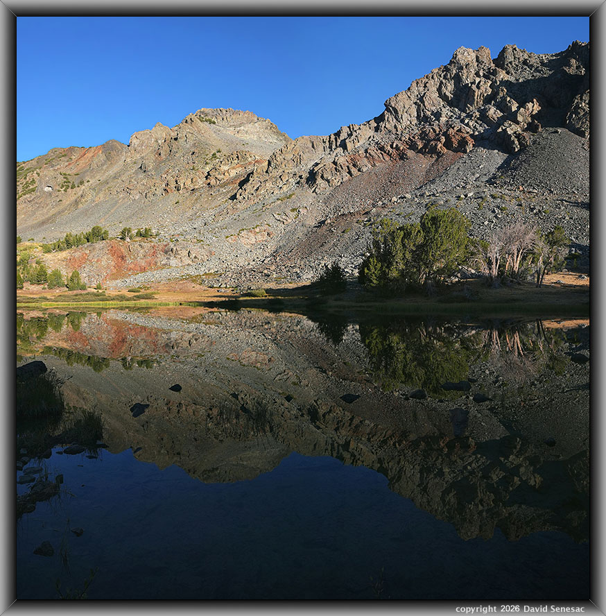
VT01459-01466-2x1v 9300x6200 pixels 2 column 1 row 2 frame 8 shot focus stack stitch blend a6700 30mm
enlarged vertical slice view
The above 2-column stitch blend image was shot with my 16mm lens, northwestward at 7:10am, with peak 11568 at the upper frame right.
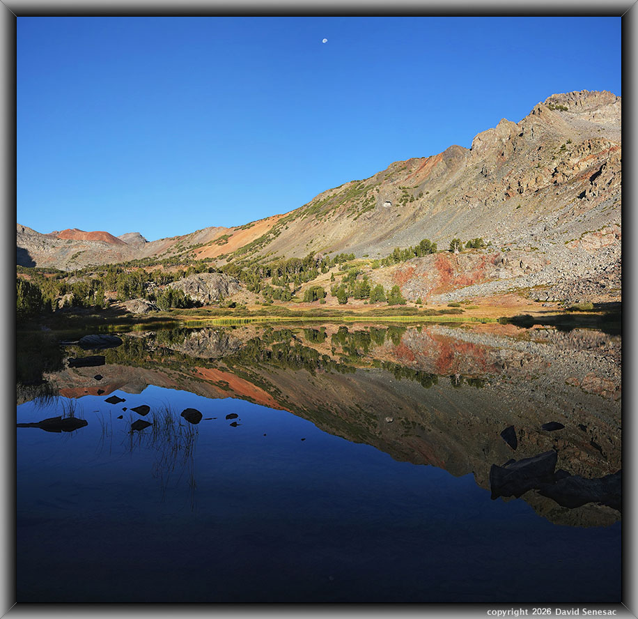
VT01467-01475-2x1v 6200x6000 pixels 2 column 1 row 2 frame 9 shot focus stack stitch blend a6700 16mm
enlarged vertical slice view
Another 2-column 16mm lake reflection with the 3/4 Moon making an appearance. On the opposite side of this small lake, if given calmer afternoon weather, are some higher unblocked afternoon down-canyon viewpoints, like the rusty section at frame mid right, or the gray dome mid left.
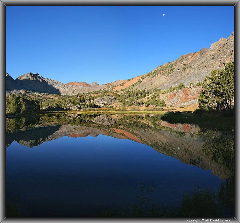
VT01476-01482-2x1v 6500x6000 pixels 2 column 1 row 2 frame 7 shot focus stack stitch blend a6700 16mm
enlarged vertical slice view
And a third 16mm lens lake reflection capture, southwestward at 7:16am. Note high on the canyon slope, a bit right of mid-frame the whitish cave or mine entrance.
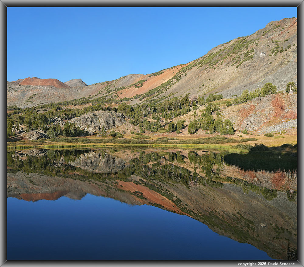
VT01487-01499-2x1v 7000x6100 pixels 2 column 1 row 2 frame 13 shot focus stack stitch blend a6700 30mm
enlarged vertical slice view
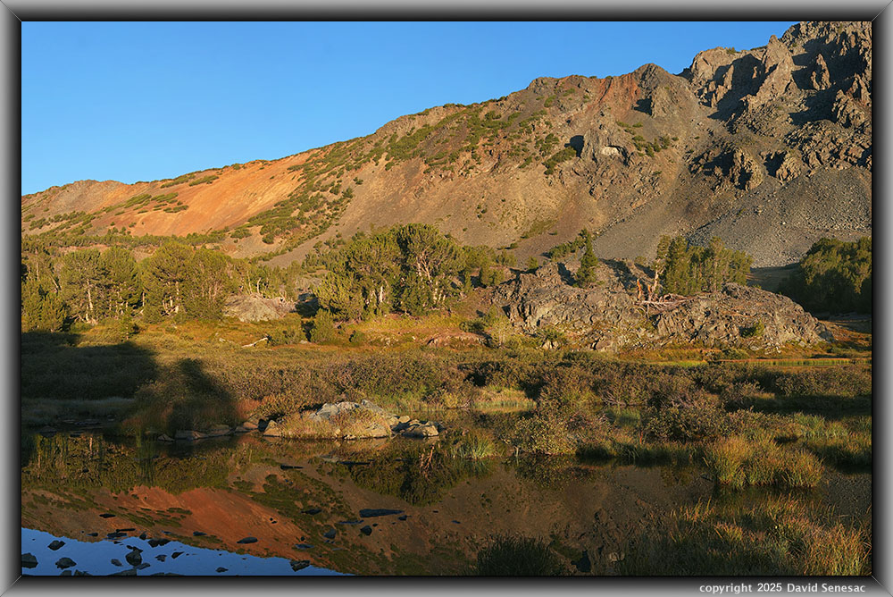
I then mounted the 30mm lens for a final subject at this lake. Since I had worked the lake on 2 mornings, I had more than enough strong material. So began exploring areas above the lake. Despite a lack of cleaner water, I much preferred this northern, sunnier, south-facing side of the canyon with its more interesting metamorphosed rocks. So decided to move my camp after I was finished with the morning photo session.
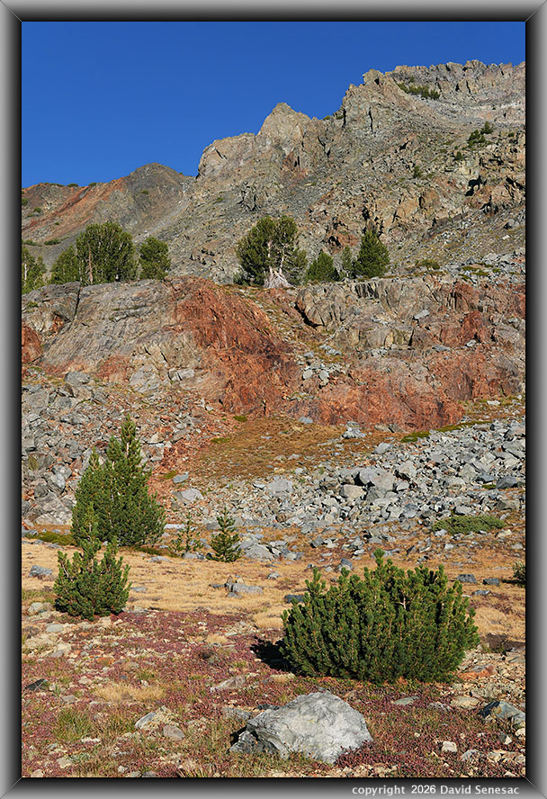
VT01500-08v 4100x6150 pixels 1 frame 9 shot focus stack blend a6700 30mm
enlarged vertical slice view
But before that later effort, at 7:44am found the above single vertical 30mm frame subject with dwarf billberry, Vaccinium cespitosum, the first perennial plants each year in the High Sierra showing fall color change. I can readily find ways to place these turf-height plants into my landscape frames along with their frequent companion, arctic willow, thus adding color variety. In this case, the turf-high plants change from green to reddish purples. That nicely contrasts types of redness with the orange reds of the rusty bedrock. These metavolcanic landscapes had fewer of that species than granite areas in the next canyon north at Green Creek.
At the mid-right edge of the frame is a stunted mountain hemlock, Tsuga mertensiana, tree that looks like a bush instead of its usual tall height if 1000 feet lower. Select the enlarged vertical slice view that shows that tree just above and right of the foreground short whitebark pine. I suspect that bushy tree is actually a more mature Krummholz form spreading downward on the slope from its genetic brothers above, pushing its bounds. At 10400 feet, this is as high as that hemlock species exists. I noticed such mountain hemlock at several locations in the upper Virginia Creek basin, and all of them appeared to be stunted to exist during winters below the snow depth where cold winds have less effect.
Also visible on that magnified slice view, at the base of the rusty bedrock, are green clumps of gone-to-seed red mountain heather, Phyllodoce breweri, that abundantly flower in this basin from mid June through mid July. Thus, see that spot as a potential future landscape subject in early July. Further up that slice, at the top of the rusty bedrock, is another patch of red mountain heather. Above that are some blond yellow hues of likely drying grasses. Then above that is a section of colorful rock with pastels; a future trip's subject at maybe 9am providing best rock sunlight color saturation. All those higher trees near the top of the frame are Krummholz form whitebark pine. This lower frame edge of talus, turf, and marshy lake edge zone had plenty of rodents, including marmots, pikas, mountain cottontails, and chipmunks.
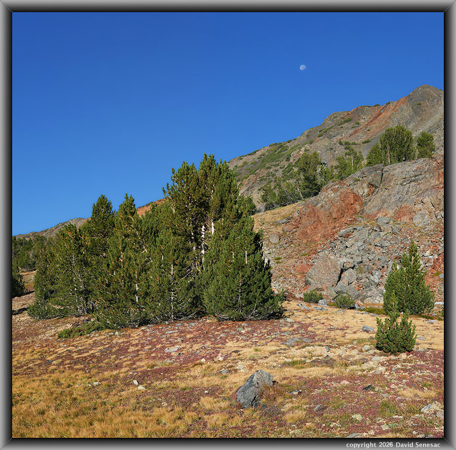
VT01509-01529-2x1v 6500x6100 pixels 2 column 1 row 2 frame 21 shot focus stack stitch blend a6700 30mm
enlarged vertical slice view
A second image with dwarf billberry at 7:44am. The whitebark pine, pinus albicaulus, is the dominant conifer species at upper elevations for the High Sierra north of Sequoia National Park. Further south, they are mixed with foxtail pines. Sometimes they look like lodgepole pines. The whitebarks usually have groups of 5 needles growing from their branchlets, while lodgepoles show 2 needles. Usually more obvious is their namesake whitish bark, while lodgepole bark may sometimes have similar smooth forms; they are not strongly white-hued. Unlike other conifers, they have three genetic forms: a tree form with a single trunk, as these young trees show; a multi-trunk form that helps at windy sites; and a stunted Krummholz form visible in this image in the background upper slopes that tend to hide beneath snow depths on steep slopes as high as 12,000 feet. The smaller branches are very flexible, which allows existence in windy environments. In the Krummholz form, any branches sticking out above the snow depth into the wind tend to break off. Although I often camp underneath these shading trees, they do exude much sticky sap. Thus, always have some isopropyl alcohol in my photo daypack to clean anything that picks up sap.
At this point in the morning, it was still earlier than when I had arrived Sunday. I could continue to work intimate landscapes. However, an up-canyon breeze was increasingly active, and I really needed to move my camp a half mile. So decided to get that done first. Thus, rambled the half mile back to my camp spot, packed up gear, filled my two 32-ounce water bottles with the clean water from that side of the canyon, then set off down the slope with a6700 plus tripod in my right hand. Note: I often carry that heavy tool around while also hefting my pack.
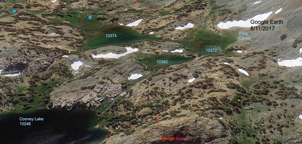
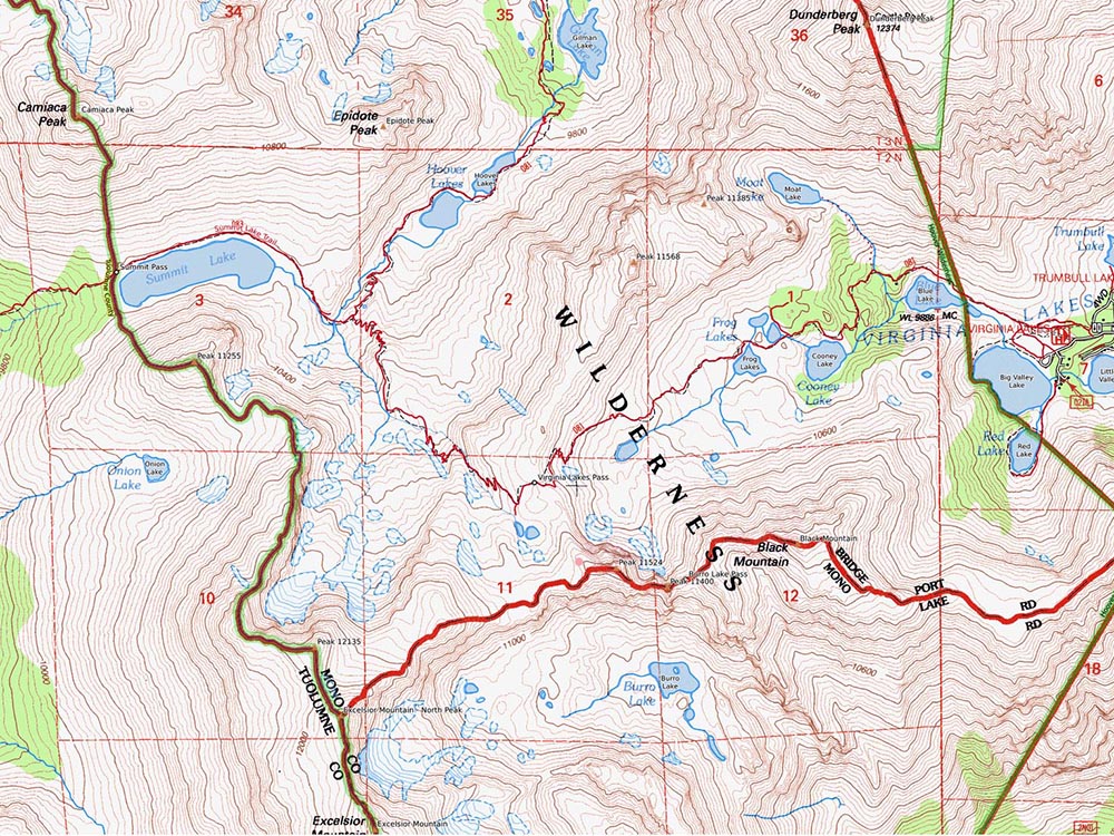
The above Google Earth images are from 8/11/2017, when an average winter would look like late June. The orange dots are on the main Virginia Pass Trail. Cooney Lake is 1.2 miles and 450 feet up from the parking lot. I camped at the magenta dots with the lime green dots, where I would camp in early July in the future, as I usually camp well away from trails or lake edges. The light blue dots were my drinking water source during this dry time of summer. The spectacular glacially shaped " Orange Dome", which visitors rarely visit, is at about 10430 feet.
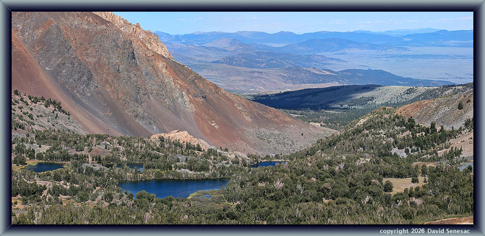
The above Pixel 10 PRO image is a 2-column horizontal stitch blend using its 5x zoom from a bit below the top of Virginia Pass and includes the Frog Lakes, Orange Dome, Cooney Lake, Dunderberg Peak, Conway Summit, Mono Valley, SR167, and several distant hills and ranges into Mineral County, Nevada. That light orange dome behind the upper Frog Lake is Orange Dome.
This Frog Lakes backpacking trip continues on Page 14.
NEXT: Page 14 Frog Lakes Backpack 2of2
2026 Trip Chronicles: Contents















