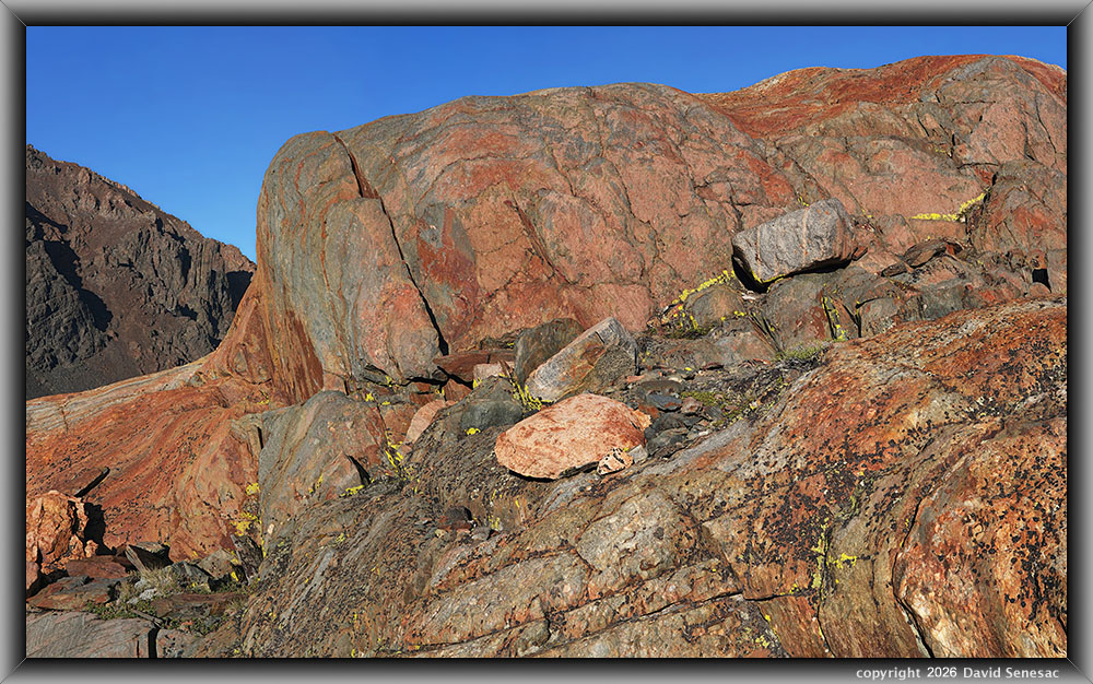
VT02566-02636-4x1v 9700x5900 pixels 4 column 1 row 4 frame 71 shot focus stack stitch blend a6700 30mm
enlarged vertical slice view image text section
NEXT: Page 15 TBD
2026 Trip Chronicles: Contents
Frog Lakes Backpack 8/31 2of2
Frog Lakes Backpack 9/1
Frog Lakes Backpack 9/2
Continuation of the Frog Lakes Backpack from Page 13, on Monday, August 31, 2026.
Within about 90 minutes, I was set up in my new semi-base camping location at a spot shaded by 3 multi-trunk whitebark pines, 150 feet from the middle Frog Lake edge. The tent spot was somewhat tilted down, but then, I regularly site my tent in such places that doesn't affect my sleeping.
There were many more heavily used illegal camp spots in a larger group of pines, just 50 feet from the lake, with flatter tent spots. I personally don't have a problem with the National Forest Service allowing such old camp spots that were created long before the 100-foot distance from drinking water sources policy was put into effect. But by not identifying such sites, say with a placard, it causes many groups to ignore the policy everywhere and camp close to lakes, as is rampant. An excuse the NFS uses for not doing so is that some people hate even tiny signs in the wilderness that IMO, is a hypocritical excuse. Further east, there were plenty of other campable spots but without any good water sources. A particularly nice camp spot with a great view down the canyon was just 900 feet away that I will choose in the future
As it was, I was 3/10 of a mile from the good water source at the inlet of the upper Frog Lake that I would not need to water filter, which I did not bring. I regularly dry camp at such distances from drinking water that is usually just a matter of a 10-minute walk each way. But for cooking water, pot cleaning water, body washing water, I was just 150 feet away. Otherwise, filling the two 32-ounce bottles is enough to last me drinking for a couple of days.
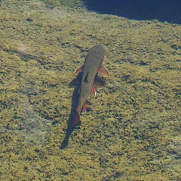
I did not bring along any fishing gear on this trip, though, as I always keep an eye on what kind of fish are in lake/stream waters. I saw plenty of eastern brook trout in all 3 Frog Lakes that have an abundance of food given all the grassy lake edges, and though most were pan-sized, I did see fish over a foot long in each lake including this wide body 14 inch or so fish at page right that was in the shallow middle lake. During the early season snowmelt, even larger fish would be able to move between lakes in the connecting creek.
VT01530-01535-2x1v 6600x6200 pixels 2 column 1 row, 5 shot focus stack stitch blend a6700 30mm
enlarged vertical slice view
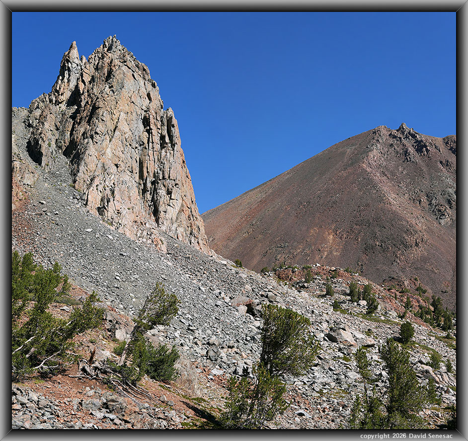
After setting up my new camp, it was still early enough for some landscape work, so I explored east of camp to a viewpoint of The Massif and 12374-foot Dunderberg Peak. At 10:09am, I shot this with a 30mm lens, 2-column stitch, subject towards the northeast. I was surprised to see how straightforward it appeared to be to hike across the talus field and easily reach Moat Lake, which I had not expected to visit on this trip.
VT01718-26h 5900x4100 pixels 1 frame 9 shot focus stack blend a6700 56mm
enlarged vertical slice view
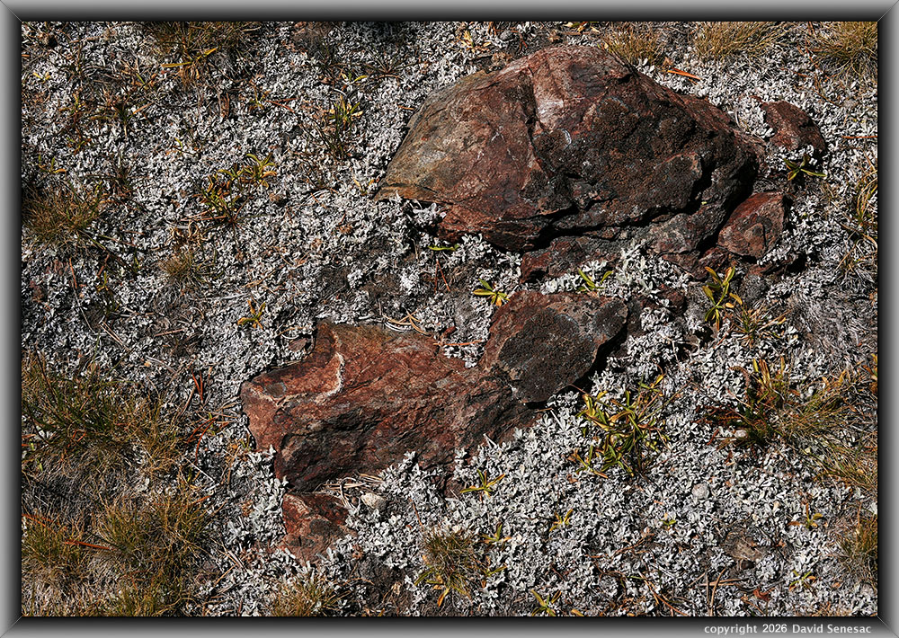
With more time left in the morning, I began exploring my new local zone. The above, captured at 12:19pm is a modest 56mm lens close-up of a common type of lichen-covered rusty metamorphic rock with turf, herbs, and light cyan-hued butterballs, aka oval-leafed buckwheat, aka alpine buckwheat, Eriogonum ovalifolium, a very common plant in the area that probably bloomed a month earlier.
VT01779-09h 6150x4100 pixels 1 frame 20 shot focus stack blend a6700 56mm
enlarged vertical slice view
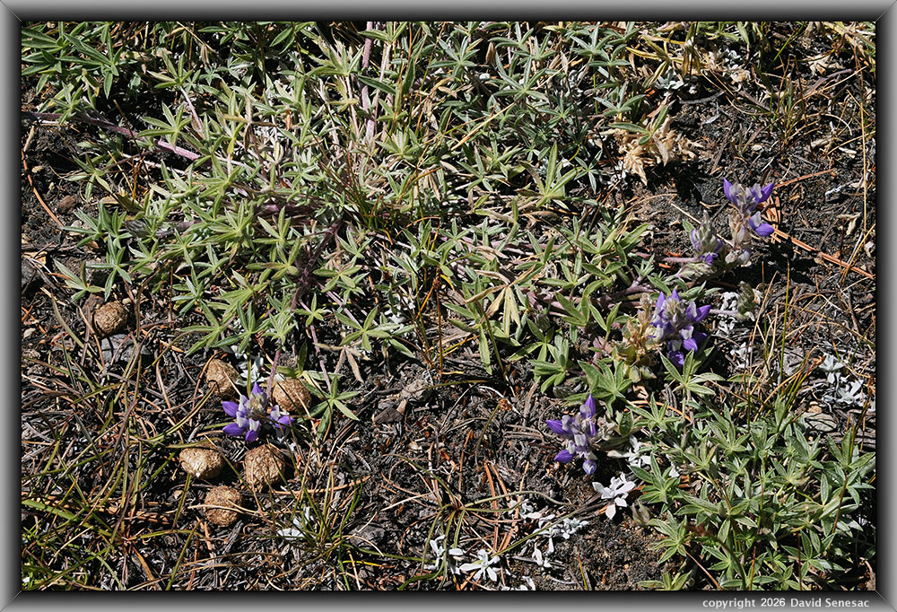
This next close-up shot at 12:34pm, shows blooming Brewer's lupine, Lupinus brewerii, with round mountain cottontail, Sylvilagus nuttallii, scat that was common in the area. Notice the dry whitebark pine needles.
VT01759-78h 6150x4100 pixels 1 frame 31 shot focus stack blend a6700 56mm
enlarged vertical slice view
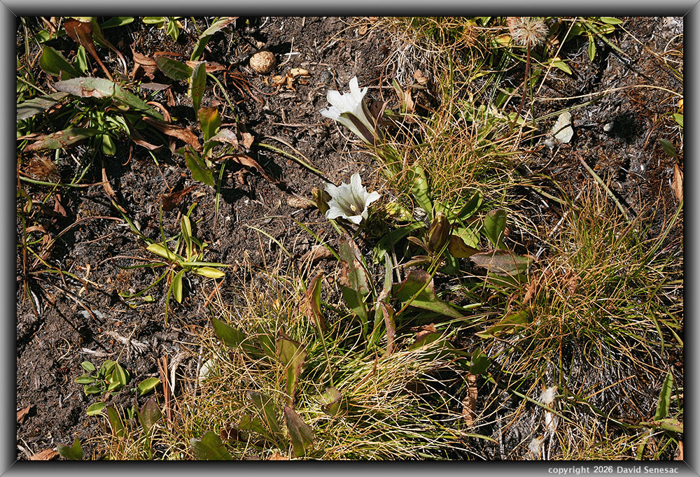
This above shot at 12:59pm, shows two late-blooming alpine gentian, Gentiana nerberryi, flowers that were common in moist turf areas. There were numerous hiker's gentians in the same areas. Also, a mountain cottontail scat. The grass is a species of the genus Carex, a sedge of which there are dozens of difficult-to-ID species, that this person avoids identifying. I do like that the many alien Eurasian species that now dominate lower California elevations could not exist in our high mountains, thus leaving those environments natural.
VT02235-57v 4100x5800 pixels 1 frame 21 shot focus stack blend a6700 56mm
enlarged vertical slice view
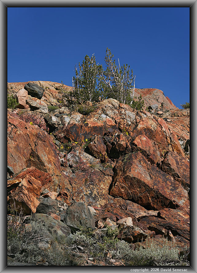
After lunch and a nap, given the gusty wind that was now making any lake subjects mediocre, I explored out towards a glacially shaped bedrock hill that I'll call the "Orange Dome". This first image above shows its top mid-right. Sagebrush species, such as the one in the lower-right corner, besides dominating Great Basin vegetation to the east, are also common to the highest Sierra Nevada elevations. The dome is a bit of an easy Class 2 climb puzzle to reach the top areas.
VT02258-02294-3x1v 9300x6000 pixels 3 column 1 row 3 frame 37 shot focus stack stitch blend a6700 30mm
enlarged vertical slice view
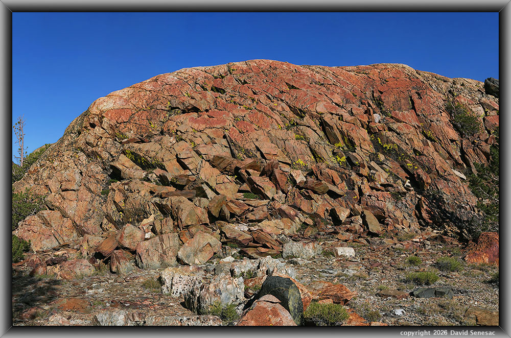
A colorful section of the metavolcanic Orange Dome with highly saturated orange against a fine, deep blue sky plus areas of lichen. Although there was a gusty wind, it did occasionally lull enough to adequately capture the little vegetation on these immobile rock subjects. Note in the foreground, gone-to-seed sulfur flower plants.
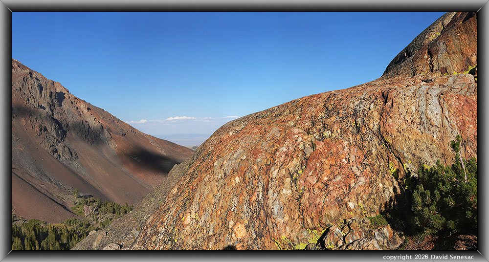
VT02485-02534-4x1v 11900x6100 pixels 4 column 1 row 4 frame 50 shot focus stack stitch blend a6700 30mm
enlarged vertical slice view
The above is a 4-column stitch blend of 11900 by 6100 pixels, requiring 50 focus bracket shots, of another section of the Orange Dome with glacially smoothed bedrock surfaces containing inclusions. At frame left, part of Dunderberg Peak with shadows cast from increasing clouds forming at the Sierra Crest. I believe the perennial left of the pine is a mountain pride penstemon plant that was common about Frog Lakes, but bloomed a month earlier. Another reason I expect to do an early July trip is that red mountain heather is also still blooming.
The most impressive section of the Orange Dome is its wind-exposed top, which is another 4 column 1 row stitch blend that required 71 focus bracket shots, image VT02566-02636-4x1v at page top. It also shows striking light orange hues.
The wind had kept increasing all afternoon and became increasingly impossible to deal with. It was also cool, maybe just 55F midday, now with an increasing wind chill. Thus, I retired to my tent early. About 8pm more clouds appeared that indicated an inside slider weather system, not in the forecast, was likely moving through. The rest of the night was one of the windiest I've ever spent, which greatly shook the branches of the three whitebark pines above my tent that provided very limited wind sheltering. The constant roar of wind in the trees and shaking tent with gusts also made it difficult to sleep despite my earplugs. The worst wind was about 4am. By that time, I had decided to pack up and leave at sunrise. However, at 6:30am with sunlight now illuminating the area, the high winds slacked off, though they were still at times very gusty, indicating the highest winds were still above in the atmosphere.
Thus, on Tuesday, September 1, 2026, I got up and decided to wait and see for a while as to what the weather would be. By 7am, I had decided to stay. And to make the breezy conditions productive, would explore over to Moat Lake, a total of just one-half mile and 200 feet of uphill from my camp. This had been the day I expected to hike up to Virginia Pass at sunrise, which was now probably gusting at hurricane-force wind levels. I had not expected to visit Moat Lake on this trip. Its location would be out of the main strong wind flow from the west.
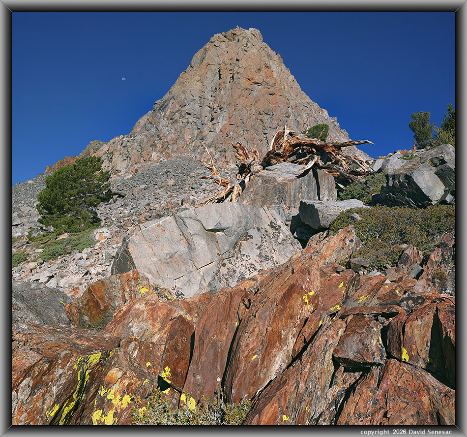
VT02681-02703-1x2h 9100x6100 pixels 1 column 2 row 2 frame 23 shot focus stack stitch blend a6700 16mm
enlarged vertical slice view
Thus, set off to Moat Lake and found there was an old use route that avoided any larger talus. A key feature that attracted me to that area is the rock tower formation called "The Massif" that is also visible from the trailhead. With such tall elements close by, I would be using my new 16mm lens. An impressive whitebark pine snag was an obvious foreground element to fit into my frame. There was also some rusty orange bedrock below with lichen that I used at 8:04am, per the image above, as a near foreground while using the lens in a horizontal, aka landscape orientation for a single column, 2-row stitch blend with much overlap. Below the pine at frame mid-left are stunted mountain hemlock as well as to the lower right of the snag and at the bottom frame edge. And yes, left of the peak, that is the Moon.
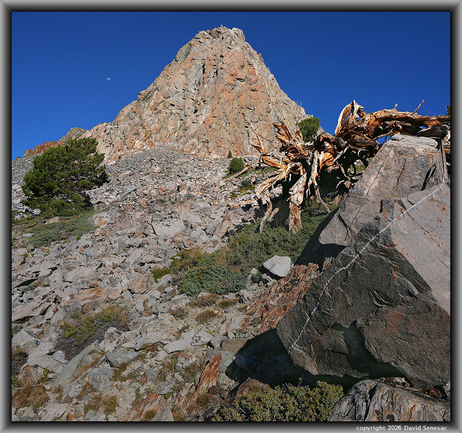
VT02704-02717-1x2h 5900x5500 pixels 1 column 2 row 2 frame 14 shot focus stack stitch blend a6700 16mm
enlarged vertical slice view
And a second Massif subject at 8:10am, with the snag looking like some alien insect monster, which shows more stunted mountain hemlock below the snag. There were also out-of-bloom red mountain heather and gooseberry plants between boulders that told me there might be some aesthetic shots here in early July.
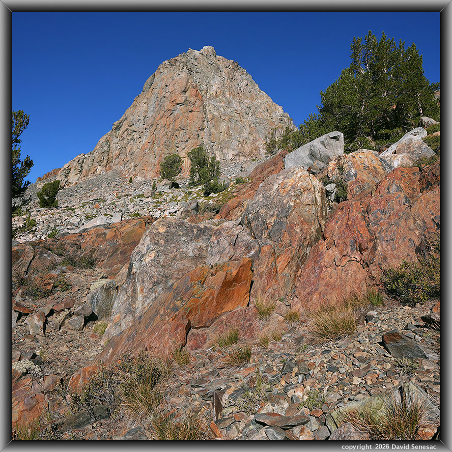
VT02718-02732-1x2h 5800x5800 pixels 1 column 2 row 2 frame 15 shot focus stack stitch blend a6700 16mm
enlarged vertical slice view
I made it across the talus zone and entered the more forested and vegetated, easier-to-travel landscape below the lake. From there at 8:24am, I worked this third Massif subject above with a colorful, glacially smoothed, rusty-hued bedrock section with inclusions. Just above the bedrock further back, the green areas below trees are red mountain heather.
VT02737-02758-2x2h 9400x5500 pixels 2 column 2 row 4 frame 22 shot focus stack stitch blend a6700 16mm
enlarged vertical slice view
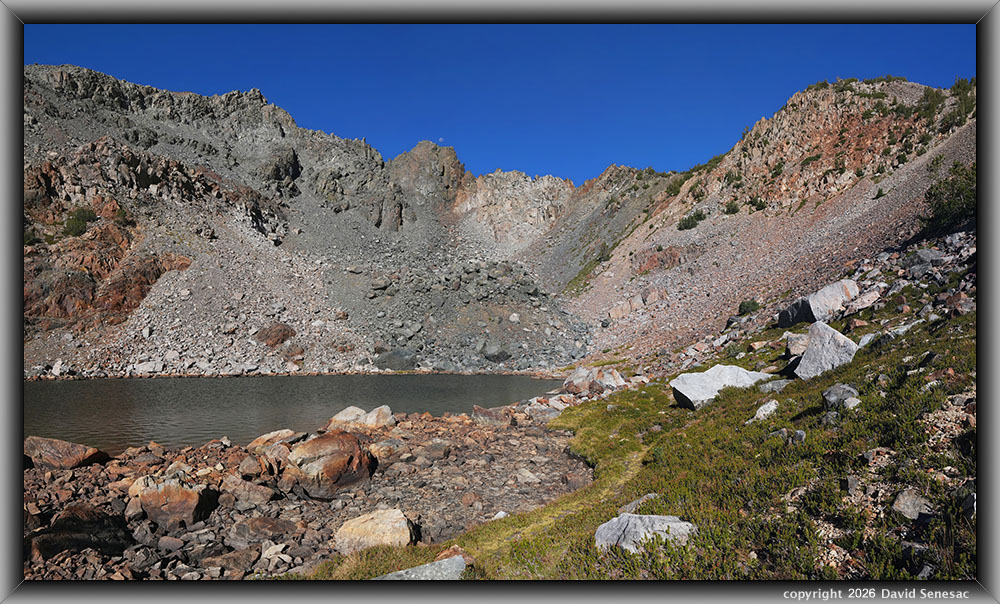
I reached Moat Lake, found a single decent shaded camp location just east of the outlet stream within whitebark pine, took some photos, then made my way towards the back end of the breezy lake that had colorful talus. The above image at 8:52am at an uncommon turfy shore area shows a curving use path with gone-to-seed red mountain heather to its right that could make an excellent subject in early July. The background had an interesting mix of different talus colors, including some at frame center with large black boulders.
VT02777-02791-3x1vh 9100x5900 pixels 3 column 1 row 3 frame 10 shot focus stack stitch blend a6700 30mm
enlarged vertical slice view
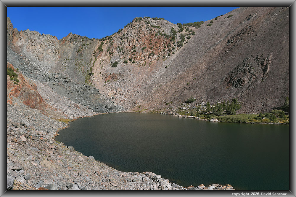
I took some more modest shots back near the outlet that still had a small flow, then climbed to a rib viewpoint to the south of the lake for this modest 30mm lens shot at 9:22am. There were several strong earlier summer subjects at this lake. Although I didn't see any fish, I do suspect brook trout were in this lake that has limited spawning only in the outlet, which likely prevented the supposed golden trout planted from establishing. Note there is a faint use trail rising 650 feet from the trail at Blue Lake.
VT02792-02h 4400x3100 pixels 1 frame 11 shot focus stack blend a6700 30mm
enlarged vertical slice view
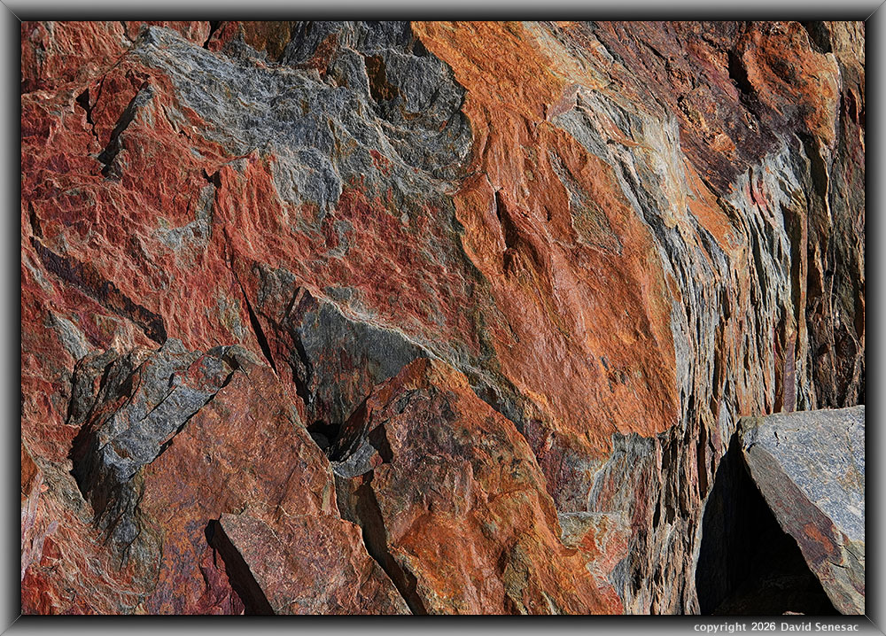
I made my way down the rib below The Massif looking for interesting rock subjects that at least would be still in the increasing wind. The a6700 Focus Bracket function sometimes stops prematurely before most distant elements are in focus; that is the case above. I cropped away most of that on the above close-up 30mm lens image at 9:36am, with an out-of-focus section still a bit visible at the upper left. That is not something easily checked in the field. This metamorphic shale shows how these rusty colored rocks with iron minerals are only so at rock surfaces exposed to water and oxygen in the air. The true rock color is a dark gray-blue.
VT02803-06h 6000x3400 pixels 1 frame 4 shot focus stack blend a6700 30mm
enlarged vertical slice view
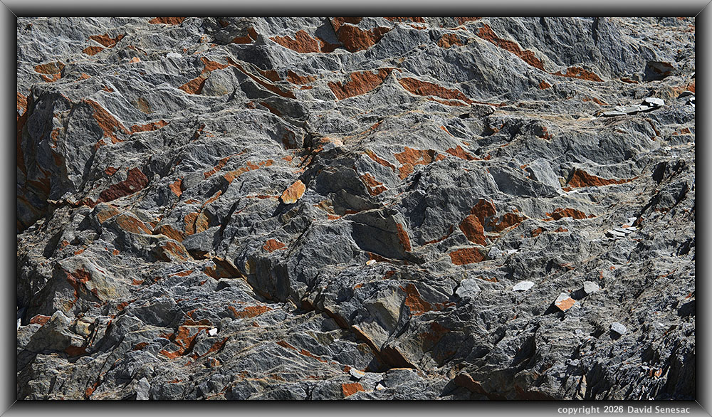
Another interesting 30mm lens shale rock close-up at 9:57am above.
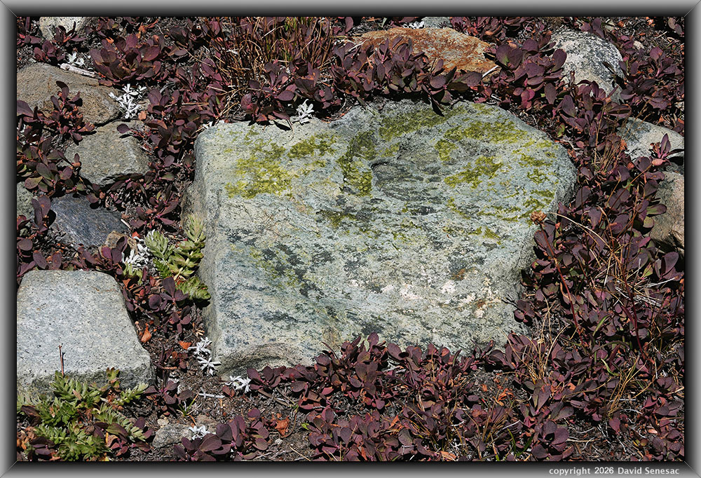
VT02857-96h 6150x4100 pixels 1 frame 40 shot focus stack blend a6700 30mm
enlarged vertical slice view
With my morning photo session ending, I went back to camp and took care of setting up charging with my solar panel. A $30 on Amazon, FlexSolar model E15 solar panel, foldable, waterproof, 2.8 amperes, 5 volts, 15 watts with a USB Type-A connector. I have been able to fully charge, while it is out in the sun for a few hours, both my a6700 batteries via its charger adaptor and Pixel 10 PRO smartphone. So the panel will be in my pack during future trips. I decided to try to find a nearby dwarf bilberry subject for a close-up and, at 11:35am, used the above to do so. The rock has areas of green tourmaline crystals. The wind was increasing, making any afternoon work except rocks difficult. Afterward, went back to camp for lunch and then found a place to have some fun.
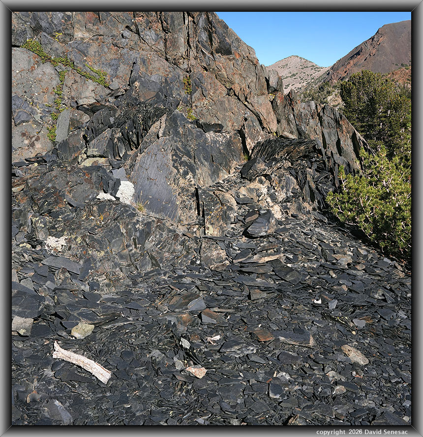
VT03031-03061-2x1vh 5900x6100 pixels 2 column 1 row 2 frame 31 shot focus stack stitch blend a6700 30mm
enlarged vertical slice view
About 4:30pm left with gear to work some nearby metamorphic rocks atop nearby glacial domes that are common in the basin. The above shows an area of dark black, highly layered shale. Below its outcrop, are myriad pieces of flake-like black fragments. Obviously, a feature geologists had been poking about at for decades but for which it appeared no one had been here during recent years. I had to wait a while for the strong wind to slacken a bit before I shot, so focus bracket registration with the pine at frame right was relatively still. Suspect the plants at frame upper left in cracks are mountain pride pestemmon perennials that would be in bloom in early July. Such magenta flowers would appear especially striking against such black rock.
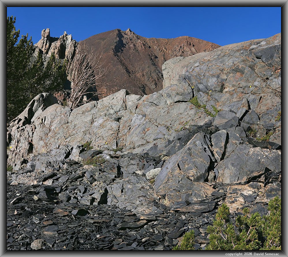
VT03064-03096-2x1vh 6900x6100 pixels 2 column 1 row 2 frame 33 shot focus stack stitch blend a6700 30mm
enlarged vertical slice view
Another view of the black shale outcrop towards the top of The Massif and Dunderberg Peak.
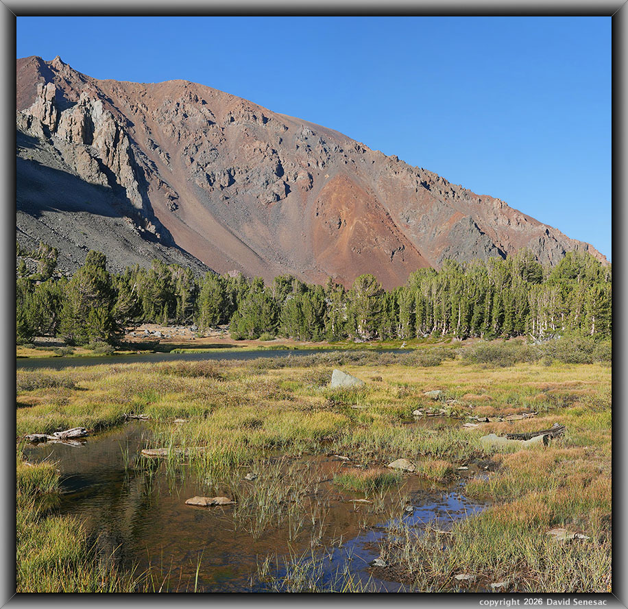
VT03146-03167-2x1vh 6300x6100 pixels 2 column 1 row 2 frame 22 shot focus stack stitch blend a6700 30mm
enlarged vertical slice view
I'd hoped to find some afternoon subjects with Dunderberg Peak in the background. Between the two upper Frog Lakes is a marshy, shallow stream section full of pan-sized brook trout that only drops 2 or 3 feet. I set up on this shot with Frog Lake 10372 at mid frame, then patiently waited for any moments of near calm to create this mediocre 2-column stitch blend. In any case, had already convinced myself to make another visit, likely in July 2027, during optimal conditions and weather.
VT03209h 6150x4100 pixels 1 frame 1 shot focus stack blend a6700 30mm
enlarged vertical slice view
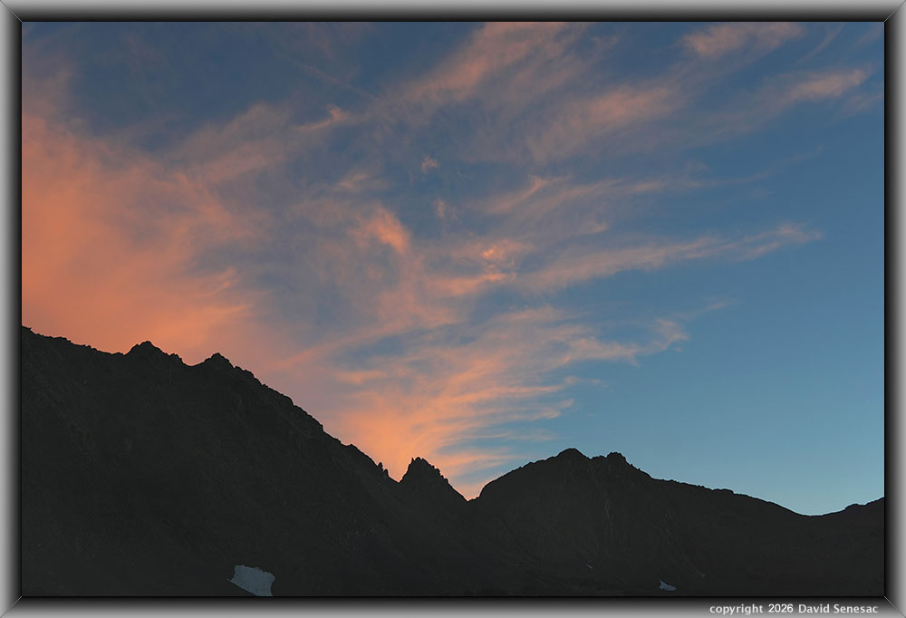
At sunset, many high cirrus clouds in the sky pointed to more inside-slider circulations passing above. I left my tent for a nearby open area where I aimed my camera using the 30mm lens at the skyline due west. Virginia Pass is the saddle frame right.
This Tuesday evening was as windy as the Tuesday wee hours had been. With difficulty, I managed to sleep despite the constant roar of gusty wind in whitebark pine branches and my tent shaking. During the late wee hours, though, clouds seemed to have disappeared; it actually became even windier. And it was colder, as it probably dropped down to just above freezing. This time I made up my mind that as soon as the sun came up, I would put on warm clothes, pack up, then head down back to the trailhead.
Thus on Wednesday, September 2, 2026, I awoke at dawn and slipped on warm clothes while pines were shaking violently. Looking outside, I noted the upper north canyon walls had an exceptionally strong orange alpenglow cast reflecting how clear the airmass was. I had packed up some of my gear before retiring, so I did so rather quickly. I was soon on my way under windy, mostly cloudy skies. Except for some pack adjustments along the way, I hiked nearly the whole 2-plus miles mostly downhill without bothering to stop trailside to sit and rest on any boulders. Thus, reached the trailhead at an early 8:30am with all morning to drive back the 250 miles home. After returning home by about 2pm, I found the NWS had indeed issued severe wind warnings across the range.
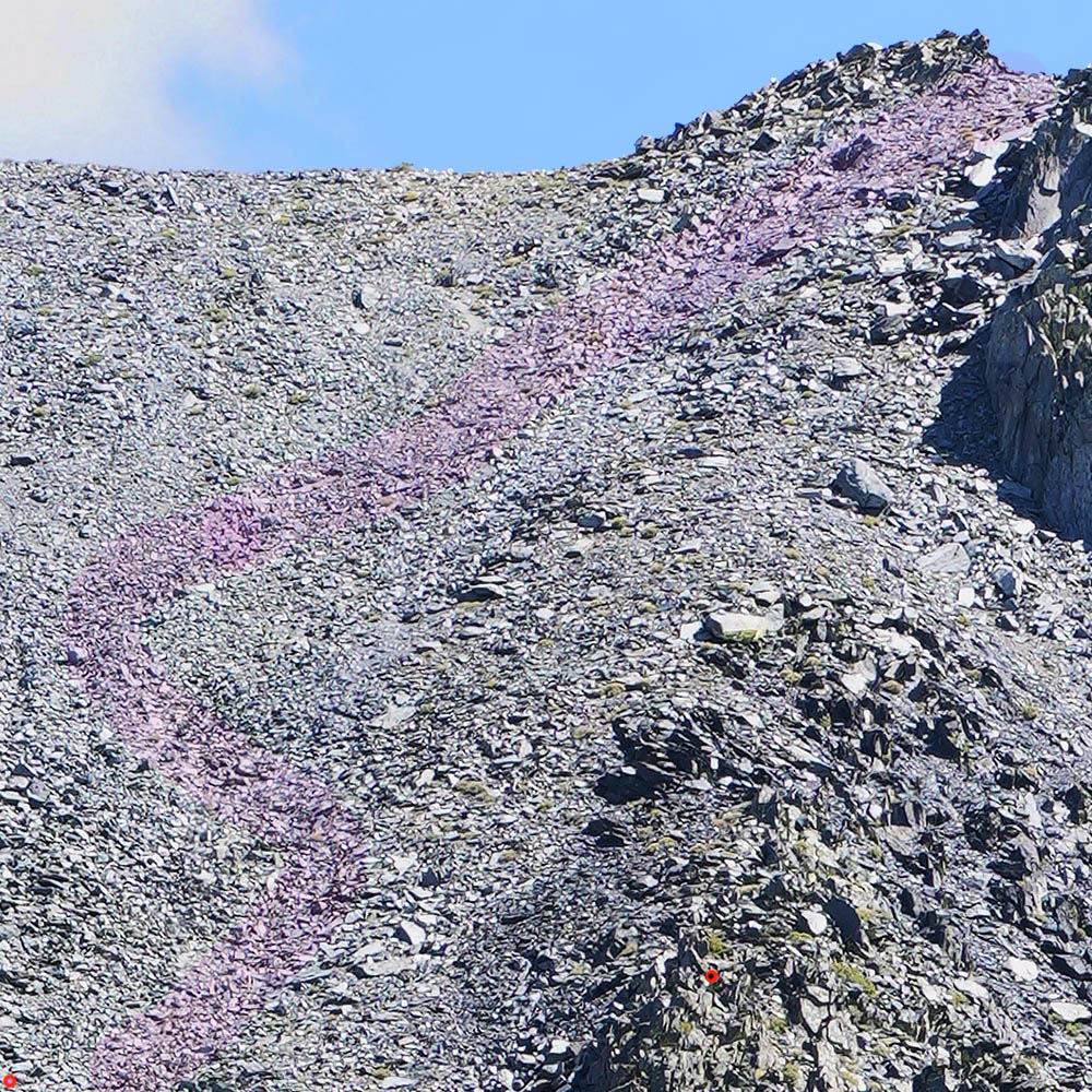
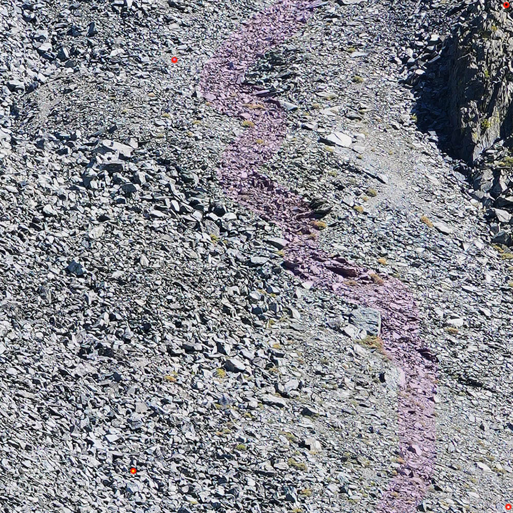
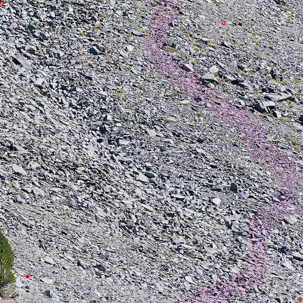
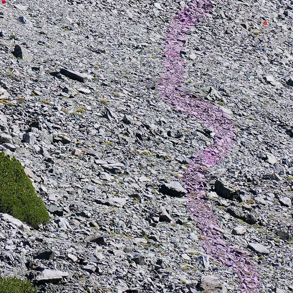
Below are 100% pixels crops of the above image VT01253-01254-2x1v.jpg captured with my 85mm lens from the Virginia Pass Trail, showing a possible route up Burro Pass that looked least difficult. The red dots with center colors are alignment markers to line up the 4 sections. On the south side, the better descent is southwest, a bit opposite the dark chute to its right. The ridge line a bit southeast provides a view down into the Burro Lake basin, not available from the pass, which is probably less effort to reach than traversing east on the ridge from the pass.
NEXT: Page 15 TBD
2026 Trip Chronicles: Contents


















