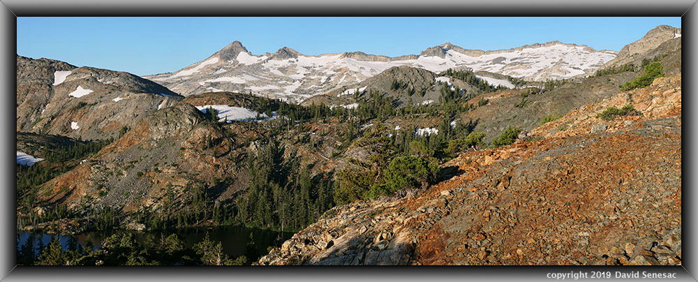
SM01523-01560-5x1v 16000x6000 pixels 5 frame 5 column 1 row 38 image focus stack stitch blend A6000 60mm
enlarged vertical slice view image text section
NEXT: Page 7 Upper Kern Basin Backpack (1of2)
2019 Trip Chronicles: Contents
Glen Alpine Creek Backpack 7/27
Glen Alpine Creek Backpack 7/28
Glen Alpine Creek Backpack 7/29
Glen Alpine Creek Backpack 7/30
Glen Alpine Creek Backpack 7/31
Glen Alpine Creek Backpack 8/1
After the San Joaquin River trip, it was a long month before I went back to the Sierra Nevada, primarily due to the considerable still-melting snow conditions. During the previous fall, when I tend to set up schedules for following summers, I'd expected to do a Desolation Wilderness trip early to mid-July. By late spring, I had pushed that back to sometime in late July. I then waited till I thought wildflowers would be at peak for my target zone, mostly by analyzing the recently added Caltopo Weekly Hi Res satellite imagery that shows snow in significantly better resolution. High Sierra areas of interest from Yosemite south would continue to be snowy until early August, so only areas to the north were acceptable. I chose to revisit the Glen Alpine Creek drainage that I've backpacked into several times primarily because of its more colorful metamorphic rock landscapes. All Desolation Wilderness areas have nice areas of Sierra junipers, a primary target, but are primarily just in granite areas.

Earlier in the month, my still-under-warranty, very sharp prime Sigma 30mm F1.4 DC DN lens had developed an electronic circuit fault, so I shipped it down to a repair facility in San Diego. Upon debugging, they found it needed a part that had to be shipped from Japan, so I would have to contend with using my older Sigma 30mm F2.8 lens that is rather soft.
With the flexibility of a retired person, I was able at short notice to secure a recreation dot gov wilderness permit starting Sunday, July 28, for 6 days, which one can print out at home without bothering to go into any ranger station. That allowed me to drive up on Saturday afternoon, July 27, and reach the trailhead beyond the far end of Fallen Leaf Lake by late afternoon. Of course, mid-summer Saturday, Tahoe roads were packed, which delayed getting to the trailhead. I'd stopped at the Raley's Y supermarket for broccoli cheese soup and some yogurts, one of which would be in my pack for an evening snack. As expected, finding trailhead parking at 6550 feet was easy, as most day users had already returned and left. The actual wilderness boundary is 2 miles beyond the parking lot, so I could legally go up to that point this evening.
Link to online USGS topo for the:
upper Glen Alpine Creek basin
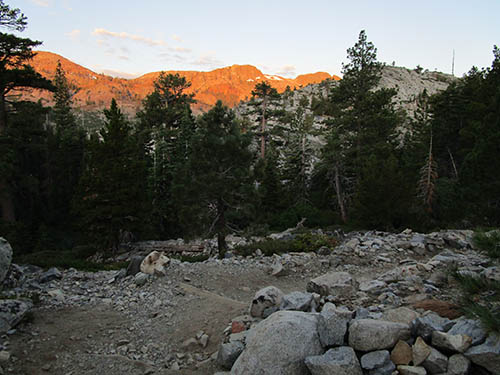
Thus set out with a carrying weight of maybe 58 pounds. There were a couple of streams before the historic Glen Alpine cabin resort area where I could have gotten water. By the time I reached my destination at 7000 feet, 1.7 miles along, up 500 feet, it was sunset. The effort to reach that point was modest, though I did sweat some. That had me doing a torso dunk in the Gilmore Branch Creek before retiring in my Big Agnes CS UL1 tent sans rain fly. I found a usable spot atop uneven bedrock out of view and far enough away from the trail that I would not have to worry much about bears. Regardless, all my food was in a Garcia canister.
As dawn rose Sunday, July 28, 2019, I packed up gear and by sunrise was back on the trail. A ridge would be blocking sunlight over the first couple of miles, keeping temperatures cool. It was soon evident I had nailed vegetation conditions, as flowers were about all expected environments. I'd wondered about mosquito conditions and would find they were not much of an issue outside of a few swampy zones, as I used little DEET during the trip. The trail traverses hillsides covered with manzanita, chinquapin, and Jeffrey pine, while rocky outcrops had a few junipers. The view on the left shows the shaded rocky trail at 7.3k and early warm light on the ridge about Keith's Dome. By 8am I'd reached the 4-mile point where I set out cross-country in order to find a camp spot. The glaciated metamorphic landscape of the upper basin is extremely rocky and uneven.
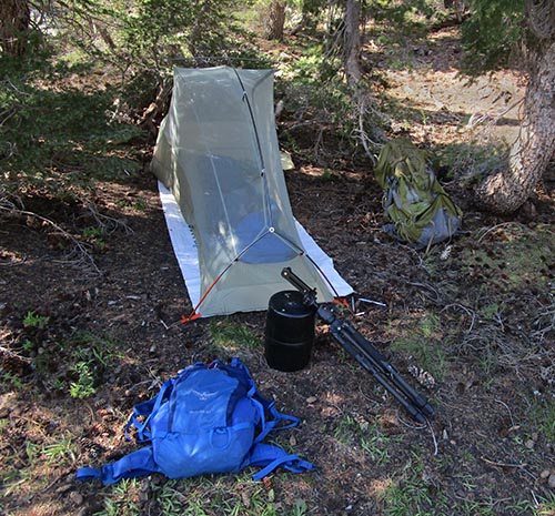
Shortly afterward, I had reached the zone 1/3 mile from the trail and not far from a stream where I expected to find my camp spot with solitude. I had several usable choices, and as I would discover in the following days, there were absolutely no signs of any groups having camped in the zone in at least several years. Instead, all used camp spots were predictably adjacent to Half Moon Lake, which was a significant distance away. And, not surprisingly, most were illegally too close to water sources, including fire pits, a reflection of inconsiderate, selfish attitudes many have in this era. Thus, set up tent and gear below some shading mountain hemlock. The blue pack is my Osprey Scarab 32 photo gear day pack. The white ground sheet is an $11 Tyvek sheet that functions well.
At this point, at mid-morning with breezes blowing, I wasn't expecting to start any photography and instead went on a 2-hour-long tour of the zone looking for prospective landscape and Sierra juniper subjects. There were several no-name ponds in the basin; however, I would be faced with mostly breezy conditions over the following days that had me looking elsewhere. Thus, I would not be paying much attention to possible reflection subjects despite the many shallow bedrock ponds, including several not shown on the topo. Upon returning, I jumped in the not-that-chilly stream, cooked lunch, and then enjoyed a nap in the tent.
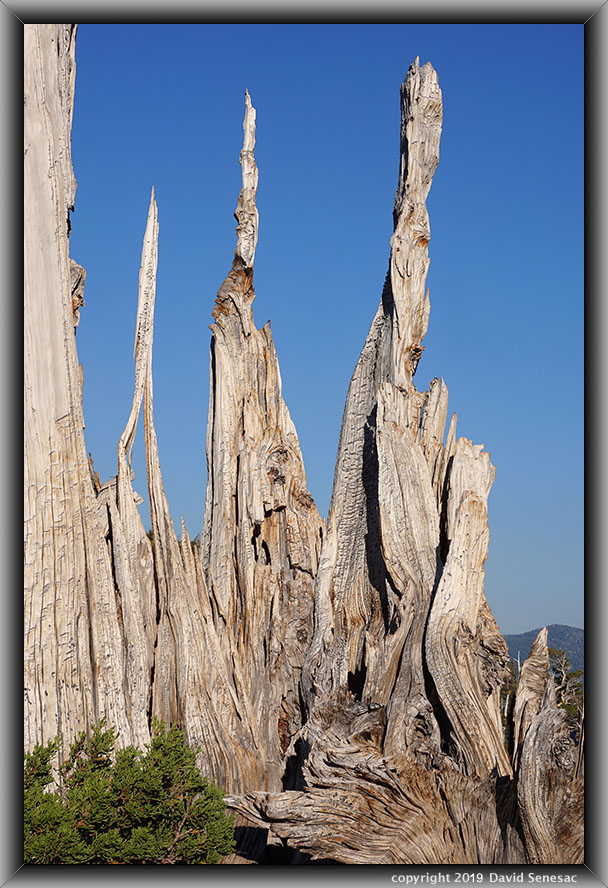
SM09938-48 4000x6000 pixels 1 frame 11 image focus stack blend A6000 60mm
enlarged vertical slice view
At 2pm, I got up and began another long exploratory ramble up on a dome where I found more junipers worth returning to. After returning to camp, I went out again at 4pm to have some fun before working on my first of 3 juniper subjects an hour later. The above image shows long-dead younger wood of a living tree nicely isolated up against the blue sky. Part of the game with junipers is locating perspectives with good background isolation that is not common. Select the enlarged vertical slice view to see nature's exquisite wood art.

The sun sets in this basin early behind Jacks Peak, so after the sun dropped behind the ridge, I had another hour to explore more at the day's end. These places are so huge that it is imperative to be ready with known subjects because periods of optimum light pass quickly. This juniper above that I set down against was about 10 feet wide at the base. It was such a comfortably cozy spot I thought about dragging my sleeping bag up there the next day for a nap. Back at camp, I enjoyed some soup before retiring, with much work to look forward to in the coming days.
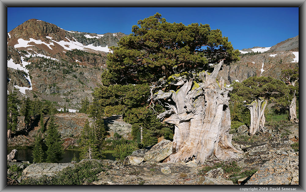
SM00008-00046-3x1v 9800x6000 pixels 3 frame 3 column 1 row 39 image focus stack stitch blend A6000 30mm
enlarged vertical slice view
No need to rise early given Mt Tallac blocking the sun, so I didn't unzip my tent door on Monday, July 29, 2019, until sunlight had time to work its way down into this upper basin. By 8am I had hiked over to the above three Sierra juniper, Juniperus grandis, landscape with snowy 9856 foot Jacks Peak in the background. These junipers have lifetimes as old as 3000 years, with this patriarch looking very old indeed. The water behind the trees at frame left is a stream pool with resident eastern brook trout. Just left of the middle juniper is a small section of Half Moon Lake. The species name was recently changed from that of western juniper, J. occidentalis, to J. grandis due to DNA evidence. At the base of the large juniper are rose-hued flowers of mountain spirae, Spiraea densiflora. Beside the stream pool are young mountain hemlock and lodgepole pine with a larger mountain white pine at the far side left frame edge.
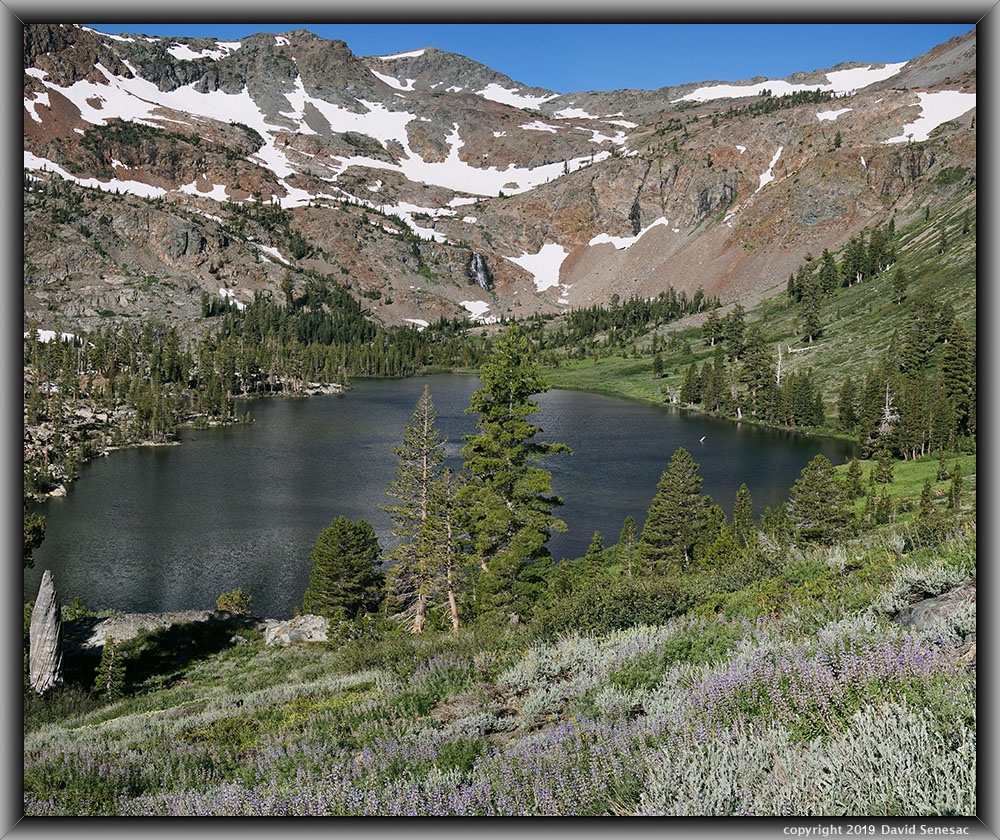
SM00068-00102-2x1v 7200x6000 pixels 2 frame 2 column 1 row 35 image focus stack stitch blend A6000 30mm
enlarged vertical slice view
With an early morning breeze waving the waters, at 8:30am, I climbed up the slopes above Half Moon Lake to capture a patch of silver lupine, Lupinus argenteus, and the length of the lake at 8150 feet. The large tree at the center lake edge is a sugar pine, Pinus lambertiana, with a large crop of its long pine cones. To its left are smaller lodgepole pines. Note the big cascade draining larger snowfields above the end of the lake.

SM00135-00166-2x1v 7200x6000 pixels 2 frame 2 column 1 row 32 image focus stack stitch blend A6000 30mm
enlarged vertical slice view
This next image was shot a bit lower off to the right where several species of wildflowers were blooming. As snows melt, water draining below the surface flows through a rocky mix of soil and mineral sands atop bedrock barriers and cracks. As they reach the lowest levels near a lake edge, moisture content increases, causing flows to push out through surface areas. Over time, that extra moisture develops greater vegetation, especially annual wildflower species, resulting in even richer soil nutrients. Closest to lake edges are the most moisture-adapted species like corn lily and swamp onion. Here at the top of more well drained soils in the lower foreground mixed in with silver grey-hued big sagebrush, Artemisia tridentata, are Applegate's paintbrush, Castilleja applegatei, with its wavy edged leaves, light yellow-hued sticky cinquefoil, Drymocallis glandulosa, pretty face, Triteleia ixiodes, yellow-hued with brown lines, and white-hued Leichtline's mariposa lily, Calochortus leichtlinii. Further down the slope in the meadow are white-hued dirty socks, Polygonum bistortoides, broadleaf lupine, Lupinus latifolius var. columbianus, silver lupine, and yet-to-bloom corn lily. Lake edge trees are lodgepole pine, pinus contorta.
The lightly used topo map trail circles this west end and around the north side of the lake, ending at Alta Morris Lake where a large old packer camp zone exists. I fully circled the lake, then explored down the canyon some before returning to camp, where I made lunch and then spent several afternoon hours snacking, taking a dip in the lake, and having fun on a bedrock flat that extends into the lake shores.

SM00216-29 4000x6000 pixels 1 frame 14 image focus stack blend A6000 60mm
enlarged vertical slice view
After returning to my camp, at about 5pm began working on more juniper subjects. This close-up image above shows wolf lichen, Letharia vulpina, which commonly grows on trees, especially old Sierra junipers, as in this subject that has a couple of interesting holes in its dead wood with blue sky beyond. Select the enlarged vertical slice view to see its intricate otherworldly form.
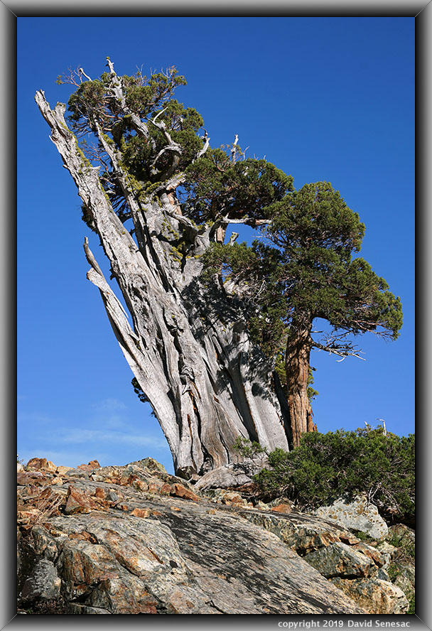
SM00230-33 4000x6000 pixels 1 frame 4 image focus stack blend A6000 60mm
enlarged vertical slice view
Above is an old Sierra juniper that grows atop the mostly barren, wind-exposed top of a dome. Such trees often form multi piggy-back trunk forms where older trunks in their wind-exposed directions eventually die off, leaving strips of living cambium on lee sides that eventually develop their own trunks. Here there are 3 such trunks, with the living trunk on the right sheltered by dead earlier trunks on the west storm-wind side. To do so, species need to have decay-resistant wood that is not easily eroded over hundreds of years. I've sometimes wondered if the species is actually the result of genetic engineering by ancient advanced alien visitors.
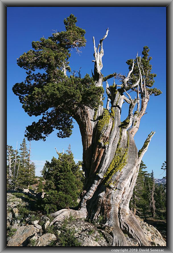
SM00252-68 4000x6000 pixels 1 frame 17 image focus stack blend A6000 60mm
enlarged vertical slice view
Another old Sierra juniper above that grows atop a smaller, less wind-exposed rock outcrop. Junipers have several different common forms, and one is this twisted trunk form. Note the strips of reddish-brown bark still attached to part of the lower trunk on the right. One usually only finds old trees like this on rocky outcrops where other tree species cannot easily grow.
SM00321-32 4000x6000 pixels 1 frame 12 image focus stack blend A6000 60mm
enlarged vertical slice view
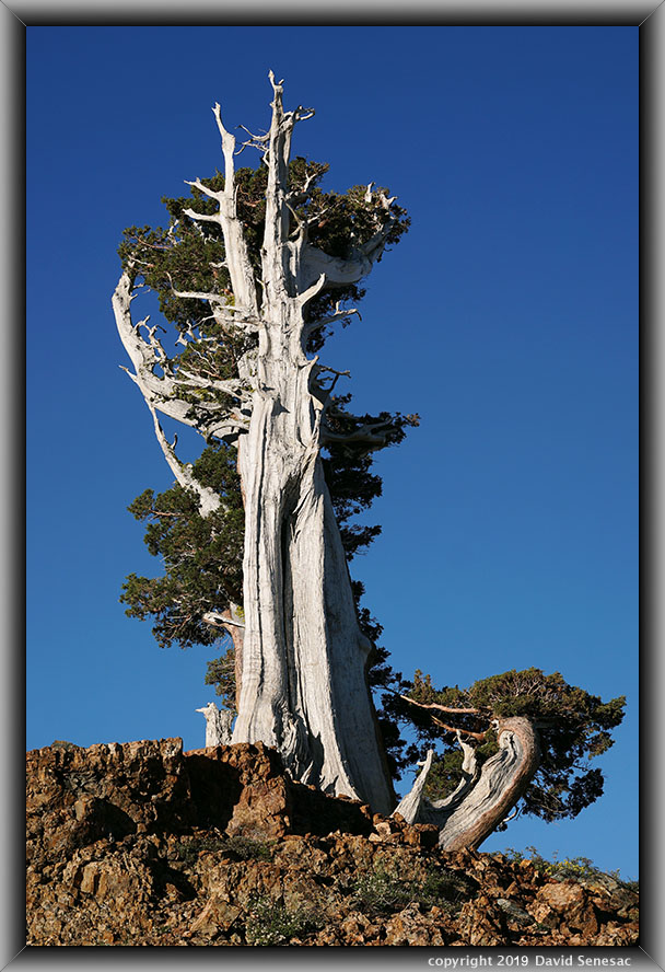
The above old Sierra juniper was another tree growing atop a wind-exposed outcrop, showing its wind-direction form. I worked a few other juniper subjects, then returned to my camp for dinner and retired.
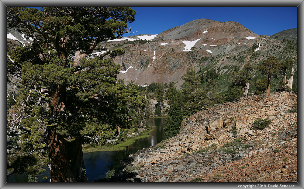
SM00667-00706-3x1v 9900x6000 pixels 3 frame 3 column 1 row 12 image focus stack stitch blend A6000 30mm
enlarged vertical slice view
Another lazy early morning of Tuesday, July 30, 2019, I got out about 7am then worked a few modest subjects. The above was shot about 9am with a juniper at frame left, then a linear stream pool, and 9974 foot Dicks Peak. Note the bands of metamorphic rock lower right in this frame that have, over hundreds of millions of years, been altered from their original horizontal deposition to more vertical. The whole upper basin lies atop this colorful rocky metamorphic geology, a Jurassic Period formation deposited in a shallow marine environment that is awkward to walk about on, and that several Pleistocene Epoch glacial periods eroded, smoothing forms.
After a couple of days at my day 2 and 3 camp spot, before lunch I moved a bit closer to Half Moon Lake where I left my gear beneath a shading lodgepole with an expectation to move it all atop nearby bedrock after the sun went down.

SM00784-95 4000x6000 pixels 1 frame 12 image focus stack blend A6000 60mm
enlarged vertical slice view
The next close-up image above shows a colorful vertical glacial surface with green tourmaline crystals and a plant growing in a crack.
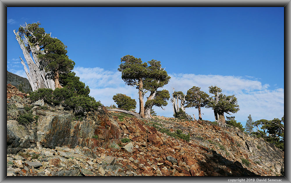
SM00905-00947-3x1v 9800x6000 pixels 3 frame 3 column 1 row 43 image focus stack stitch blend A6000 60mm
enlarged vertical slice view
The above row of junipers on a ridge includes, at frame left, the same tree as SM00230-33 above. I shot this at 6:15pm. To the left of the tree on the left is dark metavolcanic geology about Mt Tallac.
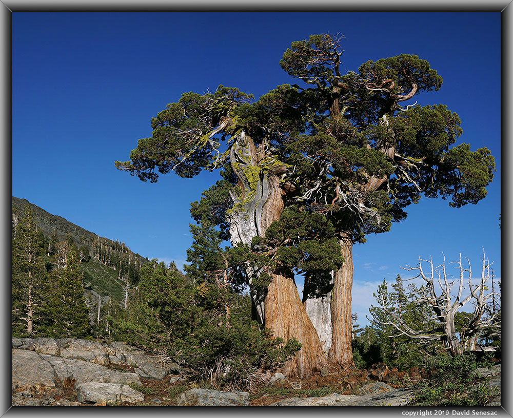
SM00963-00689-2x1v 4000x6000 pixels 2 frame 2 column 1 row 27 image focus stack stitch blend A6000 30mm
enlarged vertical slice view
Above is a large double trunk juniper that is another common form. Note the skeleton of another broad juniper below right. Similar-shaped junipers are often found in proximity, indicating close genetic relations.
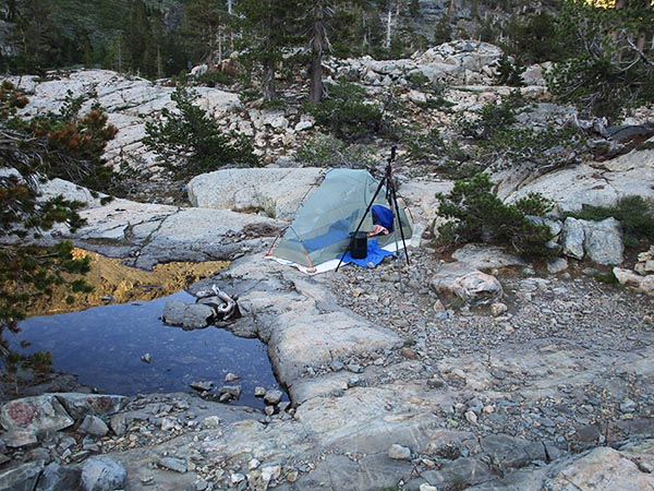
Sun once again dropped behind the ridge west, and I returned to my gear, then set up my tent on bedrock next to a small, shallow snowmelt-water pool. I was surprised to find a young solo woman had just arrived and tented a mere 150 feet away on the other side of a rock knob. I went over and greeted her, who was just as surprised as I had been to seek out this spot where few others camp, expecting isolation. After a nice conversation, all was well and quiet. During the night, I pulled my sleeping bag out of the tent, then spent a couple of hours out on the open bedrock under the starry universe. That also reflected how few mosquitoes were about in such areas at night.
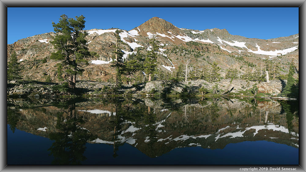
SM00990-01014-3x1v 9250x5000 pixels 3 frame 3 column 1 row 25 image focus stack stitch blend A6000 SELP1650 @24mm
enlarged vertical slice view
I rose earlier on Wednesday, July 31, 2019, packed up gear, then left with just my photography gear for a morning of work. It was the only morning with at least a few minutes of near-calm air during this otherwise breezy week. I thus visited one of several small unnamed shallow ponds on bedrock flats of the basin for the above image. The larger tree at the left shore is a western white pine, Pinus monticola, aka silver pine or California mountain pine.
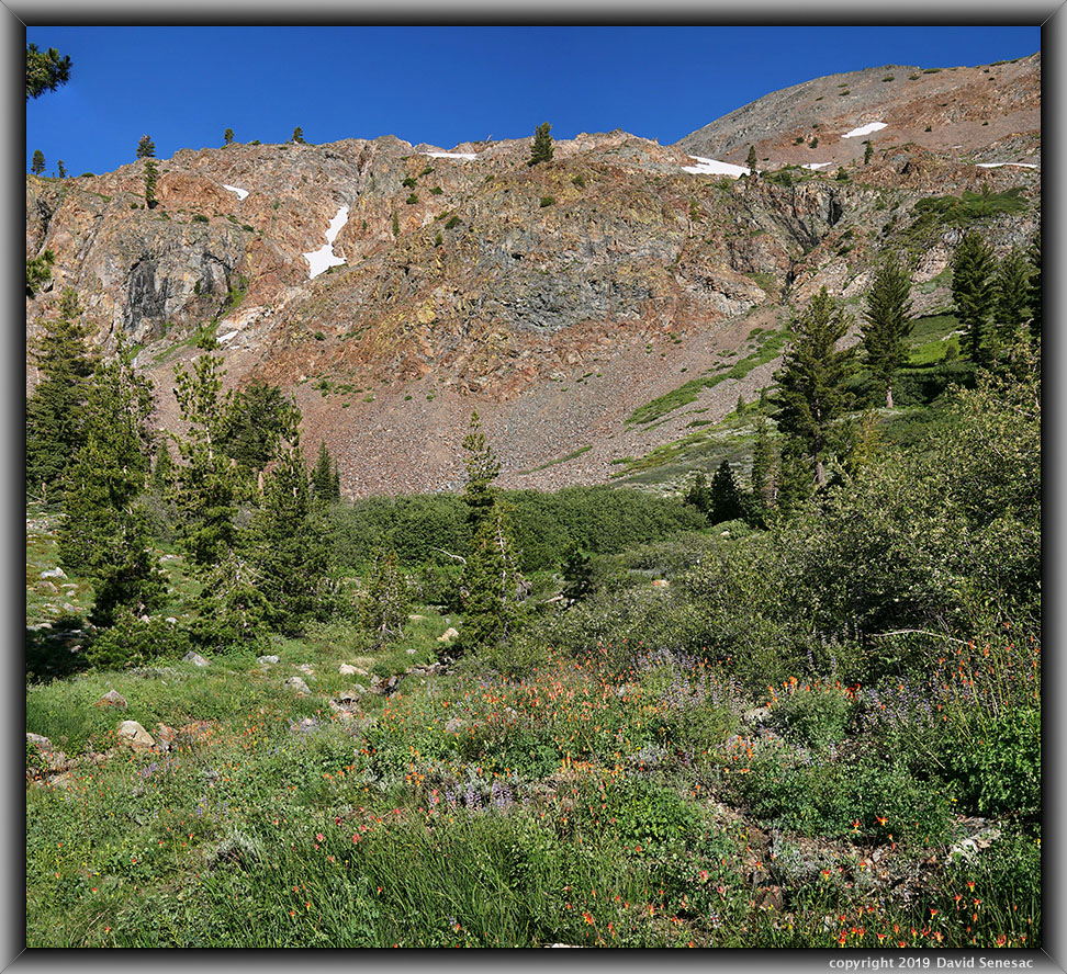
SM01020-01058-2x1v 5500x5000 pixels 2 frame 2 column 1 row 39 image focus stack stitch blend A6000 30mm
enlarged vertical slice view
I rambled quickly around the lake to an area with crimson columbine, Aquilegia formosa, silver lupine, and Applegate's paintbrush, with Dicks Peak above that I'd sized up a couple of days earlier. A stronger breeze had arrived, so it took quite a period of waiting for momentary lulls to get this shot in.
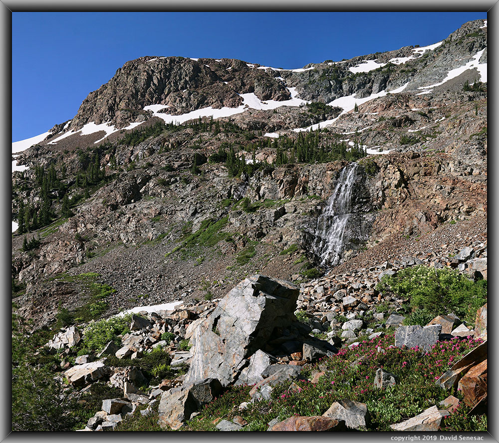
SM01020-01058-2x1v 6800x6000 pixels 2 frame 2 column 1 row 37 image focus stack stitch blend A6000 30mm
enlarged vertical slice view
Below the cascade from snowfields below Jack's Peak, within a talus berm, I found the above patches of red mountain heather, Phyllodoce breweri, and blue elderberry, Sambucus mexicana, mixed with white heather, Cassiope mertensiana. Both heather species bloom as soon as snow melts, so the snow had just recently melted there within a couple of weeks. Higher up on the slopes are more white patches of elderberry plus mountain hemlock, the only trees that tend to inhabit such heavy snow areas that melt out late on shadier northern exposures.
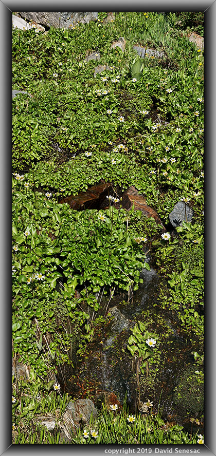
SM01121-01150-1x2v 6800x6000 pixels 2 frame 1 column 2 row 30 image focus stack stitch blend A6000 30mm
enlarged vertical slice view
Nearby, I came across a fascinating snowmelt stream lush with marsh marigold, Caltha leptosepala, where I shot a 1-column, 2-row stitch blend set worthy of someone's bathroom door.
By 10am, I was back at camp where I stashed my pack and was quickly on my way south to the ridge northeast of Susie Lake. After reaching that zone, I dropped my pack, then spent a couple of hours rambling about and exploring the area, during which I managed to get into some very unpleasant brushy areas that took time to escape from. Back at my pack, I decided to set up my tent beneath the only really shady grove of trees that was on a small bench on the brink of a modest cliff. After making lunch and taking a dip in a nearby shallow pond, I retired into my tent for an hour of pleasant napping.
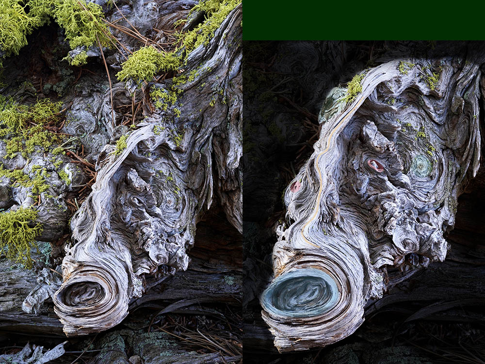
Most subjects I found in the area were going to be early morning shots the following day, so I had several hours to amuse myself. As I sat below a large juniper above my tent, I noticed the fallen branch at my feet that was covered with wolf lichen sort of looked like the shape-shifting, salt-sucking vampire in the Star Trek "Man Trap" episode. With some difficulty, scooting down as low as I could get my tripod lying prone, I managed to shoot a set of shots as above. The round areas are where branches had broken off on the old wood.
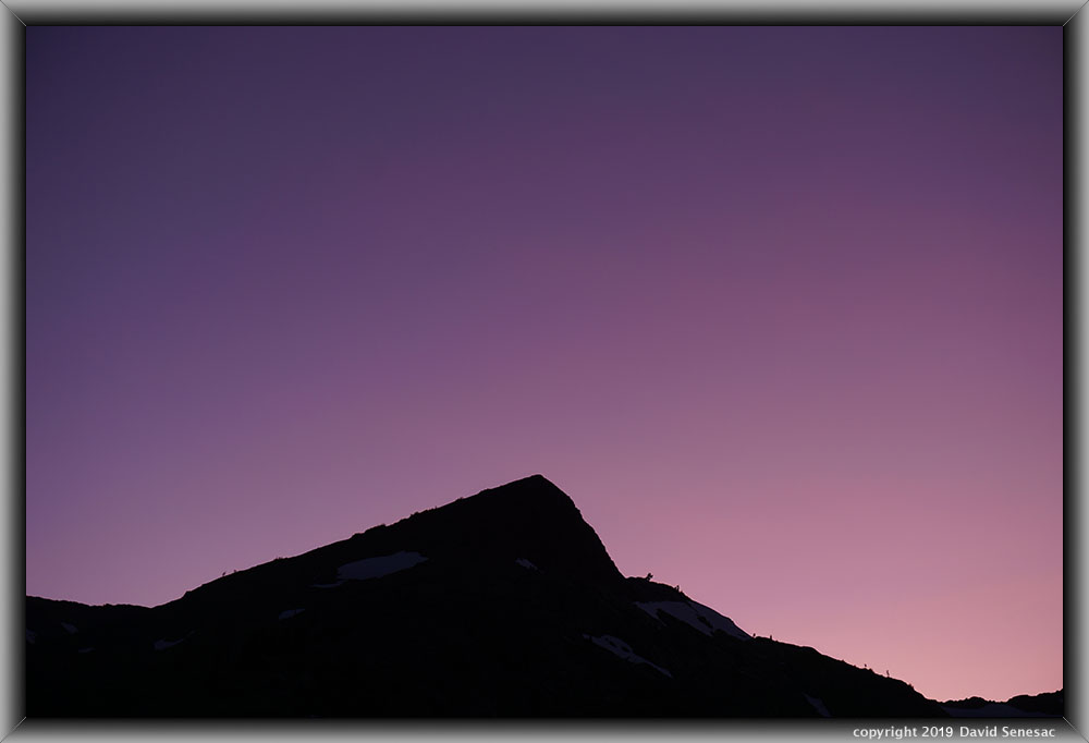
SM01479 4000x6000 pixels 1 frame 1 image A6000 SELP1650@43mm
enlarged vertical slice view
Later that afternoon, I indeed did not have much success finding strong subjects and instead had fun before retiring into my tent; that would be the last night of this 6-day trip. As dusk rose, I was surprised how strongly saturated the dusk colors looked over Jacks Peak, so I jumped out without much clothing, pushed on my SELP1650 zoom, and at 43mm captured the above silhouette.
There was no time to mess around as early dawn rose Thursday, August 1, 2019. I would pack up gear late morning upon return. Thus, I set out with a headlamp up towards the top of the ridge above camp, which required awkward footwork over the uneven rocky terrain. Once up on top, I rambled back and forth, looking at perspectives I'd surveyed midday 4 days earlier towards the snowy Crystal Range to the west-southwest, which I knew would receive first light. Unfortunately, the warm light turned out to be mediocre; that is common if skies far to the east in Nevada are not clear. Well, that was a dud and probably meant light would continue to be weak until the sun rose high enough in altitude to clear whatever it was that was out of my view behind Mt Tallac. I decided on the rustiest-hued area of bedrock Jurassic Period intrusive gabbro and diorite rock that I could get in the frame using my sharp 60mm lens; that is the 5-column, 1-row stitch blend image at page top shot at 6:50am. Susie Lake is in the lower left. 9983-foot Pyramid Peak is the summit at mid-left, and 9975-foot Mt Price at mid-right, with roundish, dark Cracked Crag in front.
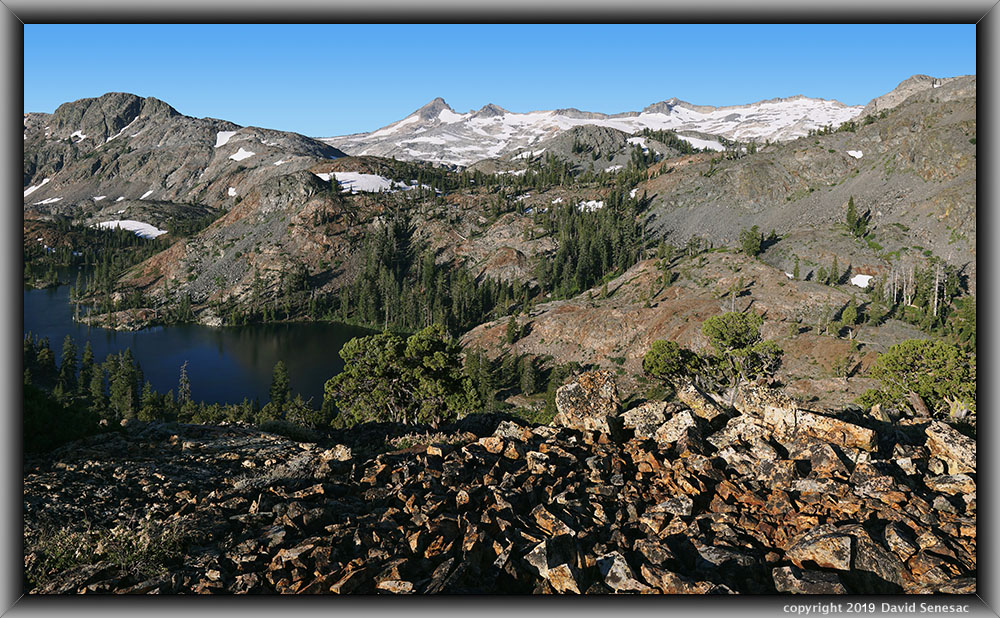
SM01575-01612-3x1v 10000x6000 pixels 3 frame 3 column 1 row 38 image A6000 30mm
enlarged vertical slice view
This next image above, using the 30mm, was shot at 7:25am and required waiting a bit for the sun to illuminate the foreground.

SM01613-01651-3x1v 10200x6000 pixels 3 frame 3 column 1 row 39 image A6000 30mm
enlarged vertical slice view
I climbed down to a perspective over the bench I had camped at for the next image above, which has a better view of Susie Lake. I spent a bit of time trying to put some of these impressive short junipers in the foreground, but that just didn't work, so I instead settled for the dark lichen-covered rocks. The Pacific Crest Trail routes from large Lake Aloha, which is unseen in front of the Crystal Range, past also unseen Heather Lake, and then around the far shores of Susie at frame left.
SM01652-01683-3x1v 10800x6000 pixels 3 frame 3 column 1 row 32 image A6000 30mm
enlarged vertical slice view
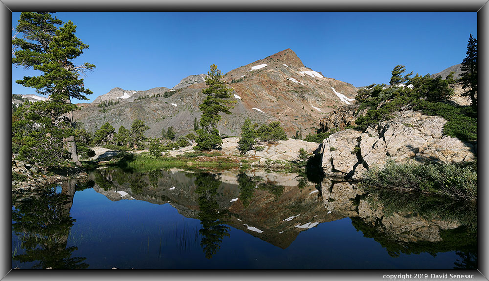
Back down near my camp, I was surprised when the breeze lulled, so I captured the above pond reflection with Jacks Peak. The large tree at frame left is a lodgepole pine, Pinus contorta, the most common Sierra Nevada species at near and below timberline areas that prefers deeper soils and water. At right along the pond are some water-loving willows that tend to indicate this small pond is probably along underground seep flows. The similar-looking large tree back a ways to the left of Jacks Peak is a Sugar Pine with a good crop of long pine cones. And to the right of Jacks Peak at midground is a fine wind-flagged juniper against the sky.
Although thousands of people hike the trails in this land of juniper's basin each summer, almost none ever explore many of the areas I've shown on this above web page. Although the basin and much of Desolation Wilderness in general has some of the largest numbers of visitors of any wilderness, the nature of its irregular glaciated terrain offers much solitude if a person simply bothers to venture as little as a third of a mile away from trails and/or lake edges. It was now almost 8:30am, and within an hour I was on my way towards the trailhead. Leisurely taking my time, I was in my Forester and driving out along Fallen Leaf Lake by 11am and a few hours later back at home.
NEXT: Page 7 Upper Kern Basin Backpack (1of2)
2019 Trip Chronicles: Contents


