
SL08755-08792-3x1v 10100x6000 pixels 3 frame 3 column 1 row 38 image focus stack stitch blend A6000 30mm
enlarged vertical slice view image text section
NEXT: Page 6 Glen Alpine Creek Backpack
2019 Trip Chronicles: Contents
South Fork of the San Joaquin River Backpack 6/25
South Fork of the San Joaquin River Backpack 6/26
South Fork of the San Joaquin River Backpack 6/27
South Fork of the San Joaquin River Backpack 6/28
South Fork of the San Joaquin River Backpack 6/29
South Fork of the San Joaquin River Backpack 6/30
The summer of 2019 followed one of the stormiest winters in history leaving a deep snow pack all through spring. Many intent on visiting the Sierra in May and June when lower areas usually open up found themselves stumbling over considerable expanses of unpleasant snowfields. I wanted to get in at least one backpacking trip in June in order to gradually build up strength for more strenuous mid summer trips. Thus early on decided to focus on the South Fork of the San Joaquin River above Florence Lake reservoir, the largest high country river in the southern Sierra Nevada that would have impressive whitewater flows. The reservoir is at 7.3k and would be climbing up as far as 8.4k upriver, thus relative low elevations. All those areas are in sunny exposures so no snow was expected. Other reasons these areas melt out at the canyon bottom melt out early is they are in the storm shadow of a 10k plus ridge to the west and afternoon breezes flow up canyon from the warm San Joaquin Valley below. Additionally making there were no serious streams without bridges to cross.

The 4 mile long reservoir has a summer ferry service that before opening would have required adding another 2 days to what would be a 6 day backpack. With 6 days I would be able to reach a key photography location I'd figured out that is 12 miles in. I'd led up group trip up the river to Evolution Lake in 2005 so was somewhat familiar with the area. The weekend before my trip began, the Florence resort announced they were open. Given fair weather, I prepared to leave during the following weekdays. Before the trip I'd been on several long road trips working Southern California wildflower areas and before that during winter was regular resort snow skiing. However due to medical issues that arose in late April keeping me sedentary, my fitness level was modest.
Thus at sunrise Tuesday June 25, 2019, drove off at dawn south on US101, east on SR152, south on US99, then east on SR168 to the Sierra National Forest Prather office where as expected I easily picked up a wilderness permit. By early afternoon had reached Florence Lake, where I paid for a $28 round trip fare. By mid afternoon crossed the lake as the only passenger in a small outboard, then set out up the trail southward about 2:30pm with a carrying weight of about 58 pounds. Besides the big whitewater river conditions, was also expecting areas to be green and flowery which they were. By mid summer areas I would venture into are usually brown and dry, long since gone to seed thus less aesthetic. The above image on a granite gruss flat shows two species of monkeyflowers among jeffrey pine and Sierra juniper with snowy 10.9k Mt Shinn in the background. The trail, before the large Piute Creek junction at 8,000 feet another 8 miles ahead, routes through a heavily glaciated granite U-shaped canyon with bedrock and open flats common. In additional to the trail is a jeep trail that services a couple private in holdings in Blaney Meadows. I chose to use the jeep trail although as expected it was longer with a bit more vertical and would take the trail on my return.
Link to online USGS topo for the:
South Fork of the San Joaquin River areas

This day I planned to only move up the trail about 4 miles to Sallie Keyes Creek in order to ensure not over stressing and body parts. The only issues this afternoon were a few muddy areas in meadows, an awkward Alder Creek crossing grabbing willows, and occasional mosquitoes. By 5pm had reached the destination, climbed up 100 feet or so above the trail, and made camp. Before cooking a Mountain House freeze dried dinner and retiring, I took a fast dip into whitewater of Sallie Keyes Creek that was about as cold as I can tolerate for a few seconds.

Sun rises slowly on the trail due to the blocking canyon ridge eastward thus offering pleasant cool early morning hiking conditions. Up about sunrise sunrise Wednesday June 26, 2019, I was soon packed up and crossing several branches of Sallie Keyes Creek with the above the more difficult, a wet barked log. Anything wet ought be crossed very carefully, especially when carrying a heavy pack. I unbuckled my pack waist belt and used my big tripod against the bark to stabilize inching across. The first view of the snow melt full river is at the 5.5 mile point and indeed it was a roaring cauldron.
Expanses along the trail showed attractive short green grasses that would remain so for just a few weeks before turning brown. By late morning was near the Piute Creek junction at about 8 miles where I turned north up onto a bench well above the busy with PCT thru hikers. After dropping my pack, I spent about an hour exploring that zone before settling on a modest shaded camp site below lodgepole pines. Much of these sunny landscapes had brushy areas of huckleberry oak and manzanita. Part of that effort was locating a water source that turned out to be further away than expected.

SL08728-42 4000x6000 pixels 1 frame 15 image focus stack blend A6000 SELP1650@18mm
enlarged vertical slice view
With half the day still ahead of me, I spent much of the afternoon rambling around, putting in considerable vertical and mileage looking for photographic subjects. Unfortunately potential river shots with peaks in the background were few as tall forest about riverside areas tended to block and minimize most views. At 4pm, I grabbed my camera gear an climbed up steeply onto the rib northwest of the Piute Creek bridge where I shot the above of Sierra juniper, Panorama Dome, with tiny bits of the creek poking through branches. I'd been expecting some better views of the big whitewater flow in the creek, an example of how stream views tended to be blocked. Note a lens of darker metamorphic rock in the foreground and up higher on the dome. A couple days later I did climb up atop that small dome across the canyon above the juniper branches at right where all creek views were likewise blocked. To the right of the left juniper and on slopes across this Piute Creek canyon are areas of chinquapin, castanopsis sempervirens, a most common species at these mid Sierra Nevada elevations on sunny exposures. The plant exudes some sticky substances and that causes them to become rather dusty if one has to barge through them. Additionally there are plenty of spiders at these elevations that also make such brush worlds their home thus adding sticky webs.

SL08747-53 4000x6000 pixels 1 frame 7 image focus stack blend A6000 SELP1650@20mm
enlarged vertical slice view
At least the view down near the bridge crossing Piute Creek provided a reasonable view of Panorama Dome in the background. I caught a thru hiker crossing the bridge above. Flows in Piute Creek had a similar volume to the South Fork of the San Joaquin so the river below the confluence at least early summer has about twice the volume.
After unproductively exploring areas of the river before the confluence, I ventured onto the image at page top, of a nice Sierra juniper with Panorama Dome in the background. There were certainly good numbers of aesthetic juniper in this zone however almost all lacked complementing scenery. I'd expected to base camp a couple days on my bench however the lack of subjects caused a change of plans in my tent during evening to instead the next morning hike up a couple further miles.
Thus at sunrise Thursday June 27, 2019, was packed up while shadows still covered the lower canyon back along the river trail. Crossing the river bridge, I left the John Muir Wilderness and entered Kings Canyon National Park. I was impressed by how much more interesting the canyon and river areas become at that point. By time I reached Aspen Meadow, first rays of sunshine reached river areas. Several groups of thru hikers that had been a few miles above in Evolution Meadow passed me on the trail while confirming there was still considerable snow beyond. Topo flat areas where I expected to camp above Aspen Meadow turned out to be either uneven with loose rock or covered by brush. Weary of looking around, I settled on a crude site near a modest side stream. Later that day I regretted not exploring just a short ways further up the river onto a rib where it was more pleasant.

SL09061-67 4000x6000 pixels 1 frame 7 image focus stack blend A6000 60mm
enlarged vertical slice view
After some mid day fun exploring steep canyon slopes near camp, at mid afternoon left for a 2 mile plus hike up the canyon trail to the most important photography viewing point I'd analyzed before the trip. The above image shot about 5:30pm shows Evolution Creek where it drops down from its hanging valley to join the river that routes due south with a similar volume. In the background several miles beyond is 13710 foot Mt Mendel and at the Sierra Crest, 13831 foot Mt Darwin.

SL09073-09087-2x2v 5000x7300 pixels 4 frame 2 column 2 row 15 image focus stack stitch blend A6000 SEL55210@168mm
enlarged vertical slice view
This next image above shows the same whitewater cascades of Evolution Creek, at 5000x7300 focus stack stitch blend using my Sony SEL55210 Zoom lens. Because at 100% pixels it isn't nearly as sharp as my Sigma 60mm prime, I've reduced its size by about one-third that is plenty sharp now if one looks at the enlarged vertical slice view.

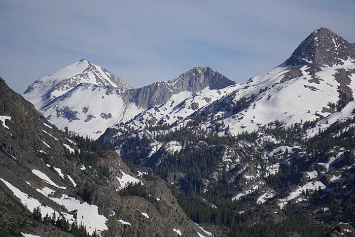
From the same perspective looking south up canyon, 12586 foot Mt Reinstein, showing how snowy areas were not far above where I explored. By time I had returned to my camp spot it was 7pm with shadows dominating lower canyon areas. After dinner and retiring into my tent, I decided to work river canyon nearby areas in the morning while moving to a third camp not too far east up river of the Piute Creek bridge.

SL09272-95 3900x5800 pixels 1 frame 24 image focus stack blend A6000 30mm
enlarged vertical slice view
At sunrise Friday June 28, 2019, packed up gear and then stashed the pack above the trail. I surveyed some prospective shots during my hike the previous afternoon including this one above with patches of mountain pride penstemon along the SF San Joaquin River where it flows deeply through a narrow gorge.

SL09377-96 5000x3300 pixels 1 frame 20 image focus stack blend A6000 SELP1650@16mm
enlarged vertical slice view
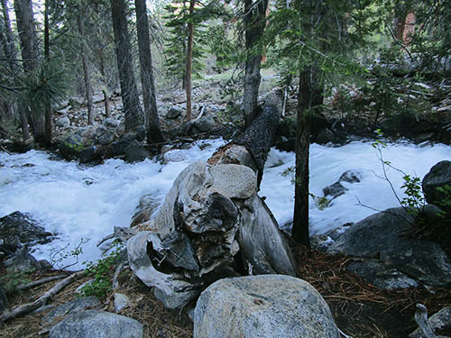
Within the river flow was a large boulder just below a flow drop with some logs wedged against bedrock and as I walked past the loud whitewater, my ears kept hearing unusual loud bonking sounds every 15 seconds or so. Well the long log on the south side would occasionally be lifted up and then come banging down on the rock.

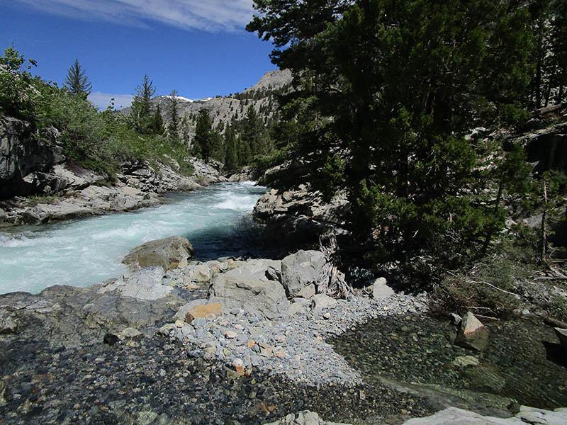
The image at right is where I took a dip in a quiet side pool of the otherwise violent flows of the river. Conveniently the trail routes near this spot.
After returning to my pack, I moved down river 1.5 miles and set up my fourth camp spot of the trip. East of the bridge are numbers of well used riverside camp spots all closer than 100 feet from the river. Although proper backcountry ethic is to not camp closer than 100 feet to water sources, it is an example of an overly simplistic dumbed down rule. Obviously when camped beside a large mountain stream, especially when peak snowmelt volumes, one does not need to worry about polluting water. If the national park was serious about such a policy they could have blocked use of these sites that have obviously been used especially by equestrian visitors for decades before that policy was implemented. In the afternoon with skies filling with clouds making possible landscapes dull, I climbed up on the small dome below Panorama Dome where as noted on day 2, I was disappointed in not being able to see Piute Creek below as it was all blocked by streamside trees. Instead spent a few hours having fun on a canyonside bench above. Late afternoon was back at my riverside camp where I enjoyed eating down snacks and candy in my food supply.

SL09725-42 3800x6000 pixels 1 frame 18 image focus stack blend A6000 SELP1650@17mm
enlarged vertical slice view
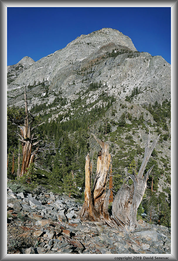
I rose slowly after sunrise Saturday June 29, 2019, day 5 of my trip and packed up gear. Later after mid day would be heading down canyon in order to stage returning to the ferry point on Sunday. But early this morning headed back up canyon in order to climb atop Muir Rock. Sun rises late in this narrow section of the canyon about 10am, so had a couple hours to explore and play around. I shot this next image above that shows a long section of the river below Muir Rock. The domes below where I camped my second day are in the background.

After returning to my pack at noon, began the trek north and made camp not far from the river about a half mile above the Muir Trail Ranch. The rest of the afternoon explored that section of the canyon that didn't offer anything I felt like pulling my big camera out for. During the trip breezes had risen each late morning that made close-up flower work too tedious for me to bother with while during mornings when conditions were sometimes calm, I was busy shooting landscapes. Generally I tend to see significant numbers of close-up wildflower subjects on my backpacking trips that I usually don't work as the same species are all found along roads given proper elevation and environments that are more easily shot on days I car camp dedicating quiet morning to focus on just close-ups. One of the best areas to do so is in fact up just up the road near Kaiser Pass I did so after a backpack in 2017.
After sunrise Sunday June 30, 2019, was soon packed up and making my way past areas I'd traveled 6 days earlier. Beyond Double Meadow I left the jeep road and used the trail that routes higher up on the canyon wall. By late morning had reached Florence Lake where I enjoyed conversations with the nice folks that own one of in holding lands up canyon. Other groups filled the ferry as we were brought back across the lake. After loading gear into the Forester, it was a long 6 hour road trip back to the SF Bay Area.
NEXT: Page 6 Glen Alpine Creek Backpack
2019 Trip Chronicles: Contents