SJ06251-06265-3x1h 13800x4000 pixels 3 frame 3 column 1 row 15 image focus stack stitch blend A6000 60mm
enlarged vertical slice view image text section
NEXT: Page 4 Carrizo Plain NM
2019 Trip Chronicles: Contents
Anza Borrego State Park 3/19
Anza Borrego State Park 3/20
Anza Borrego State Park 3/21
Anza Borrego State Park 3/22
Anza Borrego State Park 3/23
Antelope Valley California Poppy Reserve 3/24
Antelope Valley California Poppy Reserve 3/25
After returning from the Joshua Tree road trip, I redeveloped a peritoneal cavity medical issue I've had my whole adult life. What I didn't understand at the time was that it was complicated by another issue I would only be diagnosed with after returning from this second road trip south. I did manage to get a couple more days of terrific skiing in, while expecting to fit in several more between desert road trips. That other issue would close my skiing this season at a disappointing 19 days. Complicating timing for a trip south was weather that continued to forecast windy days. Finally, a small window of calm showed a couple of days, and it was then or never because the Anza-Borrego bloom was already past peak in the eastern badlands. Additionally, Antelope Valley poppies had, as expected, developed rapidly to the best conditions in over a decade. I also considered visiting the Lake Elsinore Hills poppy bloom and Carrizo Plain.
horned lizard text section
Thus, at sunrise Tuesday March 19, 2019, I left home, repeating the same route I had driven 17 days earlier. By noon, I reached Bakersfield, where I stopped for gas, more cash at a BofA ATM, and fast food. Continuing south over Tehachapi Pass on SR58 into the Mojave Desert, took US395 south to I15, then I215 and I10 at San Bernardino eastward to Indio, where late afternoon made my last pit stop for gas plus drinks, perishable food, and cubed ice for my cooler. Late afternoon, after a quick road tour of the past peak Coachella Valley Preserve, I continued driving south and, at a very windy dusk, into Anza Borrego State Park. Even though it was becoming quite dim, it was obvious, due to drying brown plants I could see that I would not be working any of the eastern areas. Considering where I could best spend the windy forecasted Thursday, I drove out onto the dirt Vern Whitaker Horse Camp road, where I parked to overnight inside my car. Online topo map of area:
online topo Coyote Canyon in Anza Borrego State Park
Up at dawn Wednesday March 20, 2019, I drove a short ways to a pullout close to the camp, then walked in. It was occupied by several nice, friendly ranch folk with their horses, large trailers, and equestrian gear. The small out-of-the-way camp at the mouth of Coyote Canyon has a very nice modern restroom with showers. Mostly sunny with a west wind, I hoped the tall east-facing mountains would block wind enough to work some sheltered close-up subjects. And indeed I tried doing so before soon giving up and just exploring for prospective subjects on calmer days. I was glad to see plants near the peak, robust, green, and flowery, with an abundance of strong material to work given some calm.
My expectation had been that it would be these east-facing mountain slopes and their canyons that would have the best flowers during the bloom cycle, as the last round of storms had watered these areas more than the badlands to the east where this year's bloom started. I sent out a text message with an image attachment on my new Moto G6 phone; however, I later learned only the text was barely transmitted, and the rest of the week I left it alone, mostly because it showed out of cell range. By mid-morning, after a half-mile excursion up the canyon, I was back at my car.
I drove into the small resort community of Borrego Springs and to the park visitor center, where the parking lot was full, and bought a new edition park map. Then it was out north on Di Giorgio Road that turned into a very dusty dirt route that reached Coyote Canyon. And because people at the visitor center were all being directed to that area that had the best peak wildflower conditions, there were many vehicles, especially SUVs, making dust clouds. I decided to drive out beyond the first creek crossing, where most 2WD vehicle drivers become intimidated and turn around despite trivial water, and find a good pullout spot to set up my base camp. A spot at ~1070 feet on a short side loop suited my taste, so I stopped and set up gear in the Forester for the day. Coyote Canyon trends southeast to northwest, and I was just a quarter mile inside the mouth before it opens up into wide, level Borrego Valley. There were a half dozen other vehicles set up in small pullouts all right next to and in view of the dirt road.
After cooking lunch, mid-afternoon, I hiked out to the nearest small spur canyon south that was mostly out of view of road drivers because a row of low hills at the canyon mouth blocked its view. The wind had decreased somewhat but was still blowing much too strongly for photography. After walking 1/4 mile and entering the side canyon, there was only a single track in the wash sand, and that was a horse hoof track that ended where the wash narrowed. Otherwise, I would find on following days, despite hundreds of vehicles on the dirt road each day, almost none of the occupants ever bothered to walk out more than a couple hundred feet from the dirt road.
Thus, there were vast pristine areas without footprints. Behavior I have seen at every other desert park I've visited, regardless of how many vehicles drive nearby roads. Instead, almost all of them stop briefly and get out of their vehicles, walk short distances, take a few pictures, then leave. Of course, many with smartphones take all manner of selfies. Even those that have tall tripods with expensive cameras stick near their cars as though a rattlesnake might be behind every bush. Or is it rumours of saber-tooth jackrabbits? And all the time I'm thinking how amazing, beautiful, and fascinating it is to walk through these areas when all green and flowery. Such desert areas are much easier to walk through versus mountain landscapes if one stays down at the flat sandy wash bottoms or bajada plains.
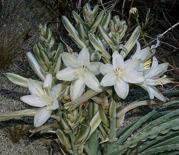
At dusk, with light dimming and the wind subsiding, I worked on this modest desert lily, Hesperocallis undulata, subject per image above right that was just a couple hundred feet from my car. These prized to come across uncommon beauties tend to be localized across the region. But one has to get out of their cars and actually explore to happen upon them. And once one finds one, there are sure to be a few more within a local hundred feet.
After a pleasant night sleeping in the back bed of my Forester, with a breezy dawn rising Thursday March 21, 2019, there was no need to rise early, so I remained inside till about 7:30am. After gathering gear for a day hike, I set out due north across Ocotillo Flat towards the mouth of a larger side canyon 3/8 mile away. The flat had the densest areas of ocotillo trees in the area, with an abundance of wildflowers beside the primary bajada wash flows. Many of the trees were also in bloom. There were lots of potential subjects if it calmed up. My target was the sunny badlands canyon wall area on the north side of Coyote Canyon, and after entering the side canyon mouth, I was soon following up its main sandy wash channel. Midway, it reached a knoll with a better view of what was above.
The main rocky south-facing canyon walls were covered with Mexican poppies, the densest displays in all the canyon, so I climbed up to about the 1550-foot elevation along a narrow wash with small cliffs right at its foot that also provided some wind protection, where I spent a couple of hours relaxing and enjoying the area, looking about for interesting close-up and landscape subject features. By late morning, I was on my way back. I drove out of Coyote Canyon into Borrego Springs and visited its one market, picking up some perishables and replacement cubed ice for the cooler. Upon return, my pull-out was still unoccupied, so I parked and set up for what would be a base camp over another 3 nights. Late afternoon, I explored back into the lonely spur canyon north where I had fun before retiring.
SJ04936-04999-2x2v 6600x9900 pixels 4 frame 2 column 2 row 64 image focus stack stitch blend A6000 30mm
enlarged vertical slice view
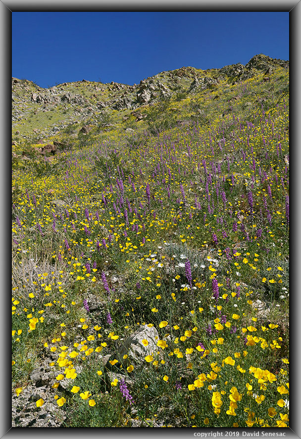
During the wee hours of the night, the strong wind finally subsided, giving hope I might finally be able to take some photos. After sunrise Friday March 22, 2019, a minor breeze was still blowing that I hoped would continue to wane, and indeed by about 8am I thought it was workable. There was also no reason to get up earlier, as poppies would not be opening up till about 10am. So I got gear together and headed back up the 3/4 mile to the same location I'd spent Thursday morning. I climbed a steep, rocky slope to the densest areas of flowers and worked the above 2-column, 2-row stitch blend subject, showing vegetation all the way to the top. The variable breeze was still troublesome, but I patiently managed to get in shots. Parish's poppies, Eschscholzia parishii, and Arizona lupine, Lupinus arizonicus, dominate these upper slopes with some white hued desert chicory, Rafinesquia neomexicana and desert pincushion, Chaenactis fremontii, also scattered throughout what most of the year is dry sun baked rock with creosote bush, Larrea tridentata, ocotillo, and barrel cactus the only year round green plants. I wanted to work more subjects in the area; however, the breeze soon increased, so I abandoned further work and made my way back to the car while unsuccessfully looking for areas with some wind protection where I might work close-ups. Well, it was soon lunchtime, so I enjoyed some midday relaxing again at my parking spot while another day's parade of vehicles increasingly drove along the dirt road.
SJ05075-92 4000x6000 pixels 1 frame 18 image focus stack blend A6000 30mm
enlarged vertical slice view
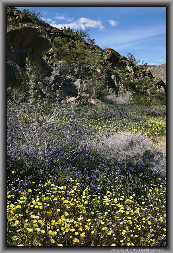
Mid-afternoon breezes subsided somewhat, so I wandered off to where I had explored on my first morning Wednesday, where I worked the above single-frame image. When breezes make capturing shots tedious, I am most likely to just try and get single-frame focus stack blended subjects in. The foreground shows a dense patch of desert dandelion, Malocothrix glabrata, that close up at night and open later in the morning much like poppies. There were expanses in Coyote Canyon where the dandelions are exceptionally dense. Mixed in were desert pincushion and blue phacelia, Phacelia distans. Framed mid-left is a tall desert lavender, Hyptis emoryi, bush that has many fragrant small fuzzy blue flowers that are always full of bees and butterflies. On the rocky slope in the background, along with creosote bush, on the skyline are dense areas of rock daisy, Perityle emoryi, and several chuparosa bushes at the base.
SJ05114-26 6000x4000 pixels 1 frame 13 image focus stack blend A6000 60mm
enlarged vertical slice view
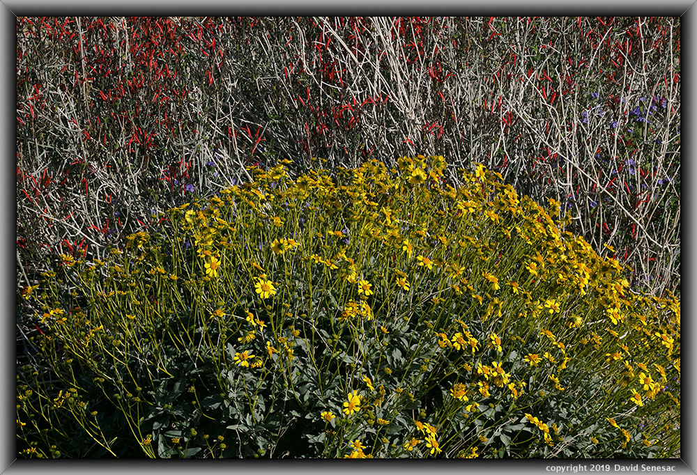
With the variable breeze inhibiting much work, I decided to patiently wait out the lulls to at least capture the above colorful image of a brittlebush, Encelia farinosa, in front of an exceptionally flowery red chuparosa, Justicia californica. Flowers on both these shrubs with stiff branches tend to move less in breezes. Also note a few blue phacelia adding to the nice color. There were many more nice subjects like this all over these canyon areas, so breezes were frustrating. And later in the afternoon, the wind became stronger again. I drove a short distance west on the dirt road to a nearby spot to spend the night.
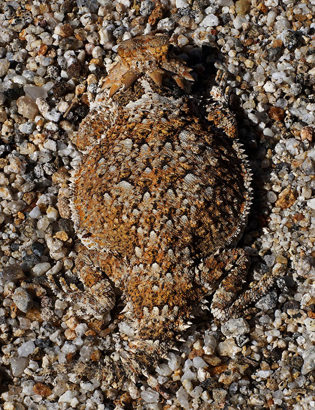
At night, the wind became loud and strong. And once again, I didn't bother getting up at sunrise Saturday, March 23, 2019, as it was still blowing hard. By mid-morning I decided to take an exploratory hike to a slope on the north side of Coyote Canyon where I could make out lupine with my binoculars. Thus, I hiked up a half mile, wandering about that area before dropping into a wash that had nice areas of wash wildflowers, especially chuparosa. I spent a couple of hours relaxing in that spot. In a sandy wash, I noticed an uncommon southern desert horned lizard, Phrynosoma platyrhinos calidarum, shown below the top of the page, so I spent some time working the miniature prehistoric beast-looking reptile. Horned lizards are not fast, so they tend to use their camouflage by staying still. I was able to move my 60mm with an extension tube to about 1 foot away; however, I did a poor job of focus stacking in part because I was up against a bush. Then got down to ground level and shot the ground-level view by moving very slowly to get into position. The lizard did move his head some as I did, so as though it was almost ready to try running away. As a grade school kid living about northeast Sacramento, we would occasionally come across horned lizards, and that was always special. Each day, I was increasingly noticing lower gastrointestinal tract pain, so I became a bit more careful with my meals.
SJ05198-09 3900x5300 pixels 1 frame 12 image focus stack blend A6000 60mm extension tube
enlarged vertical slice view
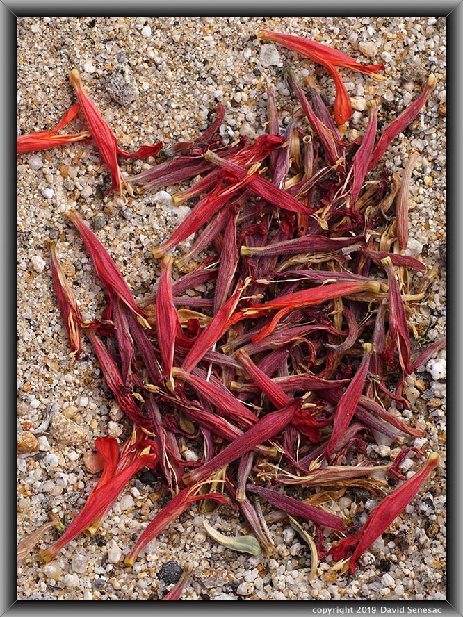
Below a chuparosa, per the image above, using my 60mm and an extension tube, I found a pile of chuparosa petals that had been blown off the bush and wind-sifted into a pile atop the sand. The rest of the day continued to be unproductive due to wind. I was glad to have brought along plenty of reading material and enjoyable food.
SJ05611-05662-3x1vb 8400x6000 pixels 3 frame 3 column 1 row 52 image focus stack stitch blend A6000 30mm
enlarged vertical slice view
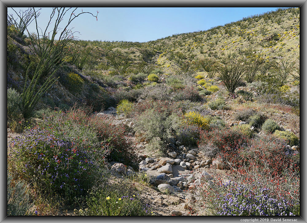
Overnight, the several days of wind finally subsided, and by sunrise Sunday March 24, 2019, I actually had some hope of finally doing some work, so I got up early and headed out once again to the northside area I had found on Saturday. Thus, I went up and worked on 2 or 3 subjects I had sized up. But on my way back, I noticed I had left my camera in Manual Focus mode when I had thought it had been in Auto Spot Focus the whole time. A mistake I had not tripped up on for a long time but always need to be aware of because there isn't an icon on the display to show that mode, and instead one needs to drill down into the Menu. Normally I check that each field session, but I became sloppy. So after waiting several days for the wind to subside, when it finally did, I blew it! I had planned to leave and head up to Antelope Valley, but since the breeze was still light at noon, I decided to hike back up the 3/4 mile in the afternoon and rework the shots. Thus, mid-afternoon, I hiked back north and worked the above modest 3-column, 1-row stitch blend while aware the light was not as good as it was while I worked it during the morning. Note the beavertail pricklypear, Opuntia basilaris, cactus blooming below an octoillo mid frame right.
It was time to leave, as I expected Antelope Valley poppies were likely now at their peak. It was the best bloom of my adult lifetime, with the term "Super Bloom" raging in news media. I'd spent 4 nights in this desert park and really did not have much to show for it due to the wind, but that is what often happens on these spring field trips. The best one can do is try to be out there when forecasts show the lightest breezes and allocate a few days so a calm period has a better chance of happening, while lining up a set of subjects to work quickly when it occurs. And for those that wonder how I manage to regularly bring back such strong material, consider how that does not always happen, as this last week shows. Well, I did end up with a modest amount of material, but only by as penance, enduring long hours of tedious post-processing for images that would usually just be deleted. In any case, I had a lot of fun just experiencing the natural areas, which is just as important as the photography. These are wonderful, fascinating landscapes I was glad to have lived within once again. I drove off back up to Indio, where I had a major pit stop for gas, food, and ice, then continued on to San Gorgonio Pass, where I parked overnight not far from the I10 freeway.
SJ05869-80 4700x3200 pixels 1 frame 12 image focus stack blend A6000 60mm extension tube
enlarged vertical slice view
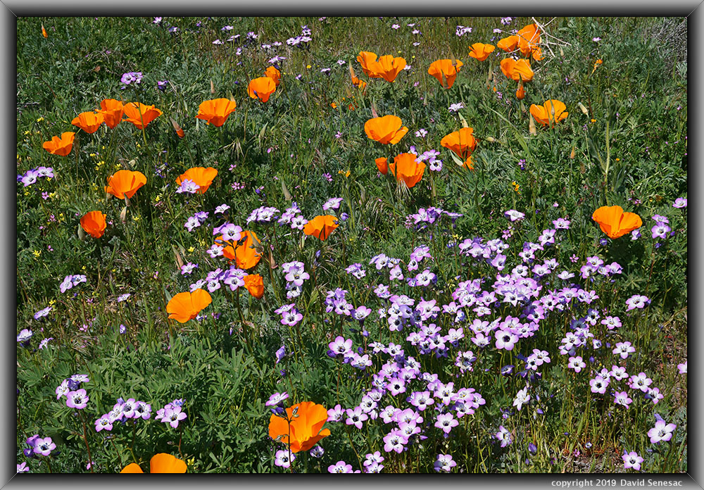
After the sun rose Monday, March 25, 2019, I spent an hour walking around that area, as there were some nice flowers. However, not enough to pull out my camera, and I was soon on my way west on I10, then I215, I15 and SR18 towards Palmdale. Mid-morning, stopped in Palmdale for gas and fresh ice, then headed west towards the orange poppy hills several miles west. Along the way, found flowers in many fields to the east, so at 11am stopped at one that also had swaths of gilia. It was a clear, sunny blue sky day, and variable breezes were generally light. The above image shows Davy's gilia, Gilia latiflora ssp. davyi, amidst California poppy, Eschscholtzia californica. Also note a few goldfields, fiddleneck, and filaree.
SJ05891-06015-4x2v 12400x9200 pixels 8 frame 4 column 2 row 125 image focus stack stitch blend A6000 60mm
enlarged vertical slice view
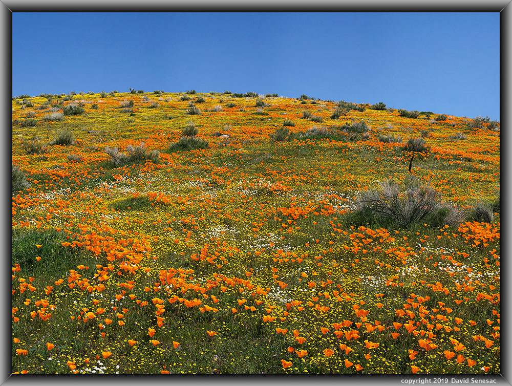
Heading west on Lancaster Blvd, as I got closer to the poppy reserve, increasing numbers of cars and people were parked along pullouts out among blazing orange fields of flowers. The road into the park was backed up, which blocked my way west for a bit. Somewhat later, I reached 210 St W where, somewhere north, I left the paved road onto a familiar obscure dirt road that runs along Broad Canyon wash. There I noted some slopes were not as impressive as they were on my previous visit in 2015, except for one rather excellent slope. Thus parked and set out with gear towards flowers, where I set up to work the above subject with my 60mm lens to capture a large 4-column, 2-row stitch blend that focus stacking required 125 shots. Dazzling color from California poppy, goldfields, Lasthenia californica, and creamcups, Plastystemon californica, interspersed with little pink hued filaree and ragged looking rabbitbrush, Ericameria bloomeri, that bloom late summer and are the only visible perennial on these landscapes most of the year other than the alien plague of tumbleweeds.
SJ06016-06052-3x1v 9800x6000 pixels 3 frame 3 column 1 row 37 image focus stack stitch blend A6000 60mm
enlarged vertical slice view
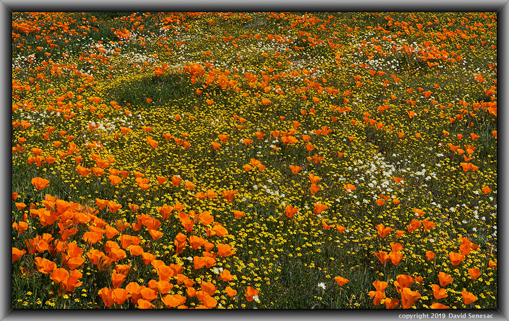
Next, I worked, as above, on a dense area of flowers in a section of the previous image, but pointed downward.
SJ06053-06087-2x1v 6800x6000 pixels 2 frame 2 column 1 row 35 image focus stack stitch blend A6000 60mm diffusion disk
enlarged vertical slice view
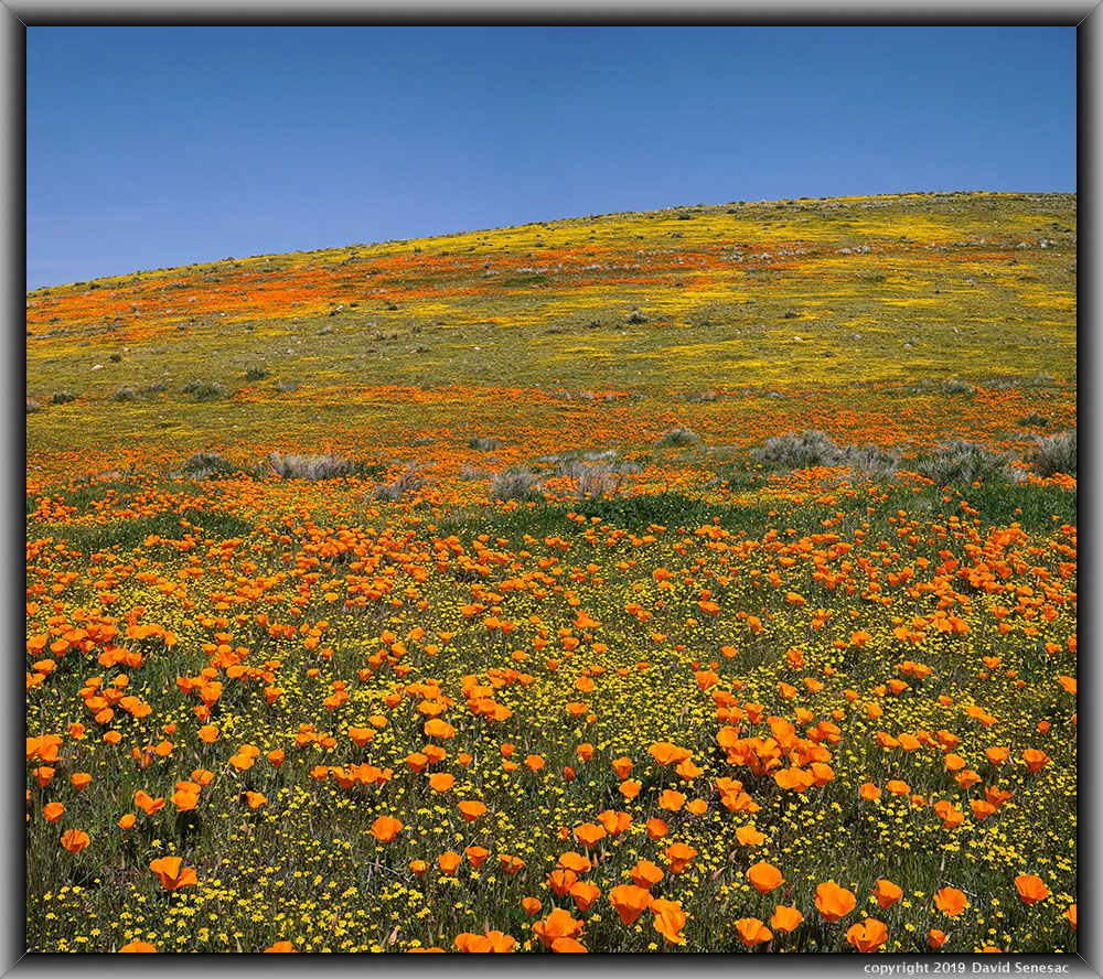
The image above was on the same slope, a bit lower, shot with my 30mm.
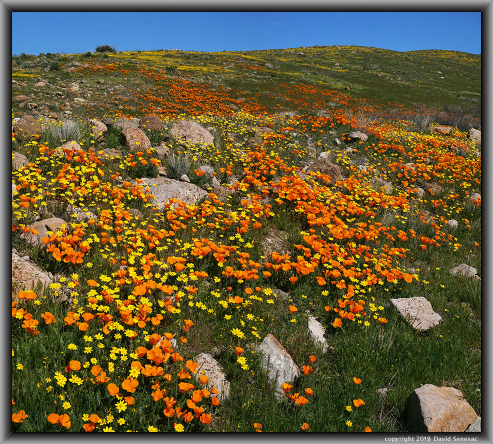
SJ06088-06127-2x1v 6700x6000 pixels 2 frame 2 column 1 row 40 image focus stack stitch blend A6000 30mm
enlarged vertical slice view
I walked higher on the hill to a wash that had areas of Bigelow's coreopsis, Coreopsis bigelovii. The above was also a somewhat interesting subject, as the upper hill area was being shadowed by clouds continually forming above.
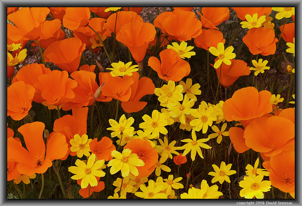
SJ06130-38 7200x6750 pixels 1 frame 9 image focus stack blend A6000 60mm diffusion disk
enlarged vertical slice view
At a particularly lush spot, I worked the above close-up of California poppy and goldfields using my 60mm lens and the circular 32-inch diffusion disk. A breeze had been gradually increasing, so I left the area and drove north to Avenue D, aka SR138, and then north a mile on an obscure paved road to where it turns to dirt. Areas to the west, I've dispersed camp in the past and have Joshua trees. Areas north of the poppy reserve are now dominated by solar farms. Next, I drove onto dirt road W Ave D-8 and out to the east end of Fairmont Butte, where I assessed landscapes as weak. As the afternoon came to an end, I ended up parking off Lancaster Blvd with a plan to hike out to east areas of the reserve the next morning. Overnight, I was increasingly concerned about my noted worsening gastrointestinal condition. I was going to need to dismiss going into Carrizo Plain National Monument as I'd planned and instead drive straight home tomorrow after a morning session.
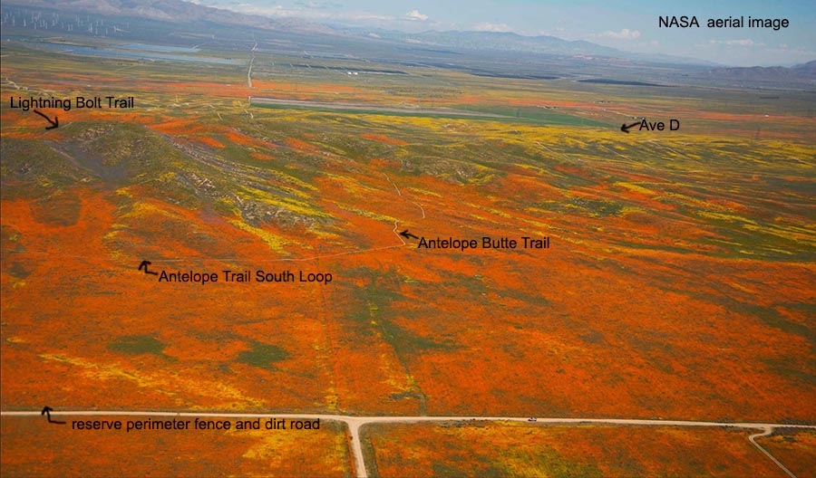
With poppies opening slowly, I was in no hurry to drive into the reserve except to get a parking spot. If anyone doubts how amazing this Super Bloom was, one just needs to look at the above NASA aerial image. By 8am Tuesday, March 26, 2019, I did so, which required an $8 fee. I would need to amuse myself for about an hour before heading out. The skies were mostly cloudy with thin high clouds, and there was a minor breeze from the west. Initially, the parking lot was about 1/4 full but increasingly filled after 9am. Several television news crews with expensive satellite vans full of electronic gear were parked in a separate lot and giving interviews to park personnel and visitors walking out onto the ATV-wide flat trails. The above NASA flyover image, looking north, shows the vast areas of dense flowers far beyond just the reserve that is mostly out of view to the left of this picture. In the distance to the left are wind farms and solar cell farms. Vast Edwards AFB is off to the upper right of the frame. Lancaster Blvd would be a half mile south of the dirt perimeter road.
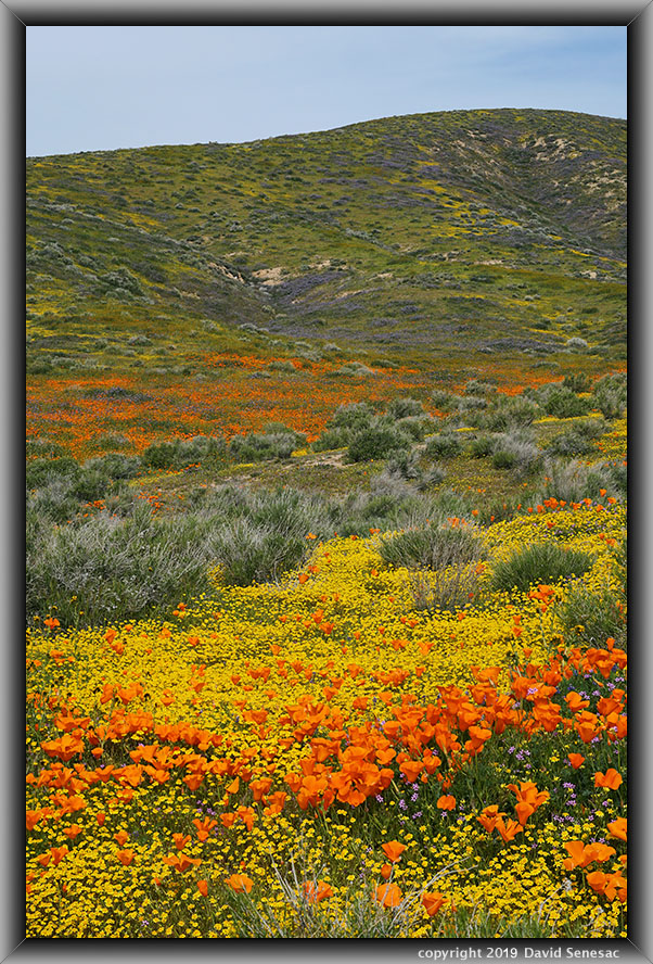
SJ06139-46b 3900x5500 pixels 1 frame 10 image focus stack blend A6000 60mm
enlarged vertical slice view
About 9am, I set off onto the Antelope Trail South Loop trail that is on the far eastern side of the reserve. Although it had the best mix of flowers, it had the fewest visitors hiking on it, as it reaches out a couple of miles from the parking area and cannot be seen from Lancaster Blvd, as one would need to have driven out on the perimeter road, as I did Monday. My intestinal issue was increasingly bothering me, leaving me feeling unpleasant and not particularly mentally sharp. I passed a couple of 2-person groups. About 1.5 miles along, I stopped for the above subject that was actually supposed to be a 3-stitch blend panorama with my 30mm lens. Instead, I accidentally had my 60mm lens on, which I normally would have obviously noticed when looking into the electronic viewfinder. But not this day. And that lens remained on my A6000 until I noticed what had happened an hour later. Instead of 2 spectacular 3-column, 1-row panoramas, I captured 6 single frames that did not overlap, so could not be stitched and, though colorful, were not geometrically aesthetic. First time I'd ever made that mistake and probably won't ever again. The above shows the left frame of the first subject I began shooting at 9:30am. Purple flowers higher up the slope are phacelia. A breeze was rapidly increasing.
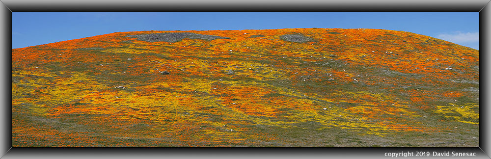
It took 90 minutes to complete my hike across trails on the top of the ridgeline and reach the western end of the reserve, where on Thursday I had spied an otherworldly-looking slope from Lancaster Blvd. That is the above is a 3-column, 1-row horizontal stitch blend. Very few of my images are horizontal stitches; however, in this case my 60mm lens just fit the height of the subject from the Poppy Trail North Loop trail. Within the reserve, visitors must strictly remain on trails. Thus, no wandering out onto flower slopes like I had down the previous day outside the reserve. Accordingly, one must contend with setting up shots from trailside positions. Although that eliminates many potentially better shots, the positive is that none of these landscapes has been tracked up by trampled vegetation. The image of this hill is at page top. The image shows California poppy and goldfields with areas of rabbitbrush and piles of alien tumbleweed, aka Russian thistle. I wish the State Park service would, during the safety of winter after rains, burn most of those tumbleweed piles, as they tend to get stuck together in ugly masses that would make getting rid of most of them easy. Instead, they become a tourist eyesore during years like this.
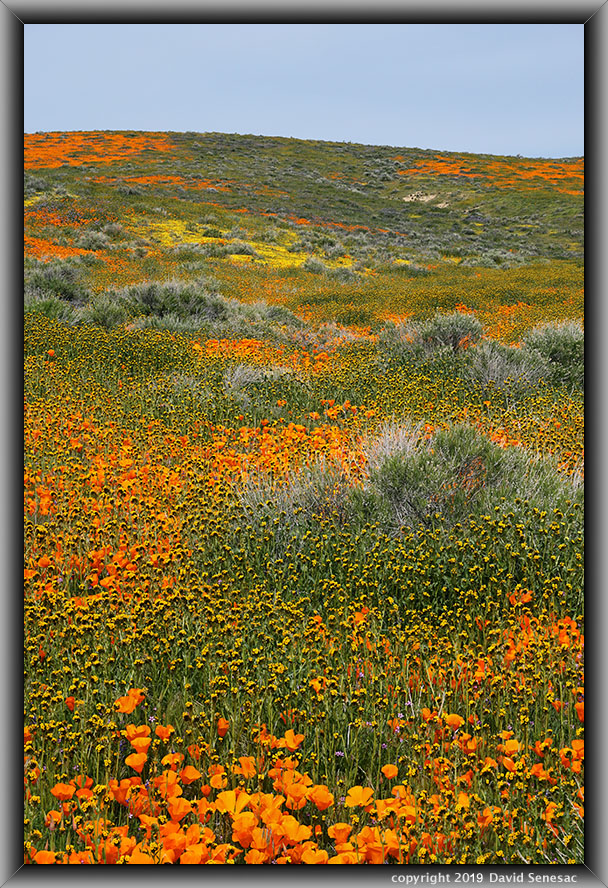
SJ06225-42 4000x5600 pixels 1 frame 18 image focus stack blend A6000 60mm
enlarged vertical slice view
Above is another one of the 60mm mistake frames. Note the robust fiddleneck.
Within an hour, I was on my way west on SR138 to I5 then over the Grapevine into the San Joaquin Valley, and several hours later, late afternoon, I reached home. My work in Anza Borrego was relatively unproductive, while my first afternoon at Antelope Valley I did knock off a few nice images. Compounding that were a couple of uncharacteristic cockpit errors for this person who prides himself on consistency in performing complex operations. On my 2015 Trip Chronicles page, one will find a more productive visit to the area, and during trips before that, using my 4x5 film view camera, I have several fine images, including several in 2005 at Anza Borrego.
After returning home on a Sunday from my Antelope Valley road trip, with abdominal pains, I immediately set up an appointment with my Kaiser Permanente doctor for Monday morning. She quickly diagnosed my problem as acute diverticulitis, a condition older people can develop, which is quite a serious medical condition that our ancestors would likely have died from soon. More about that on this next Page 4.
NEXT: Page 4 Carrizo Plain NM
2019 Trip Chronicles: Contents


