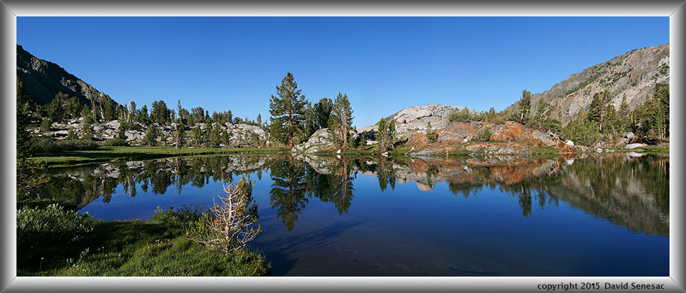

OI05320-05351-5x1v 15000x6000 pixels 5 frame 5 column 1 row 32 image focus stack stitch blend A6000 30mm
enlarged vertical slice view
NEXT: Page 11 WF Carson River ; HNA Lee Vining Creek
2015 Trip Chronicles: Contents
Fish Creek backpack 7/4
Fish Creek backpack 7/5
Fish Creek backpack 7/6
Fish Creek backpack 7/7
Fish Creek backpack 7/8
Fish Creek backpack 7/9
Fish Creek backpack 7/10
Fish Creek backpack 7/11
This was expected to be the most important backpacking trip of my 2015 summer and two of my bros Joe and Mike were along. We would be hiking out of the Coldwater Creek Trailhead of Mammoth Lakes at 9240 feet in Inyo National Forest into the John Muir Wilderness going over Duck Pass at 10740 feet into the Fish Creek drainage. I had obtained a reserved permit from recreation.gov for a Saturday July 4 start and would be coming out 9 days later on Sunday July 12. And per my usual style it was elaborately planned in detail. However such trips always have lots of options depending on conditions and in this case stormy weather put us into those options from the start. Link to online topographic map of:
Coldwater Creek Trailhead to Duck Pass
My description that follows will purposely be only vaguely informative as to where we traveled, camp at, times of day, and descriptions of imagery as has been the case with other features on my website. For aesthetic photographic landscape locations, I am a strong advocate in photographers exploring on their own in remote areas including wilderness areas to find otherwise unknown subjects instead of having precise information like GPS coordinates, detailed map directions, or detailed guiding information that makes it too easy for those that otherwise have made little effort to find where to set down their tripods. That said, I find nothing wrong with providing such information for locations as popular icons and other front country destinations that have long been common knowledge in the public domain. However as an expert in many landscape areas of California going forward at this unique technological knee in human history for the sake of our spirit of adventure and exploratory enjoyment, have drawn that line in the sand. In any case a few in the audience will readily be able to identify locations of some of the images and I would hope they share my silence much like the brotherhood of fishermen with closed lips that have knowledge of uncommon backcountry lakes with large trout that require strenuous effort to reach .
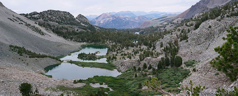
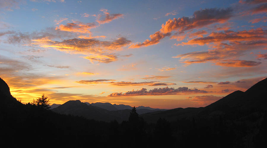
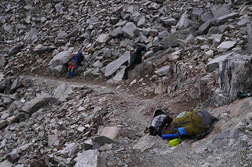
The first day hiking did not go as planned. Mike had problems with the altitude so I adjusted to a very slow tedious pace and more importantly the weather had me abandoning planned photography about the east end of Duck Lake. Instead we moved further along the route than planned with a hope of picking up what I missed on the return leg. Starting in the evening, we night hiked up the trail. The beautiful dusk image above looking north northwest was photographed by brother Joe. By the wee hours of Saturday had stopped for a short period of sleep before continuing on towards the pass at day break July 4. Saturday was totally cloudy pretty much all day except for a few short periods of sun poking through cumulus buildups between afternoon thunderstorms. My carrying weight was just 63 pounds or down about 5 pounds from 2014. Whenever Joe is along I also bring along my fishing gear that adds 2 or 3 pounds. That first day both Joe and I grabbed some of Mike's gear to help move along the trail. The above image is from a bit north of Duck Pass on the headwall with Barney Lake below and the pumice cone that is Mammoth Mountain in the distance. One can also see Skelton and Arrowhead lakes down in the green forest mid frame. Note the trail through talus frame right. These areas above the trailhead are quite scenic and have good fishing for pan sized eastern brook trout, thus are fine destinations for short overnight backpacking trips as long as one bothers to move well off away from the heavily traveled trail. And the image below at right is in the talus on the north side of Duck Pass. I briefly stop a great deal while carrying heavy loads as every waist high rock or log has my name.
Finally reaching the pass at 3.6 miles by late morning was a relief because I had feared getting caught in thunderstorms moving north on the south side of the pass we could not see from the view blocked north side. The cloudy skies south looked much less threatening so we would then enjoy 1.7 miles of easy unrushed downhill to the PCT/JMT junction. By midday there were fair numbers of groups with most day hikers passing us on the trail. On the far south side of huge Duck Lake we noticed a group had illegally set their tent up right at the water's edge. Reaching the lake outlet at 4.9 miles I found the scenery more interesting than expected and Joe noted he would be happy to camp in the area during our return leg. There were other advantages to doing so thus we agreed to do so instead of laboring all the way over to the east shores. I could more readily take care of my interests there on a one day solo trip. Actually the whole Duck Lake basin looked more aesthetic than what I had gleaned from Google Earth and the few images on Google Images, so the basin will be in my future base camping plans.
We took a couple hour lunch break at the Duck Lake Trail and PCT Trail junction then continued on a route towards a destination. Later we could see a dark thunderstorm to the south over the whole Silver Divide moving north in our direction. Our packs had rain covers on and we were wearing rain jackets but not rain pants. Generally through Wednesday clouds would be moving from the south and south-southeast that is a typical monsoon flow when high pressure is to the east over the Four Corners region of the Great Basin. With the main dark clouds now bearing down on us and sprinkling changing to moderate rain, moving downhill, I pushed the other two ahead as much as they could bear. We finally were close to where I hoped to camp about a dense tall lodgepole pine grove I'd sized up on Google Earth when heavy rain with small hail caught us tramping through a wet marshy meadow. While crossing a step across stream Joe stepped on a green surface that were plants floating atop water that drowned one of his boots up into his pant leg.
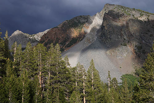
We reached the grove and immediately moved about finding driest areas below densest branches and canopies. It continued to rain rather heavily for about a half hour then waned. After that first storm passed Joe and I quickly set up our tents and gear while Mike with just a bivy sack was content to defer that till later. The two of us made dinner then retired into our tents for a nap. One of the most powerful lightning storms I've experience the last couple decades moved over us with many bright and frequent bolts cracking loud thunder from ink black clouds while rain and beebee sized hail pummeled our tent flies. Fortunately we were at maybe the safest place in the zone. Quite appropriate since it was after all The Fourth of July! After that waned Mike hiked out to survey our mosquitoey area and by late afternoon some sun began poking through the cumulus build ups so I also did some exploring about the area. I told the other two I would be getting up at dawn to get a jump on areas I wanted to photograph. Joe and Mike could enjoy dawdling about in the morning having a breakfast before breaking camp then meet me at an easily identified location. All of us were glad to get a long night of sleep and rest.
After a good night of solid sleep, I woke at dim dawn Sunday morning July 5 well refreshed. Packing up quickly in the dim dawn light aided by my headlamp, I was ready to move out by 5:30am. A chore I can crank through quickly given an adult lifetime doing so. The others had of course been awakened by my racket and would be getting up themselves not long after I left then slowly breaking camp. I was initially wearing rain jacket and pants because all vegetation was quite wet, but as I moved beyond the meadows into a duff understory lodgepole forest to begin climbing, packed that away lest evaporation from sweat start condensing on the rain pant inner surface then soak into my Levi jeans. Moving along at a strong pace up canyon walls breathing strongly, I reached my destination in a bit over an hour and set up my camera gear.
My Sony A6000 APS-C 24 megapixel mirrorless body went atop a Nodal Ninja III MK II panoramic head that was atop a Manfrotto MH054M0 magnesium ballhead and Induro CT113 carbon fiber tripod. For most of the below images used a Sigma 30mm f2.8 DN lens. Skies were nicely sunny this morning but I did not expect that to last as there was obviously still a monsoon flow above. The third subject worked is the pond at page top, a 15,000 by 6000 pixel 5x1 panoramic stitch of horizontal frames processed from 32 individual shots or enough to make a sharp 50 by 20 inch print. The exceptionally beautiful pond few obviously ever visit had turfy shores on its south end and a section of shore with rusty metamorphic rock that added nice color. If one looks at the enlarged vertical slice view, the center slice shows a patch of red heather at the base of the tall tree at center and brighter red a bit right of some great red paintbrush. The thought of camping about this pond sometime in the future is a delightful notion. As is common, an up canyon breeze soon increased so that was the last subject I was able to capture a decent water reflection of.
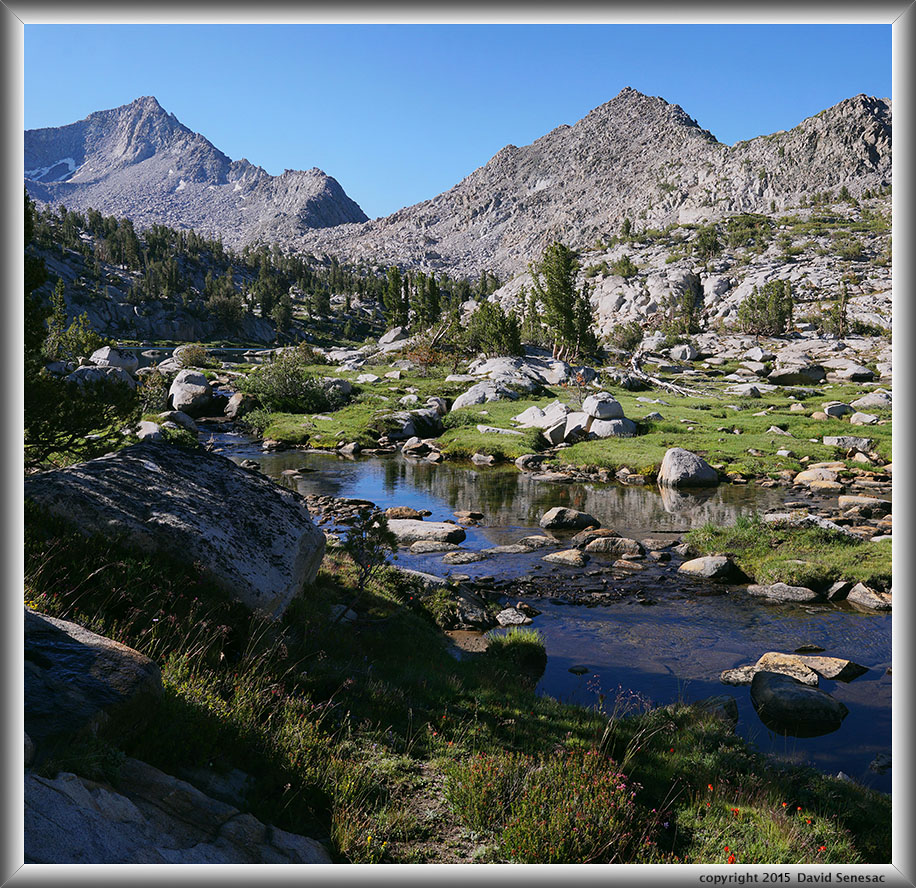
OI05372-05383-2x1v 6200x6000 pixels 2 frame 2 column 1 row 12 image focus stack stitch blend A6000 30mm
enlarged vertical slice view
There were a lot of possible subjects in the zone we would be base camping at the next couple nights. Even though my strategy was to focus on morning lake reflections now given the stiff breeze, that was not going to happen this morning. It was however worthwhile for me to ramble about to various places I'd studied on the topographic map so that I could be more efficient the following two mornings. Often periods with morning calm are brief so a landscape photographer needs to work quickly moving with the speed of an endurance athlete from location to location. The mountain landscape photography I've performed for decades requires a strong body with innate superior balance skills in the style of the late Galen Rowell. As hoped in setting a trip date, these elevations of High Sierra timberline country now in the first week of July during this very droughty year, were near what would be peak blooming for most wildflower species or about 4 weeks earlier than normal. A common indication one has arrived at peak is turfy areas have a wonderfully vibrant green that in the intense sunlight at these high elevations glows strongly. Visit a few weeks early and such turf would be like the image lower down this page with pink hued alpine laurel in the foreground about still dormant grasses. A few weeks later from now and those grasses quickly show yellow that eventually become brown, thus the window is just a few short weeks. The image above is one of the areas I traveled through. In the foreground are great red paintbrush, Brewer's lupine, dirty socks, and red heather. Further up the stream one can see a small lake. Higher up on the background peak at frame edge left, the visible snow is not from the previous winter but rather decades old snow now shrinking smaller than during any historic times.
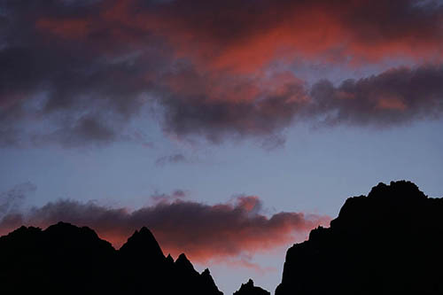
My morning was well spent and though I did in fact work as insurance a few frames with lakes primary subjects, Monday morning visiting the same areas would be nicely calm with superior results. By mid morning had returned to our rendezvous location and not long after Joe and Mike arrived. We set up tents at an excellent lightning safe location, well away from water, below large shading whitebark pines about a concave landscape zone, on thick dry duff surfaces no others had used for years. Well actually the dried needly, twiggy, pine cone duff debris had lots of usual chipmunk and chickaree holes and we would enjoy watching them scurrying about at all hours, sometimes comically investigating our cooking gear. Fresh clean water was abundant in the zone and these remote streams and lakes had pan sized golden and rainbow trout keeping Joe adventurous and excited. Skies clouded up by noon.
We found some wonderful creek cascades with small falls to jump into the refreshing cool waters during early afternoon then laid about warm smooth streamside granite while sun still found holes in clouds. Almost every day we do so in the backcountry unless weather is especially chilly because we much prefer feeling clean instead of the usual backpacker mindset of trail grubbiness without washing for days. Well that is I and Joe while grubster Mike would only get in a creek if someone tossed a bottle of beer in. Late afternoon we explored out to a plateau near our camp with nice views down canyon. Some cumulus showers in the area moved us back towards camp for dinners at the end of our day. By sunset clouds cleared to the west allowing long red frequencies of setting sunlight to paint clouds with warm light. We enjoyed a second peaceful night with long hours of sleep.
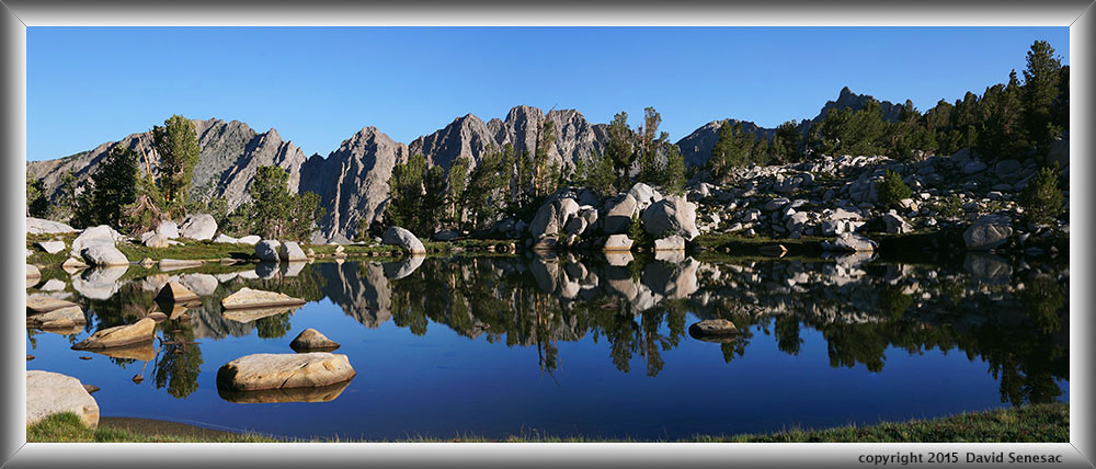
OI05694-05704-2x1h 10000x4000 pixels 2 frame 2 column 1 row 11 image focus stack stitch blend A6000 30mm
enlarged vertical slice view
The next morning Monday July 6 rose at mid dawn, filled my daypack for a long morning ramble, then quickly moved up canyon to subjects I'd surveyed Sunday morning. The above is a 10,000 by 4000 pixel 2x1 horizontal frame stitch of a wonderful turf pond with an impressive ridge rising up in the distance beyond. And yes it was again sunny while more calm at least at this 7am early time of morning. Were there trout in the pond, the mirroring water surface would not be so perfect. For lake reflections, I much prefer small lakes and ponds verus larger lakes where far side elements as trees, rocks, and flowers are close enough to still render with meaningful size. My A6000 mirrorless body is just small enough to use the small Nodal Ninja 3 MK II panoramic head instead of usual much heavier DSLR panoramic gear. The head weighs just 17 ounces and is robust enough I just toss it into my daypack folded without any padding. It's normal lens orientation is the much preferred vertical though I can orient my Manfrotto ballhead using it awkwardly in an unstable vibration prone horizontal orientation as I did above.
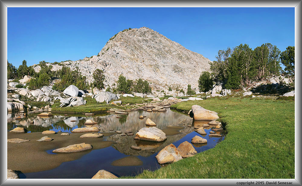
OI05742-05764-3x1v 8700x5200 pixels 3 frame 3 column 1 row 23 image focus stack stitch blend A6000 30mm
enlarged vertical slice view
Forty minutes later worked yet another beautiful timberline turf pond, above with a nicely curving pond edge, a few foreground alpine shooting star, dodecatheon jeffreyi, and a complementing rounded glacial shaped peaklet beyond, with scattered whitebark pines and touches of red mountain heather against boulders. A 3x1 vertical frame stitch 8700 by 5200 pixels. Select the enlarged vertical slice view link in order to see enough detail for the flowers. The world's most beautiful most luxuriant lawns are not on golf courses in communities of the rich, nor do they require any mowing, while having the most cushiony soft surface one might imagine. Actually the turf is usually a complex old evolved intertwined matrix of several species. Black alpine sedge, carex nigrans is often the primary grass structural component with alpine laurel, arctic willow, dwarf bilberry, mosses, and fungi. Another beautiful remote zone I'd love to camp at on a future visit. Most visitors pass through such areas quickly that could easily satisfy this person base camping a couple days. And if so we would be sure to climb that little peak in the landscape.
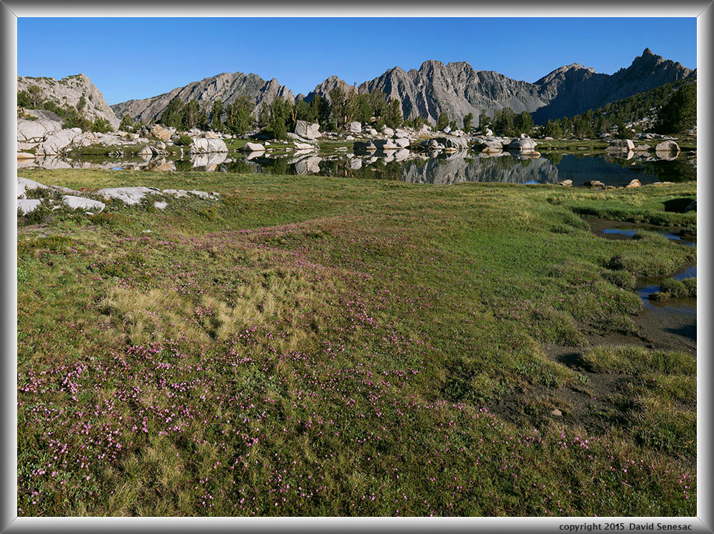
OI05765-05785-3x1v 8100x6000 pixels 3 frame 3 column 1 row 21 image focus stack stitch blend A6000 30mm
enlarged vertical slice view
This next image above is another lakeshore landscape, a 3x1 vertical frame stitch, 8500 by 6250 pixels. The foreground shows pink hued alpine laurel, kalmia polofolia, some white heather, and red mountain heather against rocks, then a pond at mid ground. Alpine laurel the earliest turf resident species to bloom each summer, covers areas of turf like this if one visits while these areas are still soggy from snowmelt. There will usually also be emerging areas showing the two other above heath family species though turf areas are likely to not yet be fully greened up.
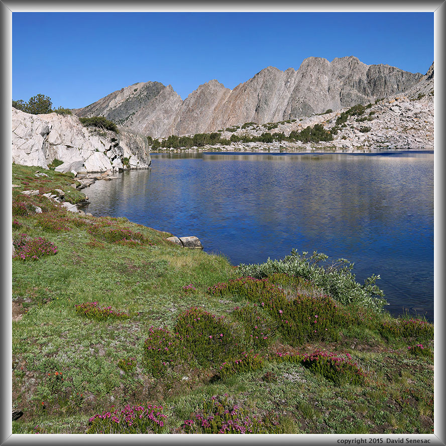
OI05835-05848-2x1v 6000x6000 pixels 2 frame 2 column 1 row 14 image focus stack stitch blend A6000 30mm
enlarged vertical slice view
The expected breeze eventually showed that ended my pond reflection work. I was quite satisfied to get in this one brief morning of perfect conditions while about ideal timberline landscapes that guaranteed a level of photographic success for the trip regardless of what happened in subsequent days. Brother Joe escaping from camp had caught up with me fishing rod in hand. We rambled some distance challenging terrain successfully to minimize vertical climbing then split up as he ventured off to fishing waters while I captured the above breezy lake surface scene. Along the shore a nice complement of red mountain heather, phyllodoce breweri with one shore edge clump of gray-leaved Sierra willow, salix orestera, adding contrast to blue waters. Upon leaving this zone, I left far more good material than I brought back that queues up yet another magnificent area I can only hope to return to again some summer before I become too old. Oh Lord please grant me that happy wish to walk in your wonderful gardens through eternity.
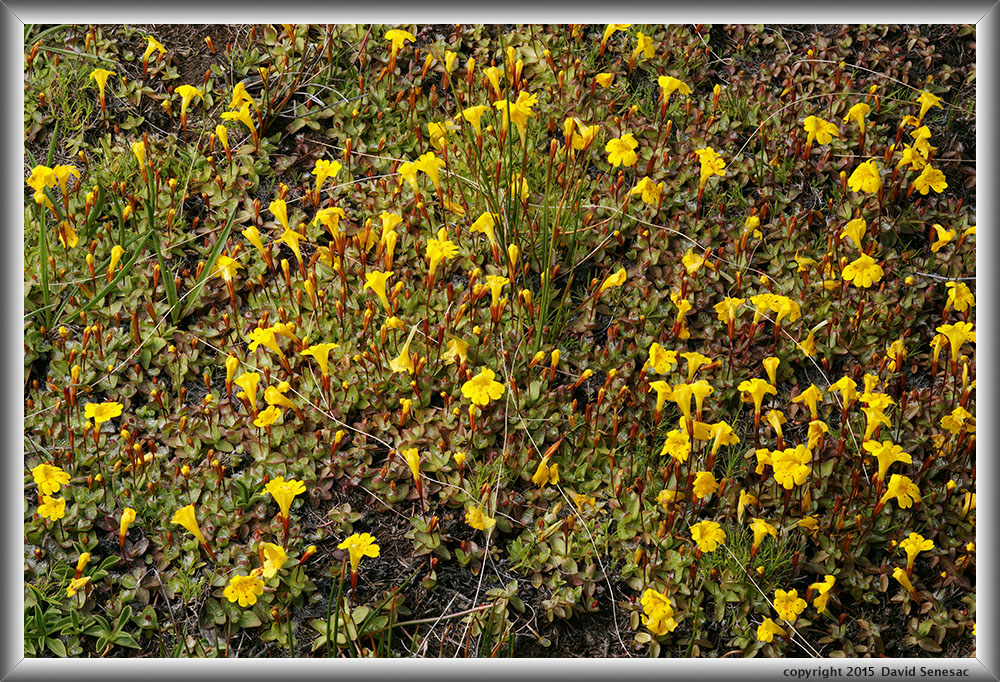
OI05962-8 6000x4000 pixels 1 frame 7 image focus stack blend A6000 60mm
enlarged vertical slice view
With my gaze away from breeze disturbed water landscapes, noticed some nice close-up subjects including this dense patch above of small sized common monkeyflower, mimulus gutatus.
OI05978-5 5800x3800 pixels 1 frame 8 image focus stack blend A6000 60mm
enlarged vertical slice view
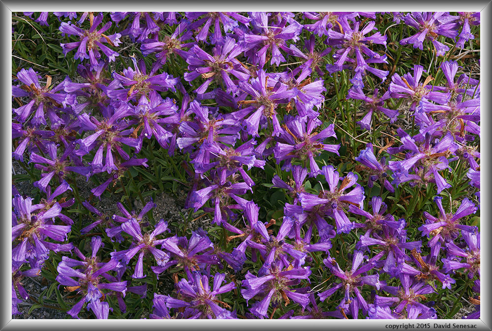
Nearby the monkeyflower image above, was a dense patch of the ubiquitous whorled flowers of Sierra penstemon, penstemon heterodoxus.
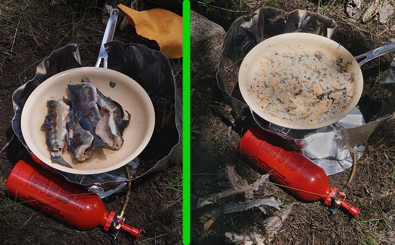
Back at camp before midday, I did some fishing using a red dots on yellow Mepps spinner, quickly catching enough for a pan full to enjoy a trout with rice lunch feast . And note that is my newest MSR Whisperlite stove as I handed down my old beat up set to Mike. See the fish bones lower left? Our standard fish in pan process removes bones, fins using fork and pliers leaving just meat which we then mix in pre-cooked Minute Rice. Pan is covered by aluminum foil through a few on-off-on cycles that gradually dries out the flesh, then we dump in the rice, mix, and go through a final cycle.
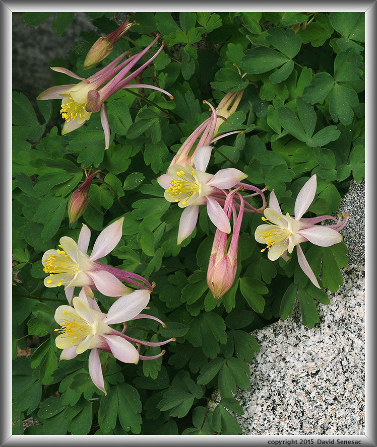
In the afternoon located a nice Coville's columbine subject above. Late afternoon the three of us investigated some large talus "shelters" a minor distance from camp. Cumulus rains without lightning snuck up on us coming over a tall nearby peak keeping us pinned under talus for a long couple hours before we were able to escape to camp. As we made dinners, clouds however waned to the west providing another dusk sky with nice yet not great color.
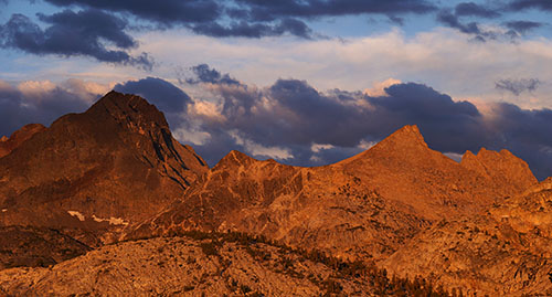
Sunrise on our fourth day, Tuesday July 7 broke and we went to work packing up gear. Before 7am we were on our route out with early skies mostly sunny once again. As we left the Virginia Lake area skies showed the same pattern of minor building clouds. It was again breezy by an early 8am. Numbers of other groups were also making their way north or south on the trail as we engaged in frequent hello greetings. We would be on the trail for a fair distance this morning. We reached Tully Hole at 9.5k late morning with skies now once again showing threatening cumulus buildups that had us concerned on reaching our destination before any rains. We continued upward. A couple hours later we had reached our destination area, set up our tents and gear promptly, then once again thunderstorms began chasing us inside our tents where we remained till late afternoon. Well of course the trail hiking had been a strenuous effort so that was in some sense welcome. A break in storms came and Joe and I used that window to jump in a nearby lake for the day's refreshing dip cleaning off our trail dust and sweat. Then he managed some fishing while I surveyed shots for the following morning. More showers were in the area that had us move back to our tents but by sunset skies began clearing whence I shot the modest image above right of Red and White Peak. I'd already spent too much time lounging in my tent both at night and during afternoons so with a Sandisk Sansa II player in my ears, enjoyed roaming about a glacial granite landscape in the dark so didn't retire until about 11pm that evening.
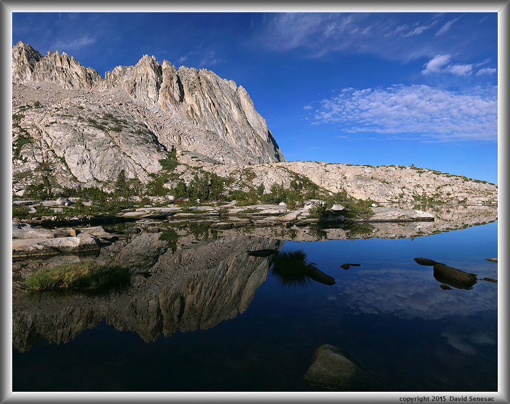
OI06070-06105-4x2v 11500x9000 pixels 8 frame 4 column 2 row 36 image focus stack stitch blend A6000 30mm
enlarged vertical slice view
Early the next morning Wednesday July 8, I rambled off to a primary lake target on the trip but as sun rose on the landscape, a growing early breeze limited attempts for lake reflections. I did manage the above large landscape lake reflection with nice clouds early at 7:20am while shadows were still in a foreground cove. An 11500 by 9000 pixel 4x2 vertical stitch panel set using 35 images. Mike and Joe joined up and we climbed up on a ridge exploring about before returning to camp so Joe could do some more serious fishing. Again the monsoon flow cumulus built up late morning and began chasing us back into our tents during the afternoon and pounding us at times with beebee sized hail. By the end of the afternoon skies began clearing again. In the distance Red Slate Mountain at 13,170 feet, in image below right, is coated with hail. By evening the night sky showed mostly stars. But that wasn't a sign our stormy weather might end though I noticed clouds were now moving in more from the west.
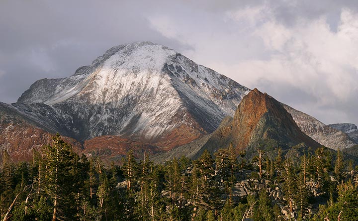
At 2am Thursday July 9 I woke up and the dark skies were starry. However an hour later at 3pm awoke again and skies were suddenly mostly cloudy. About a half hour later we could hear thunder in the distance with lightning flashing. Thus began one of the most violent thunderstorm events I've experienced in the Sierra during my lifetime. By 4pm the storm was right on top of us with major lightning flashing every few seconds and the monstrous scary sound of strikes blasting the ground of nearby terrain with short delays till thunder. At first, outside the lightning, it was just minor rain splattering on our tents with some strong frontal downdrafts but then all hell broke loose as the main towering cloud apparently moved in atop us. The hail was easily the worst I've ever endured. To avoid lightning, I squirmed to keep my body atop my short length Thermarest NeoAir within my Marmot Pinnacle down bag inside my Big Agnes UL1 that was atop a cheap blue plastic tarp. At one point turned on my flashlight, lifted up the vestibule a wee bit and was looking at about an inch deep depth of grape to cherry sized hail. The top of my sleeping bag was wet from a cloud of mist being beaten into the air from the underside of my rain fly from the hail bombardment. The underside of the fly was wet from forming condensation as the air temperature had dropped into the high 30s. This creature was scared. The lightning eased up first while waves of hail continued that then changed minute by minute to mostly heavy rains then back to smaller hail. Once the lightning waned I was quick to get out a spare cotton t-shirt and wipe up dampness inside the tent. Somehow water was pooling a bit at the lower end of the UL1 inside so dealt with that. Water had managed to drip down the sides of the tent then between my ground sheet and the tent tub floor so suspected it had found a pinhole to wick up through.
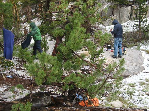
As dawn broke lying in my bag, escape scenarios to lower elevations were running through my mind. When it got light enough to see outside, I noticed areas outside were a solid white and wet sleety snow was falling. Temperature was probably about 35F degrees or unusually low for July in the Sierra at the 10k plus elevation we were about. As soon as light rains stopped we moved into action coming up with a game plan. Waited a short while to see if rains would return and when we could see a lighter section of clouds moving in we sprang into action. It was critical we pack up and move down far enough into the canyon before rains resumed. If rains resumed while we were exposed with gear lying all about unprotected packing up, it could be a hypothermic disaster. If another lightning storm moved in, while we were moving over the first exposed third of a mile on a ridge, we could get fried. Hail and snow on the ground was rapidly melting into slushy boot top deep ponds. Duff surfaces were water soaked mushy. We rapidly pushed gear into our pack including wet gear like tent and ground sheet. Image at left by Joe.
We moved out and got about a mile down our route when darker clouds moved back in with cold rains. Joe and I were of course wearing rain gear with pack rain covers on our packs. Mike only had a now wet old and leaky jacket. The cold rain pinned us down for over an hour and that caused us to become chilled just standing while also getting dripped on by now saturated dense tree canopy spots. We would have to move along rain or not. When the rain became only moderate, we stumbled ahead reaching Tully Hole by mid morning. On the way down we noticed some higher peaks looked like snow cones. There we surveyed the possible unpleasant locations we might set up camps at if strong storms moved back in. My 2012 Gortex boots were no longer waterproof after walking through all the slush and water and wool sock were thoroughly soaked.
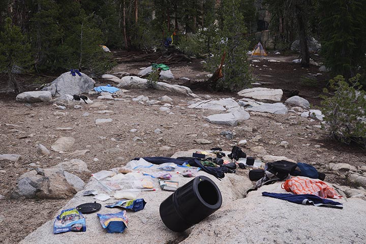
About an hour later, conditions lightened up so we reorganized gear and started climbing the PCT/JMT up the 900 feet towards Virginia Lake. Numbers of thru hiking groups from Virginia Lake were moving south down the trail into Fish Creek obviously eager to escape those higher areas. Of course thru trail hikers often have minimal storm gear. By time we reached the summit plateau at about 10.3k it was snowing in the mid 30s however snow was only accumulating on vegetation. We made our way around to the south side of the large lake locating a very nice area to set up at. Once again it was far away from the busy areas near the trail. Beside us was a tall joint crack wall of about 80 feet height a few hundred yards long. Trees were well spaced across the landscape with well drained deep dry sandy soil and there was no signs of flowing water indicating even during the big storm it simply all soaked in, thus quite lightning safe. About then snow stopped, skies lightened up with the sun almost poking through clouds. We strung up rope as we had already done several times during the trip and hung up anything that needed drying. I also spread items like food from within my Garcia canister over now sun warming granite boulders. In the image above, my UL1 tent is a bit right of center near frame top and items hanging on my rope are a bit left of some small trees.
Within a couple hours we had cooked lunches and dried much of our gear. It was still mostly cloudy out but the storm of that morning was not going to return with temperatures rising into 40s. We were feeling immensely relieved, now making plans to enjoy the rest of Thursday afternoon and the remaining few days of our trip. It was rather obvious that if the rain had not let up, we would have had a miserable cold wet time stuck down at Tully Hole. A sobering reality none of us will forget in the future when gear planning long Sierra trips. In the afternoon we had time to start exploring the area which was quite different from other areas we had visited thus far in the trip. During the night skies remained fully cloudy and temperatures unseasonably cool.
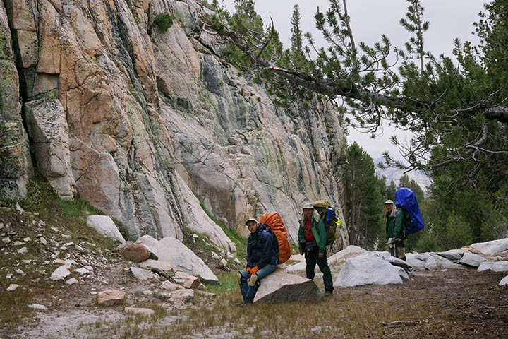
Sunrise Friday July 10 also showed fully cloudy skies. Our plan was to enjoy the morning about the lake then leave north on the PCT/JMT trail late morning in order to reach the Duck Lake outlet area where we would spend a last night, before hiking out on Saturday a day early. With flat light everywhere, I explored about taking informational shots of subjects I might work on a future trip. Joe fished a considerable area of the shoreline. Mike climbed up to a saddle on the north shore where it was possible to route around towards the trail. Late morning we leisurely packed up took the below group image with packs on at our camp spot with the tall joint crack wall, then headed out along the lake's south shore in order to meet the PCT/JMT.
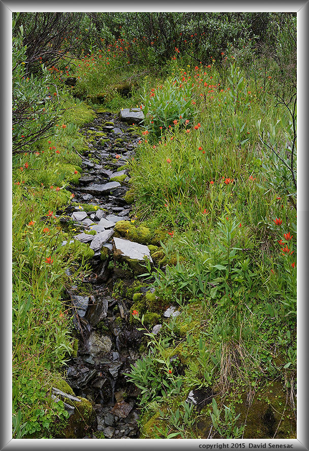
It was just a couple hundred feet up to reach the pass atop a saddle on the ridge between the Virginia Lake and Purple Lake drainages and then about 600 feet down to the outlet of Purple Lake. An impressive steep face was just west of the pass with a huge zone of metamorphic geology talus below. Then from Purple Lake was a 250 foot climb up to a traverse northward around the Fish Creek canyon to the Duck Lake creek drainage. It was a long ways for our sore bodies weary of our heavy loads so by the last mile we were all aching in various ways. I stopped a lot including some time to work this colorful lush metasedimentary willow seep near the PCT/JMT junction with the Duck Pass Trail. Abundant great red paintbrush, castilleja miniata, with common monkeyflower and a list of other species. Of course the still mostly cloudy sky diffuse light was exactly what that kind of subject required. Such seeps given continued water supplies usually peak shortly after the majority of other mid summer species.
OI06482-1 3800x5700 pixels 1 frame 10 image focus stack blend A6000 30mm
enlarged vertical slice view
Later in the afternoon we dragged into a nicely pleasant pristine camp area no others seemed to have used in recent years with a nearby water supply we didn't need to bother filtering. The area was just 30 feet above the trail on a bench and that is often all it takes to leave behind 98% of groups who almost never ever hike up above trails to locate their camps. We made camp, filled up containers with wonderfully fresh clean water, made dinner, ate a lot of extra food we would otherwise have to hike out with, explored a wee bit, then retired, mission accomplished.
OI06584-06600-1x2h 5600x5100 pixels 2 frame 1 column 2 row 17 image focus stack stitch blend A6000 30mm
enlarged vertical slice view
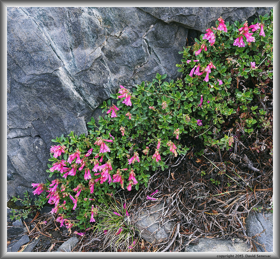
Saturday morning July 11 was our last day in the wilderness but we would first spend a full morning enjoying the west end of the huge lake. Joe went off fishing while I worked some local modest landscapes. Scattered clouds were looming over the nearby peak just south causing moving shadows in my frame, a limitation when focus stacking. At image above a close-up image of one of the Sierra's most prolific species, mountain pride penstemon, penstemon newberryi, taken in shadows.
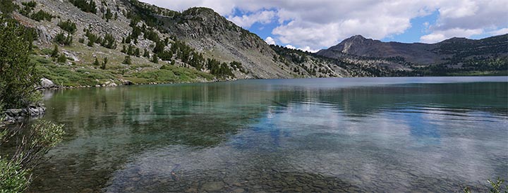
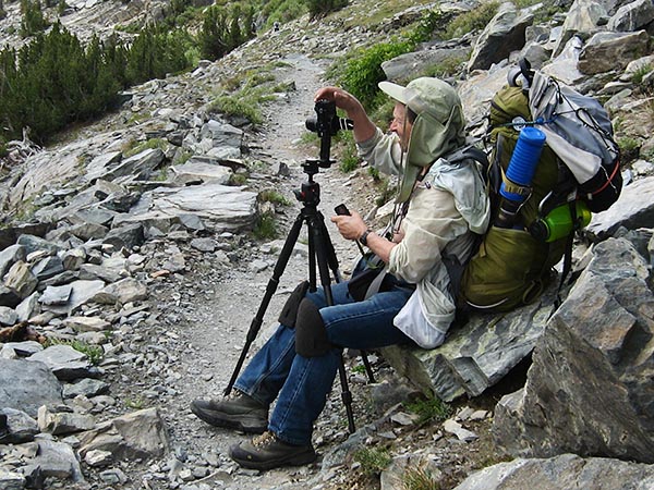
By 10am we were all back at camp packing gear up a last time. As we reached the outlet I took the image above of the north shore of Duck Lake from its outlet a bit to the left. Duck Pass is the low saddle one mile north. And the image below shot by Joe is this person taking a quick image of areas above Duck Lake I plan to climb up to on a future trip. My camera daypack was strapped to the top at that time. The blue tube is an inverted plastic Lays Stax potato chip tube covering the top of my Fenwick multi section rod. Wear the cheap foam Home Depot knee pads almost all waking hours. Although over decades have most often packed cameras and tripod away onto my pack when on a trail or route, also have often hand carried cameras atop tripods including my my larger 4x5 view camera rig whenever I expect to work enroute. Terrain has to get rather difficult before I bother to stop and stow such gear.
By time we reached the trailhead at mid day, Joe's feet were mighty sore given his too worn boots and stated he would not put his feet on another trail before buying a new pair haha. Mike who had not been on a trail in years kept talking about a list of gear that would make his next adventure on trails with us much better. And I was weary of the pain of my weighty pack pressuring against a sore area about my left kidney. We left the quite busy scene of groups arriving back at the trailhead from day hikes and a few just starting up the trail. These trips are always memmorable adventures however this trip was much more so as a survival challenge that we will be talking about the rest of our lives.
NEXT: Page 11 WF Carson River ; HNA Lee Vining Creek
2015 Trip Chronicles: Contents